
1931 Map of Confluence
USGS Topo · Published 1958About this map
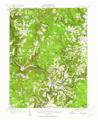
The Youghiogheny River and Casselman River converge at the town of Confluence, a critical transport hub defined by the industrial presence of the Baltimore and Ohio Railroad and the Western Maryland lines. This 1931 revision shows the rugged terrain of Laurel Hill and Turkey Foot before the major dam projects of the mid-20th century altered the river valleys. The landscape is densely populated with small agrarian and industrial markers, including the Baldwin Mine and Mary Ann Mine, alongside numerous rural educational sites like Three Maples School and Rugg School. The southern edge of the map features the National Pike passing through Somerfield, a village later submerged by the Youghiogheny River Lake. The distribution of family-named landmarks like Whites Bridge and Rogers Mill suggests a deeply rooted local economy tied to the timber and coal resources of the Laurel Highlands.
Find a feature on this map
125 named features on this map. Tap any name to fly to it.
Don’t see what you’re looking for? This feature index may not catch every label — zoom into the map to look around manually.
Map Details
Editions of this 1931 Confluence Map
2 editions found
Other maps of this area

1899 · Grantsville
USGS Topo · 1:62,500

1900 · Accident
USGS Topo · 1:62,500

1900 · Uniontown
USGS Topo · 1:62,500

1902 · Connellsville
USGS Topo · 1:62,500

1904 · Bruceton
USGS Topo · 1:62,500

1904 · Grantsville
USGS Topo · 1:62,500

1913 · Somerset
USGS Topo · 1:62,500

1915 · Somerset
USGS Topo · 1:62,500

1921 · Meyersdale
USGS Topo · 1:62,500

1922 · Confluence
USGS Topo · 1:62,500