
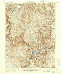
1933 Map of Confluence
USGS Topo · Published 1933About this map
The confluence of the Youghiogheny River, Casselman River, and Laurel Hill Creek anchors this 1933 survey, illustrating a landscape defined by deep river valleys and early industrial activity. The Baltimore and Ohio railroad follows the winding river bends, serving established towns like Confluence and Ursina, while the Maryland and Pennsylvania line extends through the eastern hills. The map highlights the transition from coal extraction at the Mary Ann Mine and Baldwin Mine to the preservation of high-elevation points like Sugarloaf Knob, which is topped by the Sugarloaf Fire Tower. Local life is meticulously documented through numerous rural landmarks, including the Wesley Chapel and a dense network of one-room schoolhouses like Rugg School and Pancake School, revealing the settlement patterns of Fayette and Somerset counties before modern highway development changed the regional character.
Find a feature on this map
114 named features on this map. Tap any name to fly to it.
Don’t see what you’re looking for? This feature index may not catch every label — zoom into the map to look around manually.
Map Details
Editions of this 1933 Confluence Map
2 editions found
Other maps of this area

1899 · Grantsville
USGS Topo · 1:62,500

1900 · Accident
USGS Topo · 1:62,500

1900 · Uniontown
USGS Topo · 1:62,500

1902 · Connellsville
USGS Topo · 1:62,500

1904 · Bruceton
USGS Topo · 1:62,500

1904 · Grantsville
USGS Topo · 1:62,500

1913 · Somerset
USGS Topo · 1:62,500

1915 · Somerset
USGS Topo · 1:62,500

1921 · Meyersdale
USGS Topo · 1:62,500

1922 · Confluence
USGS Topo · 1:62,500