2020s Maps of Somerset County, Pennsylvania
Explore 31 historic maps of Somerset County from the 2020s. These maps offer a rare glimpse into what life looked like during the 2020s — showing old roads, neighborhoods, homes, and landmarks that have changed or disappeared over time.
Whether you're researching your family's past, planning a metal detecting trip, or studying how Somerset County's landscape evolved across the 2020s, these high-resolution maps are a powerful tool for exploring the history of this region.
- Focus on a specific era: All maps on this page are from the 2020s, giving you a focused view of this time period.
- See what’s changed: Compare century-old streets, trails, and buildings to today's modern landscape using overlays and satellite layers.
- Research with precision: Use these maps for genealogy, historical research, land use analysis, or educational projects.
- View, download, or print: Maps are fully viewable online in high resolution, and can be downloaded or printed for your own records.
Start exploring Somerset County's history through authentic maps from the 2020s. This is your window into the past.
Somerset County, PA maps
(31)- 2023 Map of Berlin, 2023 Print
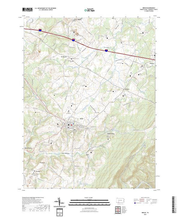 2023 Berlin2023 Print · USGSThe Somerset County highlands near Berlin are revealed here in the early twenty-first century, showing a landscape defined by small valley settlements and family landholdings. Researchers can locate numerous ancestral burial sites like the Christian Yoder Cem and trace old routes through Brotherton and Niver Junction.
 - 2023 Map of Rockwood, 2023 Print
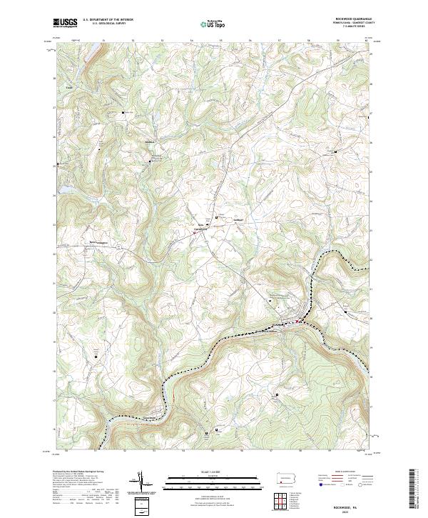 2023 Rockwood2023 Print · USGSThe Casselman River valley and its surrounding Somerset County highlands appear in this modern survey. Genealogists can trace family burial sites at Cramer-King Cem and Mount Union Cem while following the rail history at Rockwood Station.
 - 2023 Map of Fairhope, 2023 Print
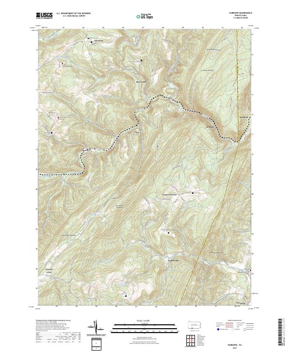 2023 Fairhope2023 Print · USGSThe Allegheny highlands of Somerset County come alive in this map, showing the rural communities and family homesteads of the region. Genealogists can trace deep roots at the Johnsburg Old Cem, Kennells Mill, and the Lepley Family Cem.
 - 2023 Map of Windber, 2023 Print
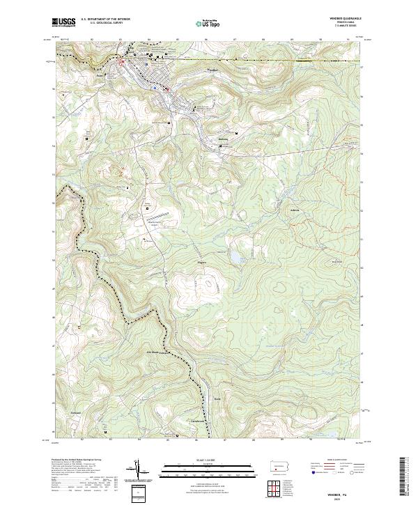 2023 Windber2023 Print · USGSThe northern Somerset County coalfields are captured here in the early twenty-first century, showing the dense settlement of Windber and its surrounding communities. Researchers can trace local heritage through sites like the Old Shade Furnace and the many ethnic cemeteries such as Hungarian Reformed Cem.
 - 2023 Map of Schellsburg, 2023 Print
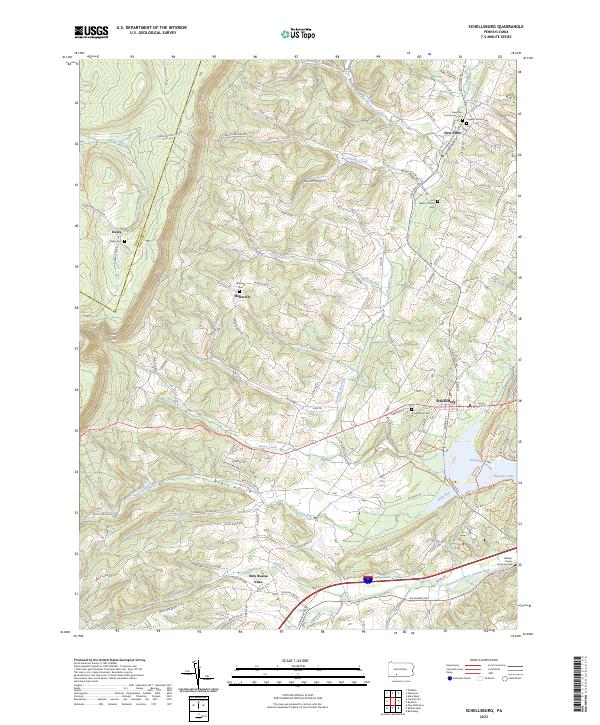 2023 Schellsburg2023 Print · USGSBedford and Somerset counties are shown here as they appeared in the early 2020s, defined by the high ridges of the Allegheny Front. Genealogists can locate family-named sites like the William Frazier Burial Ground and Cuppett Family Cem near Schellsburg.
 - 2023 Map of Ogletown, 2023 Print
 2023 Ogletown2023 Print · USGSHigh on the Allegheny ridges where Bedford and Somerset counties meet, this contemporary survey captures a landscape of deep hollows and rural crossroads. Genealogists and hikers can trace old family sites like Crum Oldham Cem and Mock Church Cem or follow the path of the Lost Turkey Trail.
 - 2023 Map of Meyersdale, 2023 Print
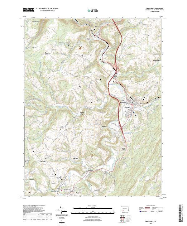 2023 Meyersdale2023 Print · USGSSomerset County's river-carved valleys are documented here in the early twenty-first century, showing the enduring footprint of Appalachian mining and farming. Researchers can trace numerous family burial grounds and early industrial sites like Shaw Mines, Berkleys Mill, and the Summit Mills Amish Church Cem.
 - 2023 Map of Confluence, 2023 Print
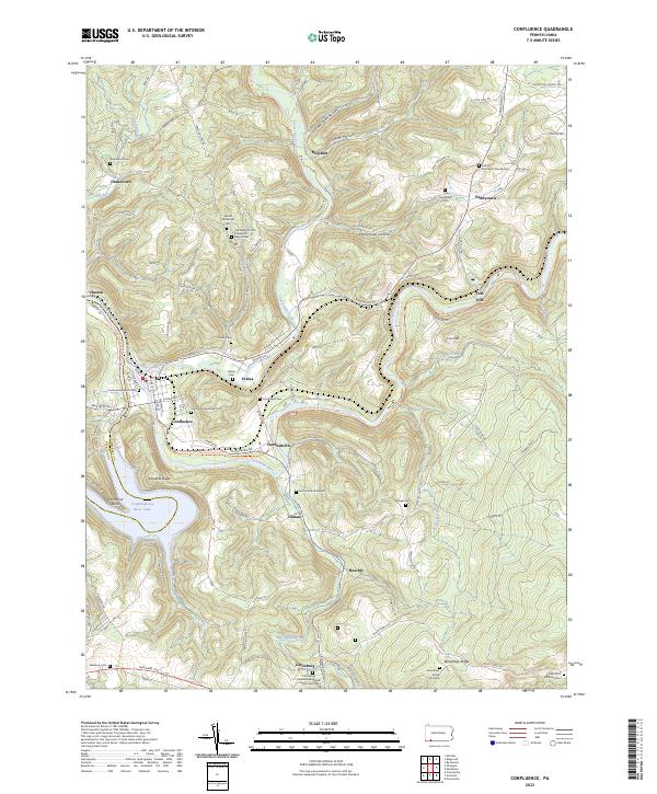 2023 Confluence2023 Print · USGSThe river valleys of Somerset County meet at the turn of the Youghiogheny, where high ridges overlook old river-town settlements. Genealogists can trace family lines at the Old Jersey Church Turkeyfoot Baptist Cemetery, McClintock Graveyard, and Boardman Burial Grounds.
 - 2023 Map of Kingwood, 2023 Print
 2023 Kingwood2023 Print · USGSSomerset County's ridge-and-valley landscape is documented here in the early twenty-first century, showing the enduring rural character of Laurel Hill. Genealogists can trace deep local roots through family landmarks like the John Younkin Family Graveyard and Schrock Family Cem.
 - 2023 Map of New Baltimore, 2023 Print
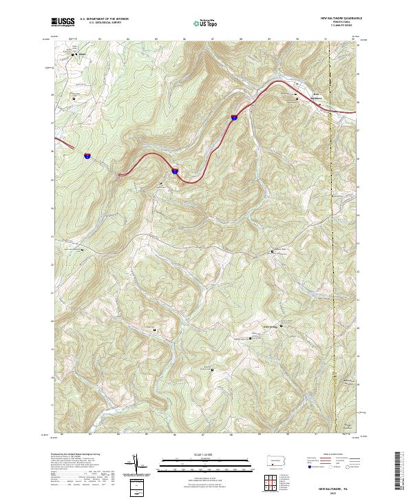 2023 New Baltimore2023 Print · USGSIn the high Allegheny ridges of Somerset and Bedford counties, this modern landscape retains its deep-rooted rural character. Genealogists can trace family heritage through numerous remote sites like Sarver Church Cem, Miller Cem, and the old community at New Baltimore.
 - 2023 Map of Murdock, 2023 Print
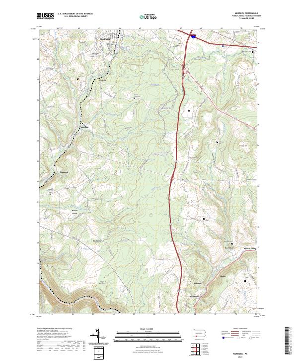 2023 Murdock2023 Print · USGSSomerset County's rural highlands and mining communities are documented here in the early twenty-first century. Researchers can locate numerous family burial grounds like Ankeny Cem and Wills Church Cem, or trace the path of E Mud Pike Rd through Beachdale.
 - 2023 Map of Markleton, 2023 Print
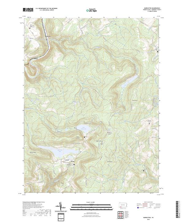 2023 Markleton2023 Print · USGSThe high Allegheny ridges of Somerset County come into focus here during the early 2020s, dominated by the summit of Mount Davis. Local historians can trace family land markers and remote burial sites like Vought Cem and the Old Jonas Maust Farm Cem.
 - 2023 Map of Mill Run, 2023 Print
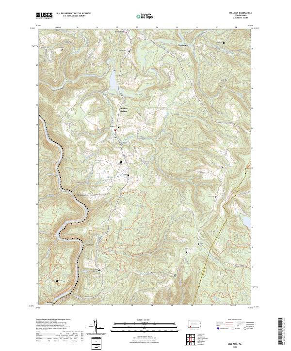 2023 Mill Run2023 Print · USGSFayette County ridge country is captured here in the 2020s, showing the deeply carved river corridors and highland settlements. Genealogists can locate family burial grounds like the Grimm Family Cem and Collins Family Cem near Normalville.
 - 2023 Map of Wittenberg, 2023 Print
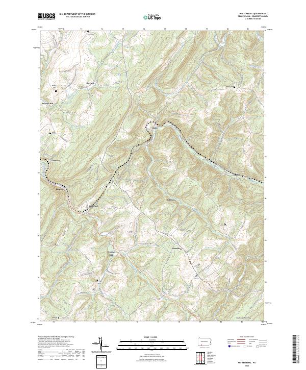 2023 Wittenberg2023 Print · USGSSomerset County in the twenty-first century remains a landscape of mountain hollows and historic mill sites. Genealogists and local historians can trace family roots through numerous burial sites like Klingaman Cem and Temple Cem near Wittenberg.
 - 2023 Map of Ohiopyle, 2023 Print
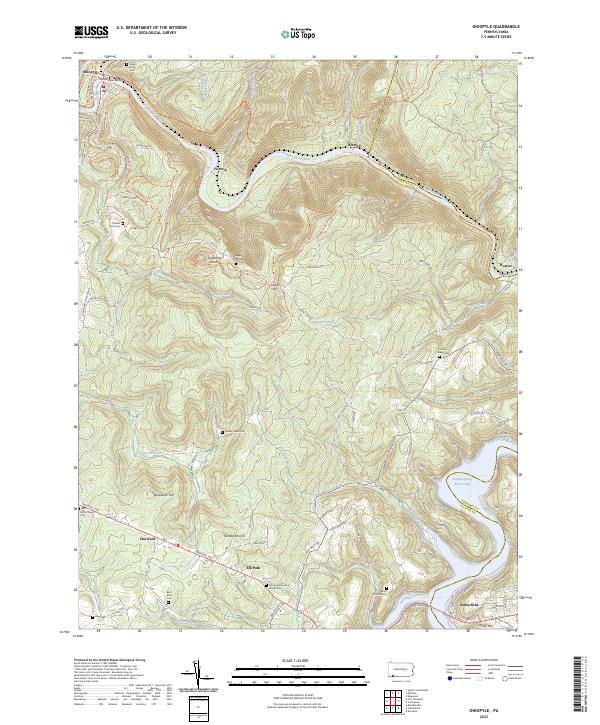 2023 Ohiopyle2023 Print · USGSThe Pennsylvania highlands between Fayette and Somerset counties are shown here in modern detail. Trace family history through numerous small burial sites like Tressler Farm Cemetery and Bird-Burd Cemetery or locate the historic National Pike.
 - 2023 Map of Ligonier, 2023 Print
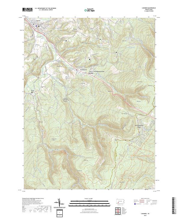 2023 Ligonier2023 Print · USGSWestmoreland County at the foot of the mountains shows a landscape shaped by early iron works and valley farming. Genealogists can trace family lines at Old Ligonier Cem or Cole Cem, while historians can locate the California Furnace and Thomas Crossroads.
 - 2023 Map of Rachelwood, 2023 Print
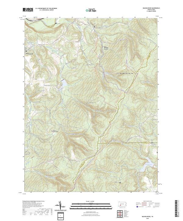 2023 Rachelwood2023 Print · USGSThe Laurel Highlands south of the Conemaugh River come into focus in this recent survey of Westmoreland County. Genealogists can locate several remote burial sites such as Mishler Cem and Legat Cem, while historians can trace the area's iron heritage at Baldwin Furnace.
 - 2023 Map of Stoystown, 2023 Print
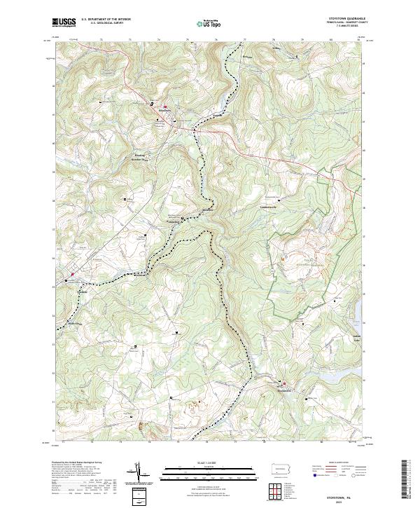 2023 Stoystown2023 Print · USGSSomerset County highlands are captured here in the early twenty-first century, featuring the Flight 93 National Memorial. Genealogists can trace family names across dozens of sites like the Stoystown Cem - West, Dibert Cem, and Shanksville Cem.
 - 2023 Map of Seven Springs, 2023 Print
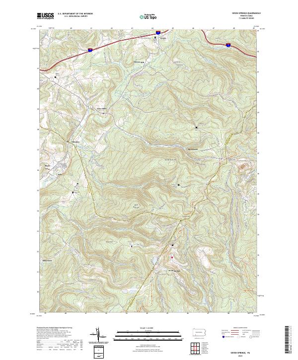 2023 Seven Springs2023 Print · USGSSeven Springs and the tri-county borders of Somerset, Westmoreland, and Fayette counties are captured here in the twenty-first century. Researchers can trace family sites like Franklin Lutheran Cem and Walnut Hill Cem or locate Horners Mill and Jones Mills.
 - 2023 Map of Boswell, 2023 Print
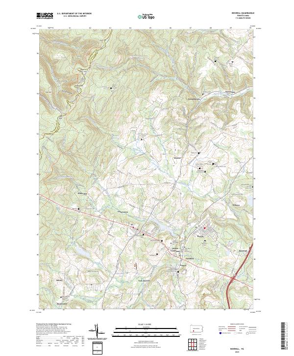 2023 Boswell2023 Print · USGSSomerset County communities like Boswell and Jennerstown are shown in detail as they appeared in 2023. You can trace family roots at Saint Stanislaus Cem or explore industrial history near Coal Junction and Klines Mill.
 - 2023 Map of Johnstown, 2023 Print
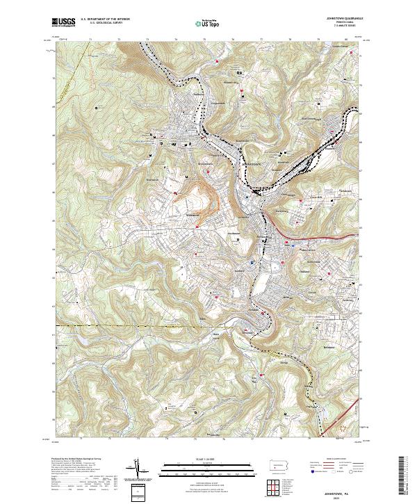 2023 Johnstown2023 Print · USGSJohnstown and its river valleys are captured in the 2020s, showing the dense network of boroughs and religious sites that define this industrial landscape. Genealogists can trace family heritage through numerous locations like Grandview Cem, Saint Rochus Cem, and the Shetler Cem.
 - 2023 Map of Central City, 2023 Print
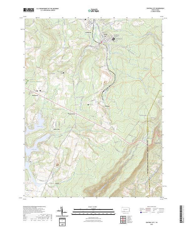 2023 Central City2023 Print · USGSSomerset County's coal-patch heritage and modern landmarks meet in this detailed survey of Central City and Cairnbrook. Genealogists can trace family sites at Shade Lutheran Church Cem and Haydu Cem or explore the Flight 93 National Memorial.
 - 2023 Map of Bakersville, 2023 Print
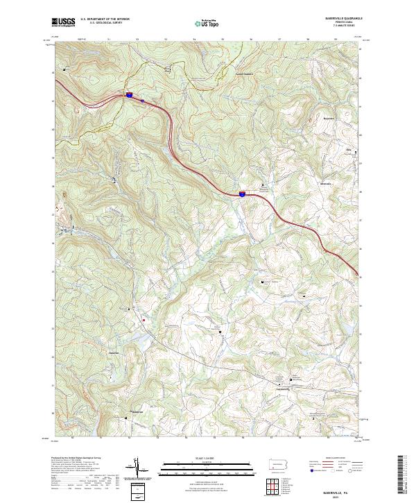 2023 Bakersville2023 Print · USGSSomerset County in the early twenty-first century reveals a landscape of high ridges and scattered rural hamlets. Local historians and genealogists can trace family roots at numerous rural burial grounds such as Young Cem and Bakersville Cem or locate small crossroads like Edie and Allenvale.
 - 2023 Map of Somerset, 2023 Print
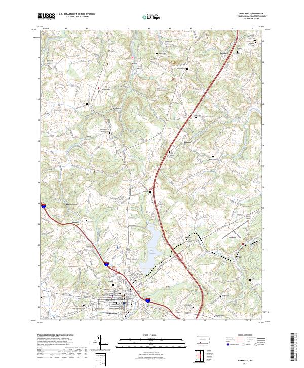 2023 Somerset2023 Print · USGSSomerset and its surrounding townships are shown here in the 2020s, centered on the waters of Lake Somerset. Genealogists can trace family names through numerous local landmarks, including the Emert Burial Ground, Husband Cem, and Sipesville Cem.
 - 2023 Map of Hooversville, 2023 Print
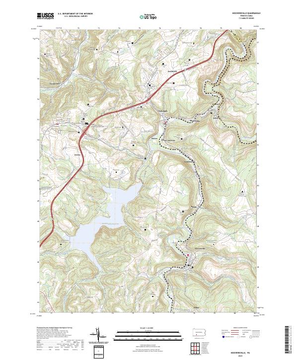 2023 Hooversville2023 Print · USGSSomerset County’s industrial and spiritual history is on full display in this modern survey of the Stonycreek River valley. Genealogists can trace family lines through dozens of sites like the Levi Yoder Burial Grounds and Hooversville Reformed Cem.
Showing maps 1-25 of 31
Top cities of Somerset County
- Somerset historical maps
- Windber historical maps
- Meyersdale historical maps
- Berlin historical maps
- Boswell historical maps
- Central City historical maps
See more
Frequently asked questions
- What are the different types of historical maps available for Somerset County?
- What is the oldest map of Somerset County?
- Where can I purchase historical maps of Somerset County for my home or office?
- Where can I download high-res historical maps of Somerset County?
- Are there historical topographic maps available for Somerset County?
- Is there historical aerial imagery available for Somerset County?
- Where are historical maps of Somerset County sourced from?