Old Maps of Addison Township, Pennsylvania for Academic Research
Study the evolution of Addison Township with 67 high-resolution historic maps. Whether you're teaching, researching, or modeling changes in land use, these maps provide essential visual documentation of urban, environmental, and geographic change.
- Analyze long-term change: Track patterns in development, transportation, and natural features.
- Ideal for environmental or urban studies: Support academic projects with primary historical map data.
- Use in the classroom or lab: Educators and researchers rely on these maps to bring historical context to life.
These maps are a powerful tool for teaching, research, and visualizing how Addison Township has changed over the decades.
Addison Township, PA maps
(67)- 1899 Map of Grantsville
 1899 Grantsville1899 Print · USGSThe Maryland-Pennsylvania borderlands are documented here at the close of the nineteenth century, showing a landscape of high ridges and narrow valley settlements. Researchers can trace family-named landmarks like Ridgley Hill and early mountain hamlets such as New Germany or Moscow Mills.
 - 1900 Map of Accident
 1900 Accident1900 Print · USGSGarrett County highlands at the turn of the century reveal a landscape of mountain settlements and river-valley industry. Genealogists can trace family roots through the Blooming Rose Settlement, early milling sites like Speelman Mills, and the Baltimore and Ohio RR corridor.6 unique versions available
 - 1904 Map of Grantsville
 1904 Grantsville1904 Print · USGSGarrett County at the close of the nineteenth century is captured here as a rugged corridor of timbering and coal transport. You can trace the path of the National Road through Grantsville or locate early industrial sites like Moscow Mills and the Jennings Brothers RR.5 unique versions available
 - 1921 Map of Meyersdale
 1921 Meyersdale1921 Print · USGSSomerset County's industrial and mountain landscape comes to life in the early 1920s as coal mining and railroads dominate the Casselman River valley. Genealogists can trace family roots through dozens of local sites like Sanners Church, Shaw Mines, and the Ganguey School.3 unique versions available
 - 1922 Map of Confluence
 1922 Confluence1922 Print · USGSThe confluence of the Youghiogheny River and Casselman River was a major rail and river hub in the 1920s. Genealogists and local historians can trace the foundations of many small settlements and mountain schools, from Ohiopyle to the Baldwin Mine and Wesley Chapel.3 unique versions available
 - 1931 Map of Confluence, 1958 Print
 1931 Confluence1958 Print · USGSThe Laurel Highlands at the start of the 1930s reveal a landscape of deep river valleys and high ridges defined by coal mining and heavy rail. Genealogists can trace family names through dozens of rural sites like Sands Church, Somerfield, and the Mary Ann Mine.2 unique versions available
 - 1933 Map of Confluence
 1933 Confluence1933 Print · USGSThe Laurel Highlands during the early 1930s come into focus through the river networks of Fayette and Somerset counties. Trace family roots at Paddytown or Somerfield, and locate long-gone schoolhouses such as Clay Run School and the Mary Ann Mine.2 unique versions available
 - 1939 Map of Meyersdale, 1955 Print
 1939 Meyersdale1955 Print · USGSSomerset County is captured here in the late 1930s, showing a landscape defined by the winding Casselman River and its coal-bearing valleys. Local historians can trace the reach of the Baltimore and Ohio Railroad past dozens of rural landmarks like Comptons Mill and Mt Davis.2 unique versions available
 - 1944 Map of Meyersdale, 1945 Print
 1944 Meyersdale1945 Print · USGSSomerset County’s rugged coal and timber country is frozen in time during the mid-1940s, showing a landscape defined by the Casselman River and its busy rail lines. Genealogists can locate dozens of named rural landmarks like Plank Road Sch, Mt Zion Ch, and the Beachley Mine.
 - 1946 Map of Grantsville, 1966 Print
 1946 Grantsville1966 Print · USGSGarrett County's high ridges and river valleys are captured here in the mid-1940s, showing a landscape defined by the historic National Pike and timbered heights. Genealogists can locate family-named features such as Zehner Hill, Yoder School, and the remote Dunghill Church.4 unique versions available
 - 1947 Map of Friendsville, 1965 Print
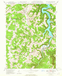 1947 Friendsville1965 Print · USGSMaryland's mountainous panhandle meets Pennsylvania and West Virginia in this mid-century study of the Youghiogheny valley. Genealogists can locate family landmarks like Thomas Cemetery and Emberson Cemetery, or rural schoolhouses like McCabe School.6 unique versions available
 - 1947 Map of Accident, 1982 Print
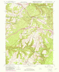 1947 Accident1982 Print · USGSMaryland's high plateau comes into focus at the middle of the century, centered on the historic National Road and the uniquely named town of Accident. Genealogists and local historians can trace family-named landmarks like Kaese Mill, Sausman Mine, and several rural Cem locations throughout the Bear Creek valley.2 unique versions available
 - 1948 Map of Cumberland
 1948 Cumberland1948 Print · USGSMid-century Appalachia and the Shenandoah Valley are shown in detail, documenting the industrial and transportation hubs of the tri-state area. Genealogists can trace family roots through settlements like Double Tollgate and Bunker Hill or along the Baltimore & Ohio RR.3 unique versions available
 - 1948 Map of Accident, 1966 Print
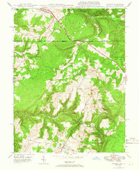 1948 Accident1966 Print · USGSGarrett County's high ridges and small mountain communities are captured here in the late 1940s as the regional timber and milling economy thrived. Researchers can trace historic family locations like Turney Cem, local industry at the Swanton Mine, and early transport along the National Pike.2 unique versions available
 - 1949 Map of Friendsville
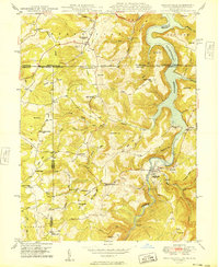 1949 Friendsville1949 Print · USGSThe tri-state borderlands of Maryland, Pennsylvania, and West Virginia appear here in the late 1940s, centered on the growing Youghiogheny Reservoir. Genealogists and historians can trace family landmarks along the Mason And Dixon Line, from Thomas Cem to the early roads of Friendsville.
 - 1949 Map of Grantsville
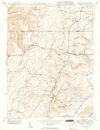 1949 Grantsville1949 Print · USGSGarrett County highlands and the Pennsylvania border are captured here just after the war as the mountain economy transitioned from timber and mining to modern transit. Genealogists can trace family names through Maple Grove Cem, Bevansville, and rural landmarks like The Dunghill.2 unique versions available
 - 1949 Map of Accident
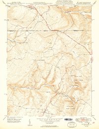 1949 Accident1949 Print · USGSThe Maryland-Pennsylvania borderlands near Accident are captured here in the late 1940s, showing a rural landscape of ridges and milling sites. Genealogists and historians can trace local family landmarks like Turney Cem, the Rich Sch, and old industry at Kaese Mill.2 unique versions available
 - 1952 Map of Cumberland
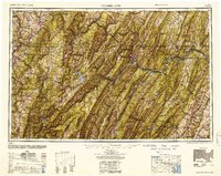 1952 Cumberland1952 Print · USGSThe Potomac Highlands and the Shenandoah Valley are revealed in this early 1950s survey of the Appalachian interior. Researchers can trace the river-and-rail corridors connecting Cumberland, Winchester, and the recreational waters of Deep Creek Lake.
 - 1956 Map of Cumberland, 1966 Print
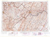 1956 Cumberland1966 Print · USGSThe tri-state Highlands in the mid-1950s show a landscape shaped by coal, timber, and the massive presence of the Baltimore & Ohio RR. Researchers can trace the industrial corridor from Cumberland through the Allegheny Mountains to mountain retreats like Deep Creek Lake.6 unique versions available
 - 1957 Map of Cumberland
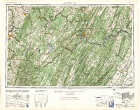 1957 Cumberland1957 Print · USGSThe Potomac River valley and the ridges of the Allegheny Front define this mid-century landscape at the intersection of Maryland, West Virginia, and Pennsylvania. Trace the steam-era rail lines of the Baltimore and Ohio RR or locate rural landmarks like St Stephens Church and Stony River Dam.
 - 1961 Map of Cumberland
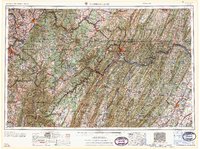 1961 Cumberland1961 Print · USGSThe tri-state highlands of Maryland, West Virginia, and Pennsylvania are shown in the mid-twentieth century as a complex landscape of ridges and river valleys. Researchers can trace the winding Potomac River and find old rail-and-river towns like Cumberland, Keyser, and Morgantown.
 - 1962 Map of Cumberland
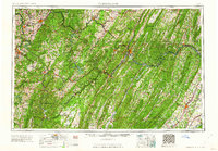 1962 Cumberland1962 Print · USGSThe central Appalachians meet at the height of the mid-century industrial era, showing the rugged topography between Morgantown and Winchester. Genealogists can trace family lands near Fort Necessity or along the vital Baltimore & Ohio RR corridors.
 - 1967 Map of Ohiopyle, 1970 Print
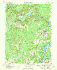 1967 Ohiopyle1970 Print · USGSThe Youghiogheny River corridor is captured here in the late sixties, showcasing the intersection of rugged mountain terrain and historic transportation routes. Genealogists and historians can trace family locations near Somerfield, Marclay Sch, and Sugarloaf Chapel Cem.3 unique versions available
 - 1967 Map of Confluence, 1970 Print
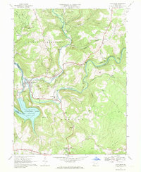 1967 Confluence1970 Print · USGSThe river junction at Confluence is captured here in the late sixties as the reservoir reshaped the valley landscape. Researchers can trace the tracks of the Baltimore and Ohio and find local landmarks like Jersey Ch and Turkeyfoot Valley Sch.4 unique versions available
 - 1968 Map of Markleton, 1972 Print
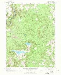 1968 Markleton1972 Print · USGSSomerset County's high country is captured in the late sixties, showing the rail-and-river corridor through the mountains. Researchers can trace the Pinkerton Tunnel, locate rural landmarks like Gem Mt Zion Ch, or find industrial footprints at the Strip Mines.2 unique versions available
Showing maps 1-25 of 67
Top cities near Addison Township
- Somerset historical maps
- Milford historical maps
- Rockwood historical maps
- Salisbury historical maps
- Confluence historical maps
- Grantsville historical maps
See more
Top neighborhoods of Addison Township
- Dumas historical maps
- Listonburg historical maps
- Beachly historical maps
- Somerfield historical maps
- Unamis historical maps
Frequently asked questions
- What are the different types of historical maps available for Addison Township?
- What is the oldest map of Addison Township?
- Where can I purchase historical maps of Addison Township for my home or office?
- Where can I download high-res historical maps of Addison Township?
- Are there historical topographic maps available for Addison Township?
- Is there historical aerial imagery available for Addison Township?
- Where are historical maps of Addison Township sourced from?