Old Maps of Callimont, Pennsylvania for Genealogy
Trace your family roots with 13 historic maps of Callimont. These high-res maps reveal old neighborhoods, homesites, landmarks, and streets — helping you uncover where your ancestors lived and how the area evolved over time.
- Explore historic neighborhoods: Identify where your relatives may have lived in the 1800s or 1900s.
- Compare maps over time: Trace the changes in streets, buildings, and landmarks for multi-generational research.
- Perfect for genealogy & ancestry research: Used by family historians and researchers to map out lineage and migration.
These maps are an incredible resource for exploring your personal connection to Callimont's past.
Callimont, PA maps
(13)- 1923 Map of Berlin
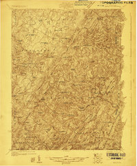 1923 Berlin1923 Print · USGSCovers Callimont, including Berlin, Fairhope Township, and other nearby areas3 unique versions available
 - 1929 Map of Berlin
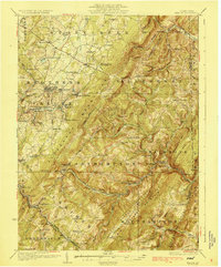 1929 Berlin1929 Print · USGSCovers Callimont, including Berlin, Fairhope Township, and other nearby areas3 unique versions available
 - 1944 Map of Berlin
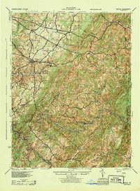 1944 Berlin1944 Print · USGSCovers Callimont, including Berlin, Fairhope Township, and other nearby areas
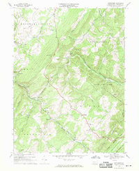
 - 1948 Map of Cumberland
 1948 Cumberland1948 Print · USGSCovers Callimont, including Morgantown, Winchester, and other nearby areas3 unique versions available
 - 1952 Map of Cumberland
 1952 Cumberland1952 Print · USGSCovers Callimont, including Morgantown, Winchester, and other nearby areas
 - 1956 Map of Cumberland, 1966 Print
 1956 Cumberland1966 Print · USGSCovers Callimont, including Morgantown, Winchester, and other nearby areas6 unique versions available
 - 1957 Map of Cumberland
 1957 Cumberland1957 Print · USGSCovers Callimont, including Morgantown, Winchester, and other nearby areas
 - 1961 Map of Cumberland
 1961 Cumberland1961 Print · USGSCovers Callimont, including Morgantown, Winchester, and other nearby areas
 - 1962 Map of Cumberland
 1962 Cumberland1962 Print · USGSCovers Callimont, including Morgantown, Winchester, and other nearby areas
 - 1967 Map of Wittenberg, 1970 Print
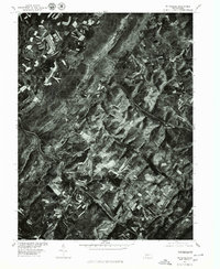
 1967 Wittenberg1970 Print · USGSCovers Callimont, including Southampton Township, Warrens Mill, and other nearby areas4 unique versions available
 - 1977 Map of Wittenburg, 1979 Print
 1977 Wittenburg1979 Print · USGSCovers Callimont, including Southampton Township, Warrens Mill, and other nearby areas
 - 1981 Map of Cumberland, 1982 Print
 1981 Cumberland1982 Print · USGSCovers Callimont, including Cumberland, Frostburg, and other nearby areas2 unique versions available
 - 2023 Map of Wittenberg, 2023 Print
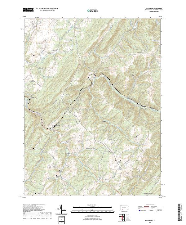 2023 Wittenberg2023 Print · USGSCovers Callimont, including Southampton Township, Northampton Township, and other nearby areas
End of results
Showing maps 1-13 of 13
Top cities near Callimont
- Cumberland historical maps
- Frostburg historical maps
- Somerset historical maps
- La Vale historical maps
- Meyersdale historical maps
- Napier Township historical maps
See more
Frequently asked questions
- What are the different types of historical maps available for Callimont?
- What is the oldest map of Callimont?
- Where can I purchase historical maps of Callimont for my home or office?
- Where can I download high-res historical maps of Callimont?
- Are there historical topographic maps available for Callimont?
- Is there historical aerial imagery available for Callimont?
- Where are historical maps of Callimont sourced from?