Old Maps of Shade Township, Pennsylvania for Genealogy
Trace your family roots with 55 historic maps of Shade Township. These high-res maps reveal old neighborhoods, homesites, landmarks, and streets — helping you uncover where your ancestors lived and how the area evolved over time.
- Explore historic neighborhoods: Identify where your relatives may have lived in the 1800s or 1900s.
- Compare maps over time: Trace the changes in streets, buildings, and landmarks for multi-generational research.
- Perfect for genealogy & ancestry research: Used by family historians and researchers to map out lineage and migration.
These maps are an incredible resource for exploring your personal connection to Shade Township's past.
Shade Township, PA maps
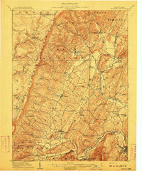
(55)- 1908 Map of Bedford, 1958 Print
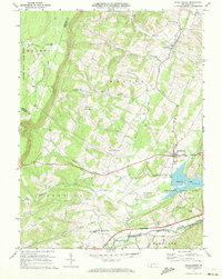
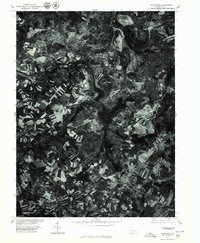
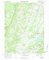
 1908 Bedford1958 Print · USGSBedford County at the turn of the century reveals a landscape of ridge-top schools and valley mill towns connected by early rail. Genealogists can trace family roots through numerous sites like Ryan Mill, Eight Square School, and Ogleton Felix PO.
 - 1910 Map of Bedford
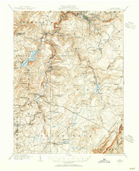
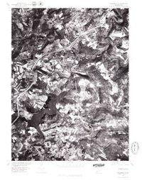
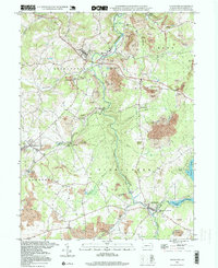
 1910 Bedford1910 Print · USGSBedford County's agrarian valleys and mountain ridges are captured here during the peak of the rural schoolhouse era. Researchers can trace ancestral locations at Weyant PO, Schellsburg, and Mowrys Mills, or locate early landmarks like Eight Square School.4 unique versions available
 - 1914 Map of Windber, 1955 Print
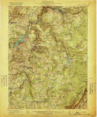
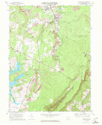
 1914 Windber1955 Print · USGSSomerset County coal and rail towns thrive along the Allegheny front during the height of the early industrial era. Genealogists and historians can trace the foundations of Windber, locate the Old Shade Furnace, and map family-named schools like Keafer School.3 unique versions available
 - 1916 Map of Windber
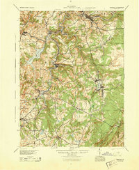
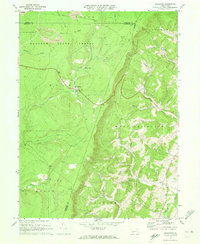
 1916 Windber1916 Print · USGSSomerset County coal country and the Laurel Highlands come alive in the decade before the Great War. Genealogists and historians can trace family locations through dozens of named sites like Old Shade Furnace, Stauffer Mine No 3, and Walkers Mill.4 unique versions available
 - 1944 Map of Windber
 1944 Windber1944 Print · USGSSomerset County's coal and rail corridors are captured here during the 1940s, showing the region's industrial peak. Genealogists can locate family landmarks like Kaufman Ch, Stoystown Sta, and numerous country schools such as Breastwork Sch.
 - 1953 Map of Pittsburgh
 1953 Pittsburgh1953 Print · USGSWestern Pennsylvania's industrial landscape at the start of the fifties shows the steel and rail corridors between Pittsburgh and Altoona. Trace family roots in river towns like Tarentum or follow the Pennsylvania Turnpike across Laurel Hill.
 - 1954 Map of Pittsburgh
 1954 Pittsburgh1954 Print · USGSWestern Pennsylvania in the early fifties remains a powerhouse of heavy industry and vital transit corridors. Genealogists and historians can trace the rail-and-river network connecting Pittsburgh, Johnstown, and Altoona via the Pennsylvania RR and the Lincoln Highway.2 unique versions available
 - 1958 Map of Pittsburgh
 1958 Pittsburgh1958 Print · USGSWestern Pennsylvania in the late fifties shows an industrial heartland defined by the confluence of the Allegheny River and Monongahela River. Researchers can trace the sprawling rail networks of the Pennsylvania RR and find established towns like Butler, Latrobe, and Windber.5 unique versions available
 - 1959 Map of Pittsburgh
 1959 Pittsburgh1959 Print · USGSWestern Pennsylvania in the late fifties is captured here at the height of its industrial era. Genealogists and historians can trace the riverfront growth of Pittsburgh, the rail works at Altoona, and the mountain gaps of Laurel Hill.
 - 1964 Map of Pittsburgh
 1964 Pittsburgh1964 Print · USGSWestern Pennsylvania in the late fifties and early sixties shows a landscape of powerful river industries and expanding highways. Genealogists and historians can trace the rail corridors of the Pennsylvania RR through industrial hubs like Johnstown, Altoona, and Nanty Glo.
 - 1971 Map of Schellsburg, 1972 Print
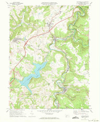
 1971 Schellsburg1972 Print · USGSBedford County at the start of the seventies reveals a landscape of protected game lands and emerging state recreation areas. Genealogists and hikers can trace old homesteads near New Paris, remote churches like Pleasant View Ch, and the shoreline of Shawnee Lake.3 unique versions available
 - 1971 Map of Central City, 1972 Print
 1971 Central City1972 Print · USGSSomerset County coal towns and lakeside developments are captured here in the early seventies. Genealogists and industrial historians can trace the Penn Central rail lines connecting Central City and Cairnbrook to local strip mines and the Township High Sch.2 unique versions available
 - 1971 Map of Hooversville, 1973 Print
 1971 Hooversville1973 Print · USGSSomerset County in the early seventies shows a landscape shaped by coal and water, from the banks of Stony Creek to the hilltop mines. Genealogists and historians can trace family locations near Hooversville, Thomas Mill, and Kaufman Cem.3 unique versions available
 - 1971 Map of Stoystown, 1973 Print
 1971 Stoystown1973 Print · USGSSomerset County's industrial and rural character is caught in transition during the early seventies as coal extraction and residential development expanded. Genealogists can locate family landmarks like Walker Cem and Hayman Ch or trace the Baltimore and Ohio rail line through Shanksville and Stoystown.4 unique versions available
 - 1971 Map of Ogletown, 1973 Print
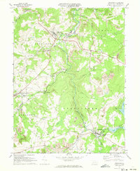
 1971 Ogletown1973 Print · USGSBedford and Somerset Counties are documented here in the early 1970s, showing a landscape defined by state forestry and mountain ridges. Researchers can locate remote settlements like Ogletown and Ryot, alongside local landmarks such as Calvary Ch and Pine Lake.4 unique versions available
 - 1971 Map of Windber, 1973 Print
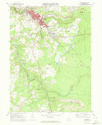 1971 Windber1973 Print · USGSWindber and the surrounding coal country are captured in the early seventies, showing a landscape of active strip mines and tight-knit company towns. Genealogists can locate family landmarks like Maple Grove Sch, Old Shade Furnace, and the community of Cairnbrook.4 unique versions available
 - 1977 Map of Central City, 1979 Print
 1977 Central City1979 Print · USGSSomerset County's coal towns and developing lakes are seen in this late-seventies aerial survey. Trace industrial land use and neighborhood growth near Central City or explore the shorelines of Indian Lake and Lake Stonycreek.
 - 1977 Map of Windber, 1979 Print
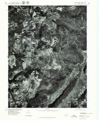
 1977 Windber1979 Print · USGSThe coal-mining landscapes of Somerset County are seen with photographic precision in the late seventies. Researchers can trace the industrial footprints of Windber and Paint or locate smaller company settlements like Cairnbrook and Reitz.
 - 1977 Map of Stoystown, 1979 Print
 1977 Stoystown1979 Print · USGSSomerset County agriculture and industry are visible in this late 1970s orthophotograph as the region balanced farming with surface mining. Researchers can trace the development of small communities like Stoystown, Shanksville, and Kimmelton along the banks of Stony Creek.
 - 1977 Map of Schellsburg, 1979 Print
 1977 Schellsburg1979 Print · USGSBedford County during the late seventies shows a rural landscape defined by the winding Raystown Branch Juniata River and the recreation area at Shawnee Lake. Genealogists can locate family roots in New Paris, Helixville, or Schellsburg, while tracing local landmarks like the New Paris Central Sch and two historic Covered Bridge crossings.
 - 1977 Map of Hooversville, 1979 Print
 1977 Hooversville1979 Print · USGSSomerset County's landscape appears in sharp relief during the late seventies, showing the industrial and agricultural patterns of the Allegheny Plateau. Trace the development of Hooversville and Jerome alongside the Quemahoning Reservoir.
 - 1977 Map of Ogletown, 1979 Print
 1977 Ogletown1979 Print · USGSBedford County's rural landscape is captured in this late-seventies aerial survey of the forest and farm country. Genealogists and historians can trace property lines and land use near settlements like Ogletown and Ryot or along the slopes of Shade Mountain.
 - 1981 Map of Johnstown, 1983 Print
 1981 Johnstown1983 Print · USGSSouth Central Pennsylvania is captured here in the early eighties, from the industrial heart of the Conemaugh Valley to the ridges of the Allegheny Front. Local historians can trace the rail corridors of Conrail and the growth of mountain communities like Ebensburg, Nanty Glo, and Windber.
 - 1994 Map of Stoystown, 1999 Print
 1994 Stoystown1999 Print · USGSSomerset County in the mid-1990s shows a landscape defined by the Stonycreek River and the legacy of the regional coal industry. Researchers can find old landmarks like the Walker Cem, the Rayman Ch, and a Covered Bridge near Shanksville.2 unique versions available
 - 1998 Map of Windber, 1999 Print
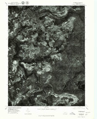
 1998 Windber1999 Print · USGSThe coal country of Somerset and Cambria counties is shown here during a period of landscape reclamation in the late nineties. Genealogists and historians can locate family landmarks like the Spaulding Sch, the Old Shade Furnace, and numerous local parishes including St Anthony Ch.
Showing maps 1-25 of 55
Top cities near Shade Township
- Johnstown historical maps
- Somerset historical maps
- Westmont historical maps
- Windber historical maps
- Stonycreek Township historical maps
- Geistown historical maps
See more
Top neighborhoods of Shade Township
- Cairnbrook historical maps
- Rowena historical maps
- Wilbur historical maps
- Crumb historical maps
- Reitz historical maps
- Gahagen historical maps
See more
Frequently asked questions
- What are the different types of historical maps available for Shade Township?
- What is the oldest map of Shade Township?
- Where can I purchase historical maps of Shade Township for my home or office?
- Where can I download high-res historical maps of Shade Township?
- Are there historical topographic maps available for Shade Township?
- Is there historical aerial imagery available for Shade Township?
- Where are historical maps of Shade Township sourced from?