1900s (20th Century) Maps of Susquehanna County, Pennsylvania
Explore 67 historic maps of Susquehanna County from the 1900s (20th Century). These maps offer a rare glimpse into what life looked like during the 1900s — showing old roads, neighborhoods, homes, and landmarks that have changed or disappeared over time.
Whether you're researching your family's past, planning a metal detecting trip, or studying how Susquehanna County's landscape evolved across the 1900s, these high-resolution maps are a powerful tool for exploring the history of this region.
- Focus on a specific era: All maps on this page are from the 1900s, giving you a focused view of this time period.
- See what’s changed: Compare century-old streets, trails, and buildings to today's modern landscape using overlays and satellite layers.
- Research with precision: Use these maps for genealogy, historical research, land use analysis, or educational projects.
- View, download, or print: Maps are fully viewable online in high resolution, and can be downloaded or printed for your own records.
Start exploring Susquehanna County's history through authentic maps from the 1900s. This is your window into the past.
Susquehanna County, PA maps
(67)- 1924 Map of Starrucca
 1924 Starrucca1924 Print · USGSThe river-and-rail economy of the Delaware valley is captured here in the mid-1920s during a period of industrial activity. Researchers can trace the junctions of the Erie RR and locate local landmarks like Cadosia Factories and Stockport Sta.
 - 1926 Map of Starrucca
 1926 Starrucca1926 Print · USGSThe river-and-rail corridor at the New York and Pennsylvania border comes alive in the mid-1920s, showing the vital confluence at Hancock. Genealogists and rail historians can trace the paths of the Erie R R, identifying old transit points like Stockport Sta and Sands Switch.
 - 1930 Map of Starrucca
 1930 Starrucca1930 Print · USGSUpper Wayne County was a major transportation and recreation hub in the 1930s, defined by the Delaware River rail corridors and numerous upland lakes. Genealogists can trace family roots through localized sites like the South Preston Grange Hall and schools like Fairmont Sch.3 unique versions available
 - 1932 Map of Susquehanna, 1959 Print
 1932 Susquehanna1959 Print · USGSSusquehanna County at the start of the 1930s is a landscape of thriving rail junctions and upland farming crossroads. Researchers can trace the path of the Erie RR through Lanesboro or locate rural landmarks like Sweet Chapel and the Lamb Cem.
 - 1933 Map of Starrucca
 1933 Starrucca1933 Print · USGSUpper Wayne County was a landscape of rail-connected dairy farms and summer camps in the years between the wars. Genealogists can locate family-named rural schools and depots from Stephens Switch and Stockport Sta to Hines Corners.3 unique versions available
 - 1935 Map of Susquehanna
 1935 Susquehanna1935 Print · USGSThe Susquehanna River valley in the 1930s was a bustling corridor of heavy rail and industrial settlements along the New York border. Genealogists and historians can trace family homesteads near rural schools like Oak Hill Sch and early transit routes like the Newburg Turnpike.3 unique versions available
 - 1943 Map of Honesdale
 1943 Honesdale1943 Print · USGSThe northern Poconos and the Upper Delaware River valley appear here during the early war years, showing a network of mountain hamlets and riverfront rail towns. Genealogists can trace family roots through numerous remote institutions like Kingsbury Hill Church, Peakville P O, and the Hiawatha School.
 - 1943 Map of Montrose, 1957 Print
 1943 Montrose1957 Print · USGSSusquehanna County at the height of the mid-century railroad era shows a landscape of upland farms and valley rail junctions. Researchers can locate long-standing family landmarks and rural hubs like South Montrose, the Lehigh Valley line, and Prospect Hill Cem.3 unique versions available
 - 1943 Map of Le Raysville, 1960 Print
 1943 Le Raysville1960 Print · USGSNortheastern Pennsylvania hill country is captured here during the mid-forties as it straddled the border of Bradford and Susquehanna counties. Genealogists can trace family names and small-town roots through Little Meadows, Le Raysville, and numerous country burial sites like the Centerville Cem.2 unique versions available
 - 1945 Map of Montrose
 1945 Montrose1945 Print · USGSSusquehanna County is shown in the mid-1940s as a landscape of rural schoolhouses and established rail corridors. Genealogists and historians can locate family landmarks such as Prospect Hill Cem, tracing the paths between Montrose and the mills at Snows Mill.2 unique versions available
 - 1945 Map of Le Raysville
 1945 Le Raysville1945 Print · USGSThe borderlands of Susquehanna and Bradford counties are captured here in the mid-1940s, showing a landscape of small farming hamlets and upland ridges. Genealogists can trace family roots through numerous remote burial sites and schools like Fowler Hill Cem or Logan Hill Sch.2 unique versions available
 - 1945 Map of Meshoppen, 1952 Print
 1945 Meshoppen1952 Print · USGSNortheastern Pennsylvania hill country and the winding Susquehanna River are captured here in the years following the war. Researchers can trace the legacy of small farming and rail communities through landmarks like Skinners Eddy, Mehoopany Sta, and Golden Hill Sch.4 unique versions available
 - 1945 Map of Auburn Center, 1956 Print
 1945 Auburn Center1956 Print · USGSSusquehanna County farming communities are captured here in the mid-1940s, showing a landscape of small hamlets and family-named hills. Researchers can locate specific homesteads near Auburn Center, Boles Cem., and several rural churches like Shannon Hill Ch.6 unique versions available
 - 1946 Map of Tunkhannock, 1952 Print
 1946 Tunkhannock1952 Print · USGSThe northern Susquehanna River valley and the Wyoming County highlands are captured here in the mid-1940s. Genealogists and historians can trace the rail-connected settlements of Nicholson and Springville or locate family landmarks like Bunnell Cem and Castle Sch.3 unique versions available
 - 1946 Map of Forest City, 1966 Print
 1946 Forest City1966 Print · USGSPost-war Susquehanna County is captured here as the coal and rail era transitions into a new chapter. Genealogists can trace family lines through Forest City and find rural landmarks like the Curtis Valley Sch or Maple Grove Cem.3 unique versions available
 - 1946 Map of Springville, 1971 Print
 1946 Springville1971 Print · USGSSusquehanna and Wyoming counties appear here in the mid-1940s, showcasing a rural landscape tied together by the Lehigh Valley railroad. Genealogists can locate family landmarks like Wallace Hill Sch, Lynn Sta, and the Bunnell Cem.2 unique versions available
 - 1946 Map of Clifford, 1971 Print
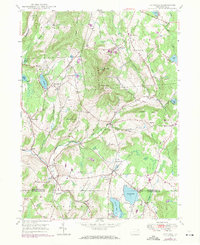 1946 Clifford1971 Print · USGSSusquehanna and Lackawanna counties come together in this mid-century survey of the high country around Elk Hill. Genealogists and local historians can trace the Old Newburg Turnpike and locate family burial grounds like Burdick Cem and Lyons Street Cem.2 unique versions available
 - 1946 Map of Hop Bottom, 1971 Print
 1946 Hop Bottom1971 Print · USGSSusquehanna County in the mid-twentieth century shows a landscape of steep creek valleys and high ridge farming. Genealogists can trace family names at St Patricks Cem, locate the Squier Hill Sch, and follow the Erie Lackawanna RR corridor.
 - 1946 Map of Lenoxville, 1971 Print
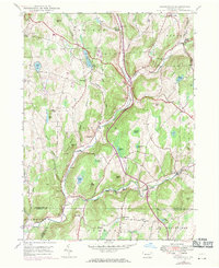 1946 Lenoxville1971 Print · USGSSusquehanna County’s rural valleys and ridges are captured here in the mid-forties, showing the transition of small farming communities. Researchers can trace the locations of local landmarks like West Lenox Ch, Wright Sch, and the riverside settlement of Glenwood.3 unique versions available
 - 1947 Map of Hopbottom
 1947 Hopbottom1947 Print · USGSSusquehanna and Wyoming counties appear here in the late 1940s as a landscape of deep rail valleys and upland farms. Family historians can locate several rural burial grounds like Squier Cem and Deckertown Cem, or trace the Delaware Lackawanna and Western through Hopbottom.
 - 1947 Map of Auburn Center
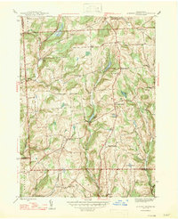 1947 Auburn Center1947 Print · USGSSusquehanna County in the late 1940s is a landscape of high ridges and rural crossroads communities. Genealogists and local historians can trace family locations near Boles Cem. or investigate old community centers like Retta, Rushboro, and South Auburn.2 unique versions available
 - 1948 Map of Springville
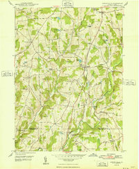 1948 Springville1948 Print · USGSSusquehanna County remains a landscape of independent crossroads and family farms in the years following the war. Genealogists can trace rural life through landmarks like Springville, the Wallace Hill Sch, and rail stops at Dimock Sta and Lynn Sta.2 unique versions available
 - 1948 Map of Clifford
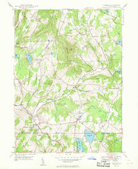 1948 Clifford1948 Print · USGSThe rolling uplands of Susquehanna County are captured here in the late 1940s, centered on the high peaks of Elk Hill. Genealogists can trace family names through many rural burial grounds like Willow View Cem and the crossroads at Burdick Corners.
 - 1949 Map of Lenoxville
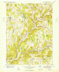 1949 Lenoxville1949 Print · USGSSusquehanna County in the late 1940s reveals a network of tight-knit valley settlements and upland farms connected by winding creek-side roads. Researchers can locate family landmarks like South Gibson Cem, the Mount View Airport, and historic rural schoolhouses including Wilson Sch and Green Grove Sch.
 - 1949 Map of Forest City
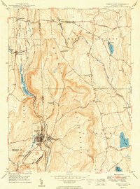 1949 Forest City1949 Print · USGSIn the decade following the war, this Pennsylvania landscape shows the enduring rail-and-river network of the Moosic Mountains. Genealogists and historians can trace family-named landmarks and rural hubs such as Pleasant Mount, Uniondale, and the St Peter and Paul Ch.2 unique versions available
Showing maps 1-25 of 67
Top cities of Susquehanna County
- Bridgewater Township historical maps
- Clifford Township historical maps
- Lenox Township historical maps
- Springville Township historical maps
- Silver Lake Township historical maps
- Harford Township historical maps
See more
Frequently asked questions
- What are the different types of historical maps available for Susquehanna County?
- What is the oldest map of Susquehanna County?
- Where can I purchase historical maps of Susquehanna County for my home or office?
- Where can I download high-res historical maps of Susquehanna County?
- Are there historical topographic maps available for Susquehanna County?
- Is there historical aerial imagery available for Susquehanna County?
- Where are historical maps of Susquehanna County sourced from?