2000s (21st Century) Maps of Susquehanna County, Pennsylvania
Explore 20 historic maps of Susquehanna County from the 2000s (21st Century). These maps offer a rare glimpse into what life looked like during the 2000s — showing old roads, neighborhoods, homes, and landmarks that have changed or disappeared over time.
Whether you're researching your family's past, planning a metal detecting trip, or studying how Susquehanna County's landscape evolved across the 2000s, these high-resolution maps are a powerful tool for exploring the history of this region.
- Focus on a specific era: All maps on this page are from the 2000s, giving you a focused view of this time period.
- See what’s changed: Compare century-old streets, trails, and buildings to today's modern landscape using overlays and satellite layers.
- Research with precision: Use these maps for genealogy, historical research, land use analysis, or educational projects.
- View, download, or print: Maps are fully viewable online in high resolution, and can be downloaded or printed for your own records.
Start exploring Susquehanna County's history through authentic maps from the 2000s. This is your window into the past.
Susquehanna County, PA maps
(20)- 2023 Map of Hop Bottom, 2023 Print
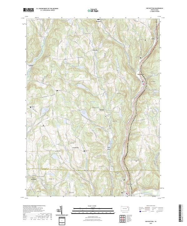 2023 Hop Bottom2023 Print · USGSThe valleys of Susquehanna County are captured here at a time when the Lackawanna RR and Lackawanna Trl remained central to regional travel. Genealogists can trace family names at the Evergreen Cem, Button Cem, or Dennis Cem.
 - 2023 Map of Clifford, 2023 Print
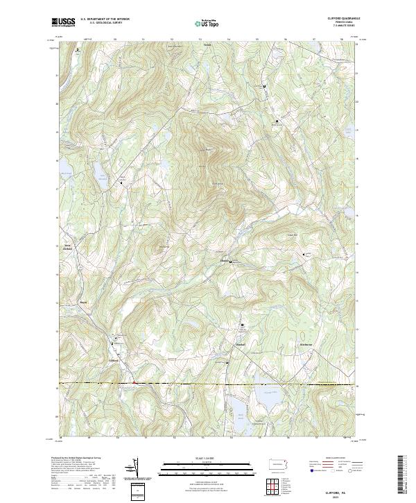 2023 Clifford2023 Print · USGSSusquehanna County highlands are shown here in the 2020s, centered on the historic crossroads of Clifford and Dundaff. Genealogists can trace family heritage at the Lyon Burial Ground, Welsh Hill Cem, and the Burdick Cem.
 - 2023 Map of Lawton, 2023 Print
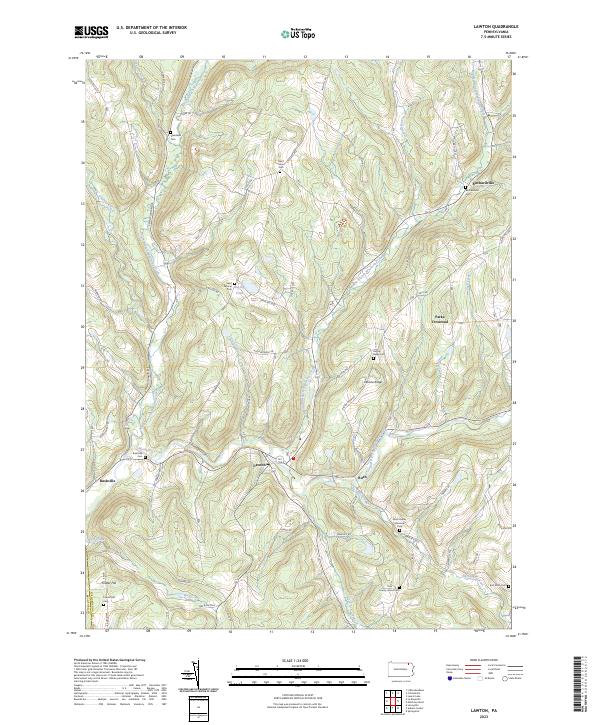 2023 Lawton2023 Print · USGSSusquehanna County at the start of the 2020s shows a landscape deeply rooted in its valley settlements and family heritage. Genealogists can trace local history through numerous sites like County Home Cem, Saint Johns Cem, and the village of Lawton.
 - 2023 Map of Susquehanna, 2023 Print
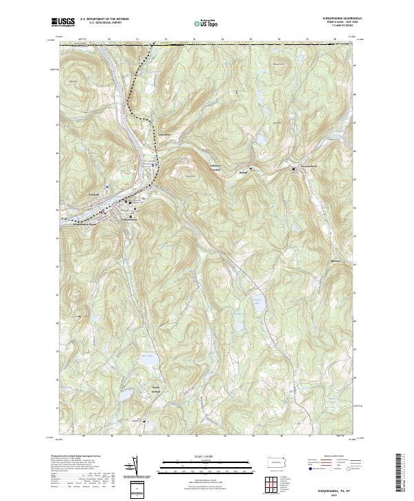 2023 Susquehanna2023 Print · USGSThe river valley at Susquehanna and Oakland is shown in this recent survey, capturing the region's transition from a major rail hub to a modern landscape. Researchers can locate numerous family burial sites like Evergreen Cem and trace the historic route of the D & H Rail-Trl.
 - 2023 Map of Montrose East, 2023 Print
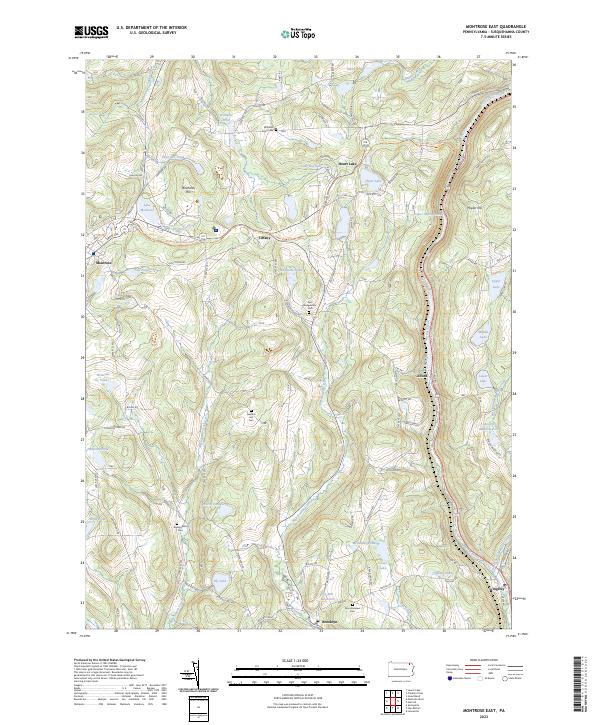 2023 Montrose East2023 Print · USGSSusquehanna County in the early twenty-first century remains a landscape of historic hilltop roads and glacial pond clusters. Researchers can trace family sites near Mountainview Cem, follow the Martins Creek corridor through Alford, or locate landmarks like Birchard Hill.
 - 2023 Map of Montrose West, 2023 Print
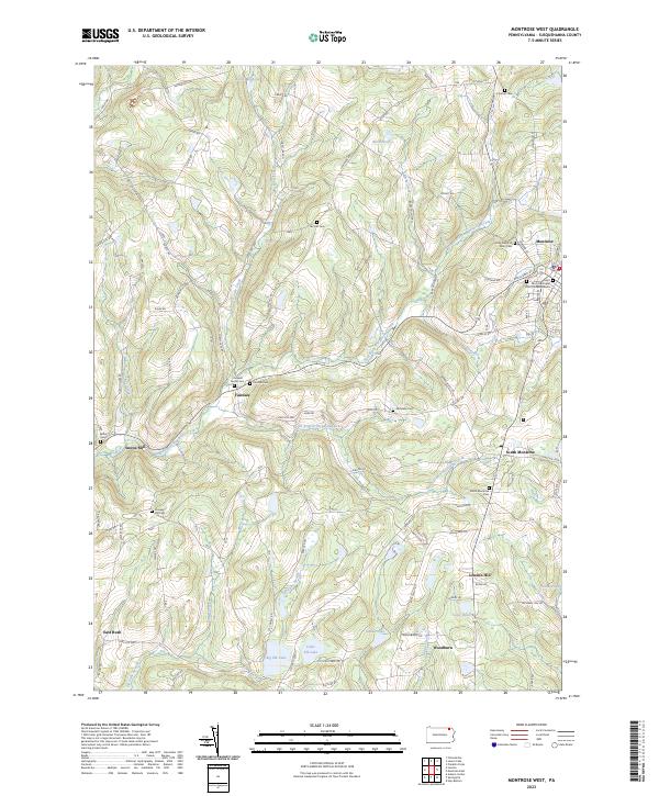 2023 Montrose West2023 Print · USGSSusquehanna County remains a region of quiet hamlets and family-named ridges in this contemporary view of the Pennsylvania uplands. Genealogists and local historians can locate several family burial sites, including Cornwell Family Cem, and trace the waters of Big Elk Lake or Forest Lake Creek.
 - 2023 Map of Springville, 2023 Print
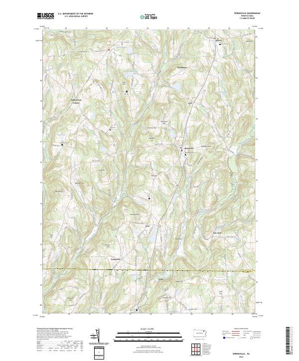 2023 Springville2023 Print · USGSSusquehanna County's agricultural highlands are captured here in the modern era, showing the enduring layout of the region's crossroads and hill-country settlements. Researchers can locate family landmarks like Bunnell Cem and Tyler Hill Cem or trace the winding course of Meshoppen Creek.
 - 2023 Map of Starrucca, 2023 Print
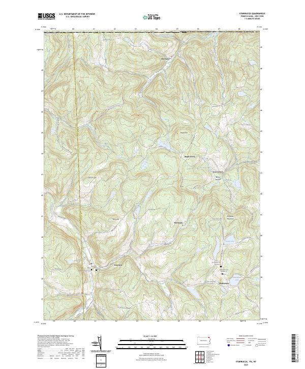 2023 Starrucca2023 Print · USGSWayne County's high ridges and creek valleys appear in recent detail, showing the rural character of the Pennsylvania-New York borderlands. Genealogists and historians can locate remote family burial sites like Shehawken Cem Number 02 or trace the path of the former D&H Rail-Trl.
 - 2023 Map of Auburn Center, 2023 Print
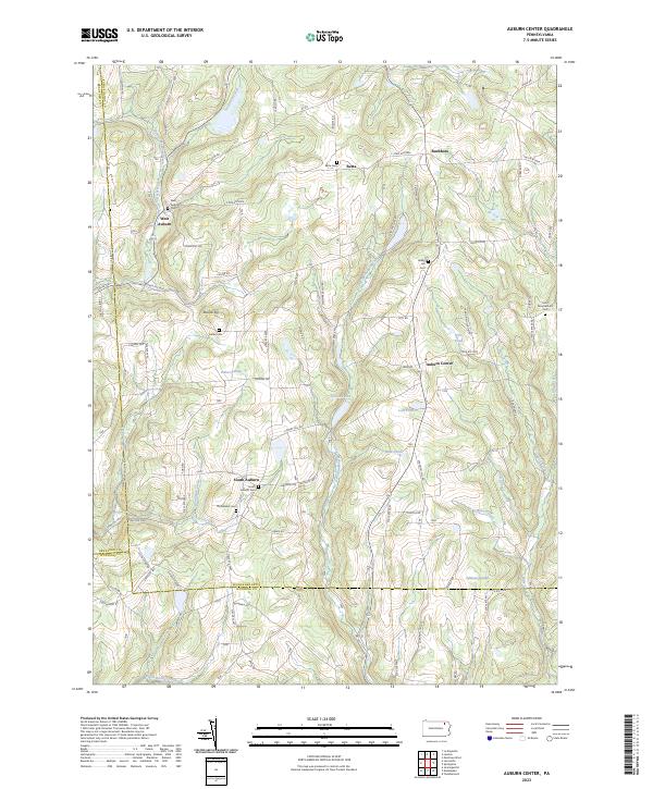 2023 Auburn Center2023 Print · USGSThe rural borderlands of Susquehanna and Wyoming Counties appear in this modern survey of the Auburn highlands. Researchers can trace family history through numerous burial sites like Bolles Cem and the small hamlets of West Auburn and Retta.
 - 2023 Map of Friendsville, 2023 Print
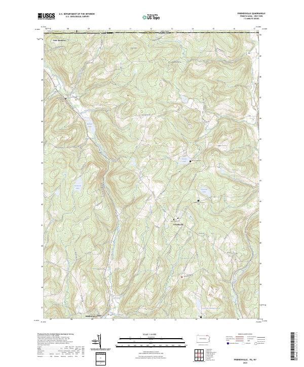 2023 Friendsville2023 Print · USGSSusquehanna County at the New York border remains a landscape of high ridges and quiet lake basins in the early twenty-first century. Researchers can locate family burial grounds and old crossroads at Quaker Churchyard Cem, Little Meadows, and Stanley Lake.
 - 2023 Map of Le Raysville, 2023 Print
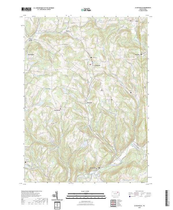 2023 Le Raysville2023 Print · USGSThe northern Pennsylvania highlands near Le Raysville are documented here in detail, showcasing a landscape of family farms and creek-side settlements. Researchers can locate ancestral burial sites like View Cem and Stevensville Cem or trace the winding course of Wyalusing Creek.
 - 2023 Map of Little Meadows, 2023 Print
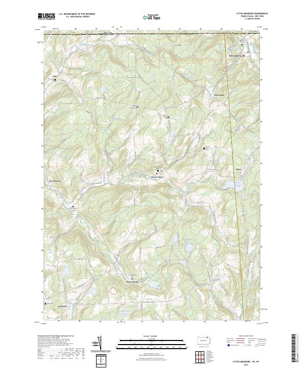 2023 Little Meadows2023 Print · USGSThe rolling hill country of the Pennsylvania-New York border comes into focus in this recent survey. Researchers can trace family history through sites like the Albert Brainard Family Cem, Cadis Cem, and the community of Warren Center.
 - 2023 Map of Thompson, 2023 Print
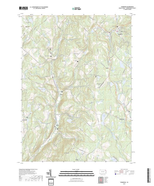 2023 Thompson2023 Print · USGSSusquehanna County’s highland landscape is documented here in the early twenty-first century, showing a region defined by its historic turnpikes and rail corridors. Researchers can trace ancestral roots through numerous burial sites like Saint Mary's Russian Cem or explore the route of the D&H Rail-Trl near Thompson.
 - 2023 Map of Lenoxville, 2023 Print
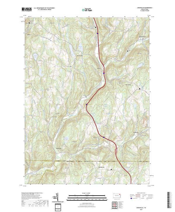 2023 Lenoxville2023 Print · USGSSusquehanna County at the turn of the twenty-first century reveals a landscape of winding creeks and high ridges. Trace local history through Maplewood Cemetery, follow the path of Tunkhannock Creek, or locate the historic West Lenox settlement.
 - 2023 Map of Harford, 2023 Print
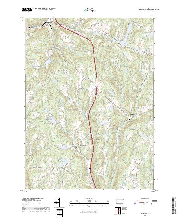 2023 Harford2023 Print · USGSSusquehanna County’s rolling upland plateau comes into focus in this recent survey of the Harford and New Milford area. Genealogists and local historians can trace family plots at Harford Cem and Gibson Cem or explore the shores of Tingley Lake.
 - 2023 Map of Franklin Forks, 2023 Print
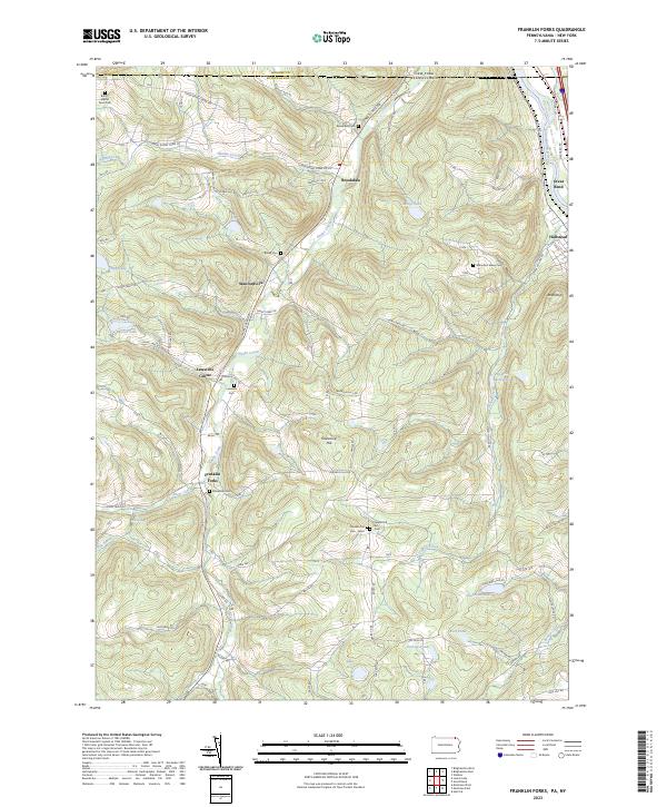 2023 Franklin Forks2023 Print · USGSSusquehanna County’s highland terrain and creek valleys are captured in modern detail just south of the New York border. Genealogists can trace family heritage through numerous remote burial sites like Butts - Martin Farm Cem, Lawsville Cem, and Mountain Valley Cem.
 - 2023 Map of Great Bend, 2023 Print
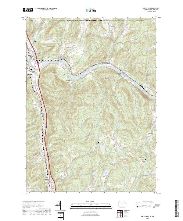 2023 Great Bend2023 Print · USGSThe Susquehanna River valley near the New York border is shown here in its modern landscape, where historical settlements and transportation corridors converge. Family historians can locate numerous burial sites, from Rose Hill Cem to the First Presbyterian Church Cem, alongside landmarks like Woodbridge Island.
 - 2023 Map of Laurel Lake, 2023 Print
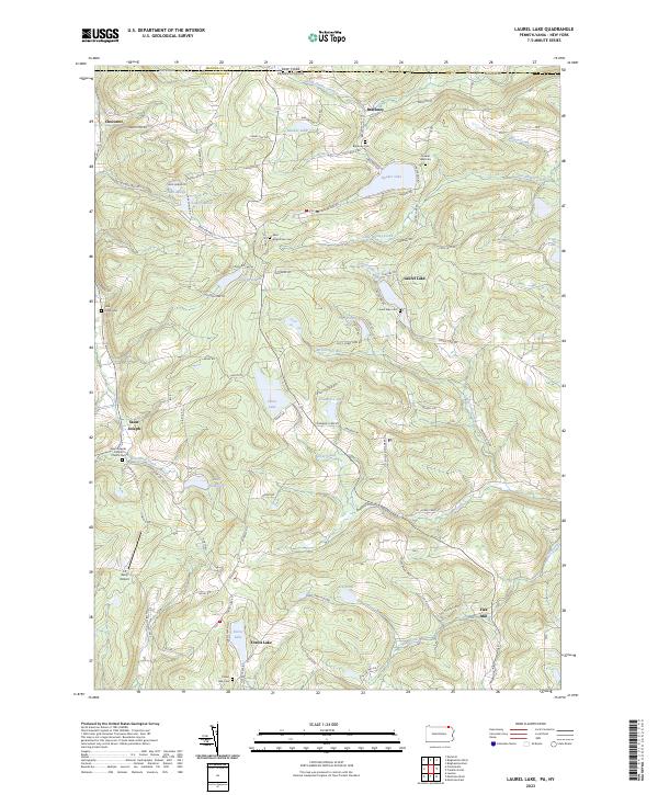 2023 Laurel Lake2023 Print · USGSThe Pennsylvania and New York border country comes alive in this 2023 survey of northern Susquehanna County. Researchers can trace rural lineages through sites like John Locke Cem, the community of Brackney, and the Saint Josephs Catholic Church.
 - 2023 Map of Orson, 2023 Print
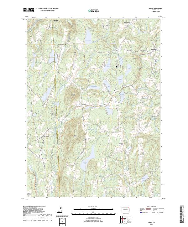 2023 Orson2023 Print · USGSWayne and Susquehanna counties are shown in the 2020s, a landscape defined by glacial lakes and the paths of old rail lines. Researchers can trace family history at the West Preston Cem or follow the historic rail grades of the O&W Rail-Trl and D&H Rail-Trl.
 - 2023 Map of Forest City, 2023 Print
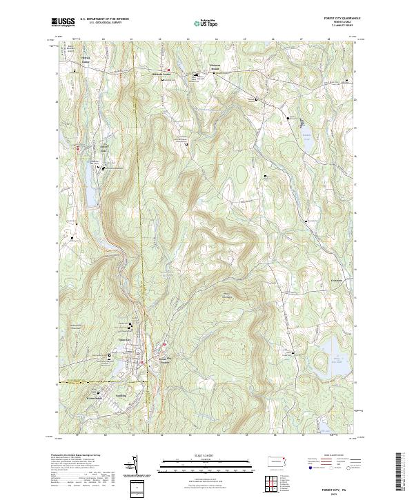 2023 Forest City2023 Print · USGSThe northern Moosic Mountains come into focus on the Susquehanna and Wayne County borders in this modern survey. Genealogists can trace family lines through the Meredith Family Cem, Wheeler Hill Cem, and the distinctive Old Colonial Mausoleum.
End of results
Showing maps 1-20 of 20
Top cities of Susquehanna County
- Bridgewater Township historical maps
- Clifford Township historical maps
- Lenox Township historical maps
- Springville Township historical maps
- Silver Lake Township historical maps
- Harford Township historical maps
See more
Frequently asked questions
- What are the different types of historical maps available for Susquehanna County?
- What is the oldest map of Susquehanna County?
- Where can I purchase historical maps of Susquehanna County for my home or office?
- Where can I download high-res historical maps of Susquehanna County?
- Are there historical topographic maps available for Susquehanna County?
- Is there historical aerial imagery available for Susquehanna County?
- Where are historical maps of Susquehanna County sourced from?