Old Maps of Clarendon Heights, Mead Township for Metal Detecting
Plan your next treasure hunt with 14 historic maps of Clarendon Heights. Find old homesites, ghost towns, trails, and gathering spots that may be lost to time — perfect for identifying promising metal detecting locations.
- Locate forgotten sites: Uncover places like long-lost settlements, abandoned rail lines, or gathering spots.
- Plan better hunts: Use map overlays combined with LiDAR or satellite views to narrow in on historically rich areas.
- Made for detectorists: Thousands of hobbyists use these maps to discover relics, coins, and hidden history.
Use these historic maps to boost your research and find new opportunities beneath the surface of Clarendon Heights.
Clarendon Heights, Mead Township maps
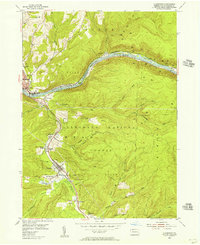
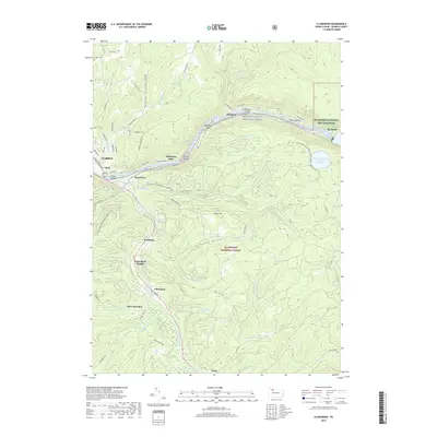
(14)- 1906 Map of Warren
 1906 Warren1906 Print · USGSWarren and its surrounding river valleys are captured here at the height of the early rail era. Genealogists can trace family names across dozens of rural landmarks, from the State Insane Asylum to scattered outposts like Lander and Old Clarendon.3 unique versions available
 - 1907 Map of Warren
 1907 Warren1907 Print · USGSWarren and its riverfront neighborhoods thrived at the dawn of the century as a hub for the Pennsylvania RR. Local historians can trace the footprint of the State Insane Asylum and find rural schools such as Dutch Hill School and Knupp School.
 - 1908 Map of Warren
 1908 Warren1908 Print · USGSThe river-and-rail economy of Warren County is documented here at the turn of the century. Genealogists can trace family-named landmarks and rural hubs like Lander, Oakland Cem, and the State Insane Asylum.3 unique versions available
 - 1954 Map of Clarendon, 1956 Print
 1954 Clarendon1956 Print · USGSMid-century Warren County is shown here as a center for the regional energy economy, dominated by the Oil Field. Family historians can trace the residents of Clarendon, Tiona, and Weldbank, or locate sites like Snyder Cem and Lincoln Sch.5 unique versions available
 - 1957 Map of Warren, 1964 Print
 1957 Warren1964 Print · USGSThe northern Pennsylvania oil and timber country comes into focus in the mid-fifties, showing the region before modern highway expansions. Trace the industrial rail networks of the Pennsylvania RR and the early Allegheny River Reservoir near Warren and Oil City.4 unique versions available
 - 1958 Map of Warren
 1958 Warren1958 Print · USGSNorthern Pennsylvania’s timber and oil country is captured here during the late fifties, showing the interplay of industrial valleys and vast state forests. Genealogists can trace family connections across the Cornplanter Indian Reservation or through rail hubs like Oil City and Saint Marys.
 - 1959 Map of Warren
 1959 Warren1959 Print · USGSNorthern Pennsylvania's oil and timber country comes alive in this late-fifties study of the forest-clad plateaus. Trace the historic Cornplanter (Indian Reservation), the sprawling Oil Field, and the rail lines of the Pennsylvania RR.2 unique versions available
 - 1971 Map of Warren
 1971 Warren1971 Print · USGSNorth Central Pennsylvania is captured here in the early seventies, showing a landscape defined by industrial centers and massive state forests. Genealogists and historians can trace the rail lines of the Penn Central and Erie Lackawanna connecting towns like Warren, Kane, and Du Bois.
 - 1983 Map of Warren, 1984 Print
 1983 Warren1984 Print · USGSNorthwestern Pennsylvania at the dawn of the 1980s reveals a landscape defined by the petroleum industry and expansive public lands. Trace the legacy of early oil at Drake Well Memorial Park and Pithole City Historical Site, or locate family sites near Warren State Hospital and Kellettville.
 - 2011 Map of Clarendon, 2011 Print
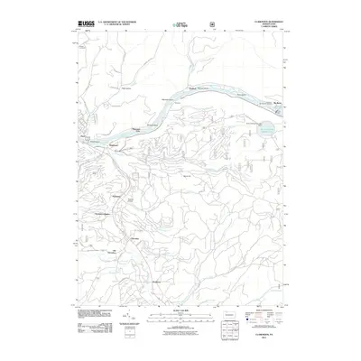 2011 Clarendon2011 Print · USGSCovers Clarendon Heights, including Warren, Sheffield Township, and other nearby areas
 - 2013 Map of Clarendon, 2013 Print
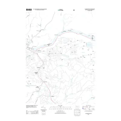 2013 Clarendon2013 Print · USGSCovers Clarendon Heights, including Warren, Sheffield Township, and other nearby areas
 - 2016 Map of Clarendon, 2016 Print
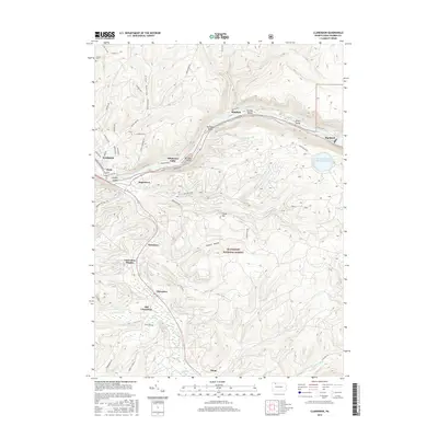 2016 Clarendon2016 Print · USGSCovers Clarendon Heights, including Warren, Sheffield Township, and other nearby areas
 - 2019 Map of Clarendon, 2019 Print
 2019 Clarendon2019 Print · USGSCovers Clarendon Heights, including Warren, Sheffield Township, and other nearby areas
 - 2023 Map of Clarendon, 2023 Print
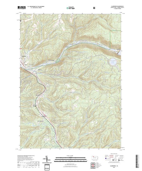 2023 Clarendon2023 Print · USGSThe northern Pennsylvania highlands and the Allegheny River valley are shown here as they appear today within the Allegheny National Forest. Researchers can trace the legacy of timber and industry through settlements like Old Clarendon, Stoneham, and Tiona, or locate family sites at Snyder Cem and Shipmans Eddy.
End of results
Showing maps 1-14 of 14
Top cities near Clarendon Heights
- Warren historical maps
- Busti historical maps
- Carroll historical maps
- Sheffield Township historical maps
- Glade historical maps
- North Warren historical maps
See more
Frequently asked questions
- What are the different types of historical maps available for Clarendon Heights?
- What is the oldest map of Clarendon Heights?
- Where can I purchase historical maps of Clarendon Heights for my home or office?
- Where can I download high-res historical maps of Clarendon Heights?
- Are there historical topographic maps available for Clarendon Heights?
- Is there historical aerial imagery available for Clarendon Heights?
- Where are historical maps of Clarendon Heights sourced from?