2020s Maps of Buffalo Township, Pennsylvania
Explore 4 historic maps of Buffalo Township from the 2020s. These maps offer a rare glimpse into what life looked like during the 2020s — showing old roads, neighborhoods, homes, and landmarks that have changed or disappeared over time.
Whether you're researching your family's past, planning a metal detecting trip, or studying how Buffalo Township's landscape evolved across the 2020s, these high-resolution maps are a powerful tool for exploring the history of this region.
- Focus on a specific era: All maps on this page are from the 2020s, giving you a focused view of this time period.
- See what’s changed: Compare century-old streets, trails, and buildings to today's modern landscape using overlays and satellite layers.
- Research with precision: Use these maps for genealogy, historical research, land use analysis, or educational projects.
- View, download, or print: Maps are fully viewable online in high resolution, and can be downloaded or printed for your own records.
Start exploring Buffalo Township's history through authentic maps from the 2020s. This is your window into the past.
Buffalo Township, PA maps
(4)- 2023 Map of Washington West, 2023 Print
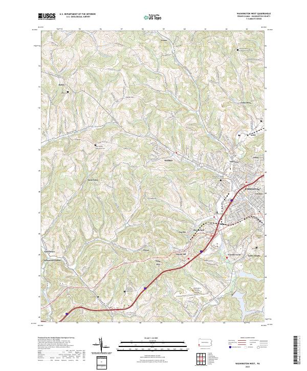 2023 Washington West2023 Print · USGSWestern Washington County during the early twenty-first century maintains its distinct coal-country and agricultural character. Genealogists can trace family names through several historic sites including Horn Cem, Arden Mines, and Buffalo Cem.
 - 2023 Map of Claysville, 2023 Print
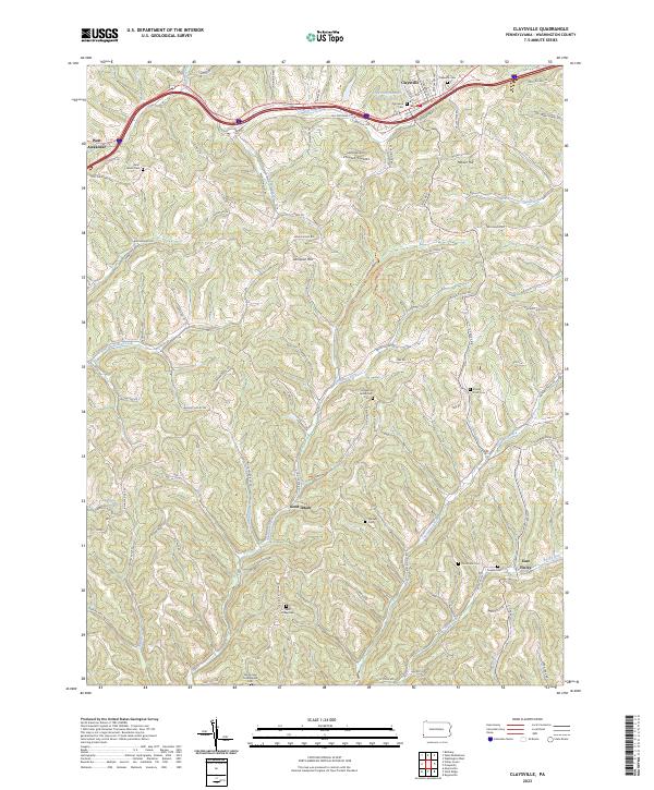 2023 Claysville2023 Print · USGSThe hills of Washington County are shown in detail during the early 2020s, centering on the historic corridor between Claysville and West Alexander. Family historians can trace local landmarks like Stoney Point Cem, Dogwood Grove Cem, and the high ground of Sampson Hill.
 - 2023 Map of Prosperity, 2023 Print
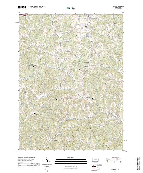 2023 Prosperity2023 Print · USGSWashington County's rural heritage is well-preserved in this study of the hills near Prosperity and Old Concord. Genealogists can trace family lineages through numerous local sites including Old Quaker Cem, Pleasant Grove Baptist Church, and Mount Zion Cem.
 - 2023 Map of West Middletown, 2023 Print
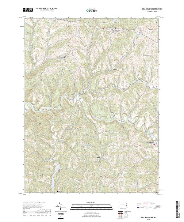 2023 West Middletown2023 Print · USGSWestern Washington County's ridge-and-hollow terrain is captured here in the modern era, showing the enduring footprint of historic hill towns. Genealogists and local historians can locate numerous rural burial sites like Miller Cem and Hupp Cem alongside settlements at West Middletown and Taylorstown.
End of results
Showing maps 1-4 of 4
Top cities near Buffalo Township
- Weirton historical maps
- Washington historical maps
- Cecil Township historical maps
- Canonsburg historical maps
- South Strabane Township historical maps
- Mount Pleasant historical maps
See more
Top neighborhoods of Buffalo Township
- Coffeys Crossing historical maps
- Rural Valley historical maps
- Finney historical maps
- Sugar Hill historical maps
- Taylorstown Station historical maps
Frequently asked questions
- What are the different types of historical maps available for Buffalo Township?
- What is the oldest map of Buffalo Township?
- Where can I purchase historical maps of Buffalo Township for my home or office?
- Where can I download high-res historical maps of Buffalo Township?
- Are there historical topographic maps available for Buffalo Township?
- Is there historical aerial imagery available for Buffalo Township?
- Where are historical maps of Buffalo Township sourced from?