2020s Maps of Preston Township, Pennsylvania
Explore 4 historic maps of Preston Township from the 2020s. These maps offer a rare glimpse into what life looked like during the 2020s — showing old roads, neighborhoods, homes, and landmarks that have changed or disappeared over time.
Whether you're researching your family's past, planning a metal detecting trip, or studying how Preston Township's landscape evolved across the 2020s, these high-resolution maps are a powerful tool for exploring the history of this region.
- Focus on a specific era: All maps on this page are from the 2020s, giving you a focused view of this time period.
- See what’s changed: Compare century-old streets, trails, and buildings to today's modern landscape using overlays and satellite layers.
- Research with precision: Use these maps for genealogy, historical research, land use analysis, or educational projects.
- View, download, or print: Maps are fully viewable online in high resolution, and can be downloaded or printed for your own records.
Start exploring Preston Township's history through authentic maps from the 2020s. This is your window into the past.
Preston Township, PA maps
(4)- 2023 Map of Starrucca, 2023 Print
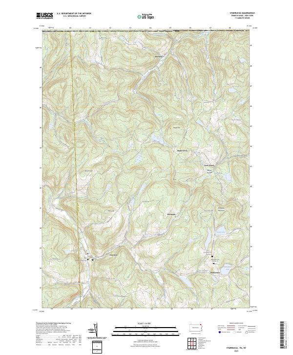 2023 Starrucca2023 Print · USGSWayne County's high ridges and creek valleys appear in recent detail, showing the rural character of the Pennsylvania-New York borderlands. Genealogists and historians can locate remote family burial sites like Shehawken Cem Number 02 or trace the path of the former D&H Rail-Trl.
 - 2023 Map of Hancock, 2023 Print
 2023 Hancock2023 Print · USGSThe Upper Delaware River valley thrives as a borderland between New York and Pennsylvania, centered on the historic river town of Hancock. Genealogists and researchers can trace the old O & W Railroad corridor and explore family history at Ball's Eddy Cemetery or Stockport.
 - 2023 Map of Lake Como, 2023 Print
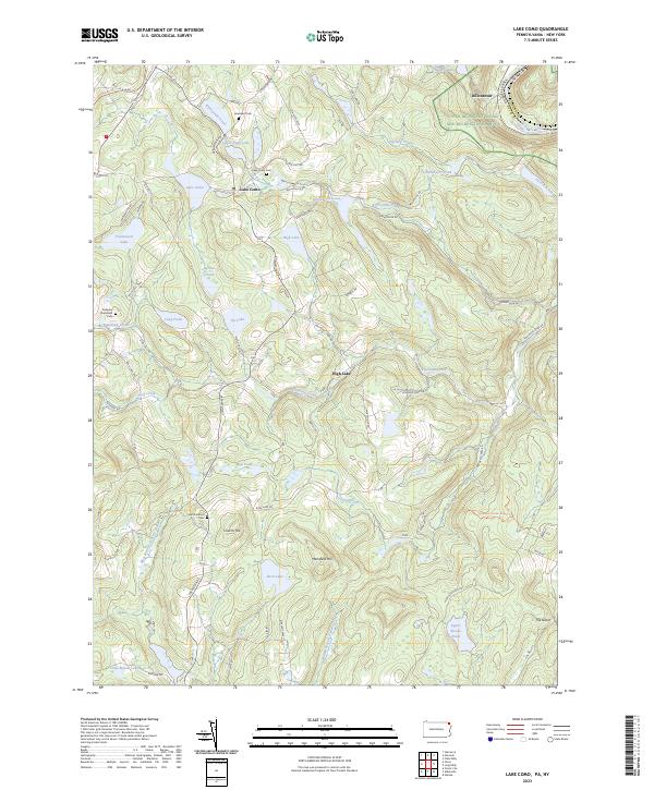 2023 Lake Como2023 Print · USGSWayne County’s high plateau is shown here at the turn of the millennium, where the O & W Rail Trl traces the path of a historic rail corridor through Lake Como. Researchers can locate several burial grounds like Jerusalem Cem and Saint Juliana's Cem near High Lake and Sly Lake.
 - 2023 Map of Orson, 2023 Print
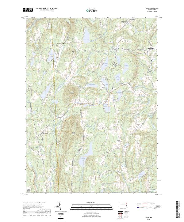 2023 Orson2023 Print · USGSWayne and Susquehanna counties are shown in the 2020s, a landscape defined by glacial lakes and the paths of old rail lines. Researchers can trace family history at the West Preston Cem or follow the historic rail grades of the O&W Rail-Trl and D&H Rail-Trl.
End of results
Showing maps 1-4 of 4
Top cities near Preston Township
- Windsor historical maps
- Damascus Township historical maps
- Hancock historical maps
- Clifford Township historical maps
- Sanford historical maps
- Deposit historical maps
See more
Top neighborhoods of Preston Township
- Preston Park historical maps
- Lakewood historical maps
- East Spruce historical maps
- Lake Como historical maps
- Preston Corner historical maps
- Shehawken historical maps
See more
Frequently asked questions
- What are the different types of historical maps available for Preston Township?
- What is the oldest map of Preston Township?
- Where can I purchase historical maps of Preston Township for my home or office?
- Where can I download high-res historical maps of Preston Township?
- Are there historical topographic maps available for Preston Township?
- Is there historical aerial imagery available for Preston Township?
- Where are historical maps of Preston Township sourced from?