Old Maps of Eaton Township, Pennsylvania for Hiking & Exploration
Hike through history with 50 historic maps of Eaton Township. Explore old trails, ghost towns, and forgotten backroads — perfect for outdoor adventurers and local explorers.
- Rediscover forgotten places: Map out old mining camps, roads, and footpaths that no longer exist on modern maps.
- Layer with modern tools: Combine with LiDAR or satellite views to plan hikes through historical terrain.
- Made for exploration: Popular among hikers, overlanders, and local history lovers.
Use these maps to find adventure and explore the hidden past of Eaton Township.
Eaton Township, PA maps
(50)- 1891 Map of Harveys Lake, 1962 Print
 1891 Harveys Lake1962 Print · USGSLuzerne and Wyoming counties are shown here in the late nineteenth century as the timber and rail industries transformed the mountains. Researchers can trace the Lehigh Valley R.R. through Noxen and locate early lake settlements like Laketon and Idetown.
 - 1893 Map of Harvey Lake
 1893 Harvey Lake1893 Print · USGSThe northern Pennsylvania Highlands are captured here in the late nineteenth century, just as the lumber industry was reshaping the landscape. Genealogists and historians can trace the early rail spurs of the Lewis Lumber R. R. and locate family-named hamlets like Cease Mills, Rittenhouse, and Sweet Valley.6 unique versions available
 - 1893 Map of Pittston
 1893 Pittston1893 Print · USGSThe industrial Wyoming Valley and the rural uplands of the Susquehanna meet in this late nineteenth-century survey. Researchers can trace the complex rail networks of Pittston and West Pittston or locate family roots in settlements like Forty Fort, Maltby, and Falls.9 unique versions available
 - 1943 Map of Scranton
 1943 Scranton1943 Print · USGSNortheastern Pennsylvania’s coal and rail corridor comes to life in the 1940s, showcasing the dense urban industrial centers of the Wyoming Valley. Genealogists can locate family landmarks like the Fayette School and Locust Ridge School or trace the early paths of the DL & W and Erie railroads.
 - 1945 Map of Meshoppen, 1952 Print
 1945 Meshoppen1952 Print · USGSNortheastern Pennsylvania hill country and the winding Susquehanna River are captured here in the years following the war. Researchers can trace the legacy of small farming and rail communities through landmarks like Skinners Eddy, Mehoopany Sta, and Golden Hill Sch.4 unique versions available
 - 1945 Map of Meshoppen, 1956 Print
 1945 Meshoppen1956 Print · USGSThe Susquehanna River loops through Wyoming County just after the war, creating a landscape defined by sharp bends and rail transit. Researchers can trace the Lehigh Valley line through the Vosburg Tunnel and locate the Russell Hill Sch and Overfield Cem.4 unique versions available
 - 1946 Map of Tunkhannock, 1952 Print
 1946 Tunkhannock1952 Print · USGSThe northern Susquehanna River valley and the Wyoming County highlands are captured here in the mid-1940s. Genealogists and historians can trace the rail-connected settlements of Nicholson and Springville or locate family landmarks like Bunnell Cem and Castle Sch.3 unique versions available
 - 1946 Map of Noxen, 1963 Print
 1946 Noxen1963 Print · USGSWyoming County settlement and mountain terrain are captured here just after the war, showing the area's transition into Luzerne County. Genealogists can trace family footprints in small hamlets like Noxen, Evans Falls, and Beaumont, or locate the Childrens Welfare Center and Faggles.5 unique versions available
 - 1946 Map of Center Moreland, 1969 Print
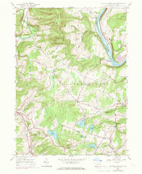 1946 Center Moreland1969 Print · USGSThe Susquehanna River valley and the hills of Wyoming County appear in detail during the post-war era. Researchers can trace the river's transport legacy via the Lehigh Valley line and locate community landmarks like Thurston Ch and the Hunter Sch.3 unique versions available
 - 1946 Map of Tunkhannock, 1971 Print
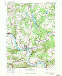 1946 Tunkhannock1971 Print · USGSTunkhannock and the winding Susquehanna River are captured here in the mid-twentieth century as the regional rail and road networks matured. Researchers can locate family sites at Sunnyside Cem, old rural schoolhouses like Castle Sch, and the grounds of St Andrews Camp.3 unique versions available
 - 1947 Map of Meshoppen
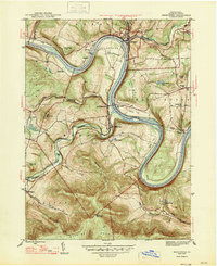 1947 Meshoppen1947 Print · USGSThe Susquehanna River dominates the Wyoming County landscape in the years following the war, where rail and river networks shaped local life. Researchers can trace family history through sites like Fox Hollow Ch, the Vosburg Tunnel, and the old Mehoopany Sta.2 unique versions available
 - 1948 Map of Tunkhannock
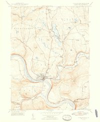 1948 Tunkhannock1948 Print · USGSTunkhannock and the Susquehanna River valley are captured here in the years following World War II, showing a landscape defined by rail and river. Genealogists can trace family names and local landmarks like Osterhout PO, Castle Sch, and Sunnyside Cem.2 unique versions available
 - 1949 Map of Center Moreland
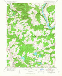 1949 Center Moreland1949 Print · USGSThe Susquehanna River corridor in the late 1940s is captured here just as local rural life revolved around the Lehigh Valley rail line and small upland hamlets. Genealogists and researchers can locate family-named landmarks and institutions like Whites Ferry, Thurston Ch, and Hunter Sch.2 unique versions available
 - 1949 Map of Noxen
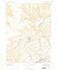 1949 Noxen1949 Print · USGSThe mountainous border of Wyoming and Luzerne counties comes into focus in the years after the war, showing the industrial and social hubs of the region. Local researchers can trace the Lehigh Valley rail corridor through Noxen and locate landmarks like the Childrens Welfare Center and Harvey Lake.2 unique versions available
 - 1950 Map of Scranton, 1952 Print
 1950 Scranton1952 Print · USGSMid-century Northeast Pennsylvania and the Hudson Valley come alive in this survey of the tri-state region. Genealogists and historians can trace the dense rail networks of the Erie RR and DL&W RR between industrial hubs like Scranton and Wilkes-Barre.
 - 1953 Map of Scranton
 1953 Scranton1953 Print · USGSNortheastern Pennsylvania and the Catskills are shown in great detail during the early fifties, a time when rail lines and river valleys dictated the region's growth. Genealogists and historians can trace the industrial hearts of Scranton and Wilkes-Barre or locate remote landmarks like High Point and Lake Wallenpaupack.
 - 1954 Map of Williamsport
 1954 Williamsport1954 Print · USGSNorth-central Pennsylvania in the mid-fifties is defined by the winding West Branch Susquehanna River and its industrial valley. Local historians can trace the massive Susquehanna Ordnance Depot and the extensive rail networks of the Pennsylvania Railroad.
 - 1959 Map of Scranton
 1959 Scranton1959 Print · USGSThe northern coalfields and the Hudson Valley meet in this mid-century survey of the Pennsylvania and New York borderlands. Genealogists and historians can trace the intricate rail networks of the Erie Railroad and the vast waters of Lake Wallenpaupack.2 unique versions available
 - 1960 Map of Williamsport
 1960 Williamsport1960 Print · USGSNorth-central Pennsylvania in the mid-twentieth century was a vital corridor of rail and river industry stretching from the New York line to the coal regions. Genealogists can trace the rail networks of the Pennsylvania RR and Lehigh Valley RR connecting towns like Williamsport, Towanda, and Lock Haven.
 - 1962 Map of Williamsport, 1966 Print
 1962 Williamsport1966 Print · USGSNorth-central Pennsylvania was a landscape of industrial river hubs and vast state woodlands in the early sixties. Researchers can trace the path of the Pennsylvania Railroad through Williamsport and explore the remote reaches of Bucktail State Park.5 unique versions available
 - 1962 Map of Scranton, 1977 Print
 1962 Scranton1977 Print · USGSThe industrial heart of eastern Pennsylvania and the New York Catskills are captured here in the early sixties. Genealogists and historians can trace the dense valley settlements from Scranton to Wilkes-Barre and the rail lines of the Erie Lackawanna Railroad.2 unique versions available
 - 1965 Map of Scranton
 1965 Scranton1965 Print · USGSThe tri-state highlands of Pennsylvania, New York, and New Jersey come alive in the mid-sixties as industry and recreation converge. Trace the intricate rail lines of the Erie Lackawanna RR or locate landmarks like the U S Military Academy.2 unique versions available
 - 1965 Map of Williamsport
 1965 Williamsport1965 Print · USGSNorth-central Pennsylvania in the mid-1960s is defined by the industrial river towns and vast timberlands of the Allegheny Plateau. Researchers can trace historic rail lines like the Erie Lackawanna and Reading as they thread through Williamsport, Lock Haven, and Jersey Shore.
 - 1966 Map of Williamsport
 1966 Williamsport1966 Print · USGSThe Susquehanna Valley was a hub of transit and industry in the mid-seventies, where the river's West Branch connected major college towns and timberlands. Researchers can trace historical rail lines like the Reading or locate regional landmarks from Jersey Shore to Ricketts Glen State Park.
 - 1981 Map of Towanda, 1982 Print
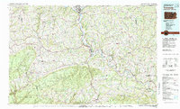 1981 Towanda1982 Print · USGSThe Susquehanna Valley at the turn of the 1980s reveals a region of mountain forests and busy river towns along the New York border. Researchers can trace the legacy of the CONRAIL lines through Sayre or locate remote landmarks like Armenia Mountain and Mt Pisgah State Park.
Showing maps 1-25 of 50
Top cities near Eaton Township
- Plains Township historical maps
- Dallas Township historical maps
- Pittston historical maps
- Kingston Township historical maps
- Exeter historical maps
- Swoyersville historical maps
See more
Top neighborhoods of Eaton Township
- Jenks historical maps
- Eatonville historical maps
- Rosengrant historical maps
- South Eaton historical maps
Frequently asked questions
- What are the different types of historical maps available for Eaton Township?
- What is the oldest map of Eaton Township?
- Where can I purchase historical maps of Eaton Township for my home or office?
- Where can I download high-res historical maps of Eaton Township?
- Are there historical topographic maps available for Eaton Township?
- Is there historical aerial imagery available for Eaton Township?
- Where are historical maps of Eaton Township sourced from?