2020s Maps of Franklin Township, Pennsylvania
Explore 2 historic maps of Franklin Township from the 2020s. These maps offer a rare glimpse into what life looked like during the 2020s — showing old roads, neighborhoods, homes, and landmarks that have changed or disappeared over time.
Whether you're researching your family's past, planning a metal detecting trip, or studying how Franklin Township's landscape evolved across the 2020s, these high-resolution maps are a powerful tool for exploring the history of this region.
- Focus on a specific era: All maps on this page are from the 2020s, giving you a focused view of this time period.
- See what’s changed: Compare century-old streets, trails, and buildings to today's modern landscape using overlays and satellite layers.
- Research with precision: Use these maps for genealogy, historical research, land use analysis, or educational projects.
- View, download, or print: Maps are fully viewable online in high resolution, and can be downloaded or printed for your own records.
Start exploring Franklin Township's history through authentic maps from the 2020s. This is your window into the past.
Franklin Township, PA maps
(2)- 2023 Map of Dillsburg, 2023 Print
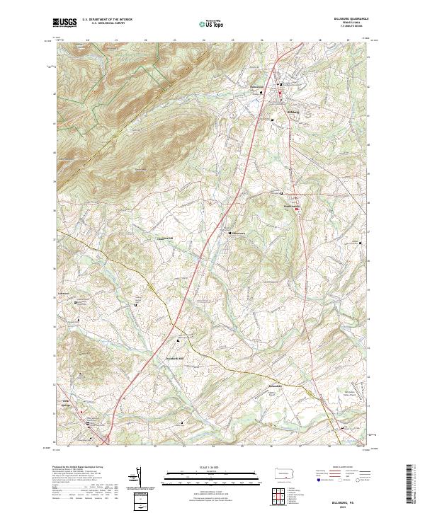 2023 Dillsburg2023 Print · USGSDillsburg and its surrounding rural townships appear here in the early 2020s as a landscape of interconnected valley farms and timbered ridges. Genealogists can locate family names at the Latimore Mennonite Meetinghouse Cemetery or trace the path of the Mason Dixon Trail past Deardorffs Mill.
 - 2023 Map of Mount Holly Springs, 2023 Print
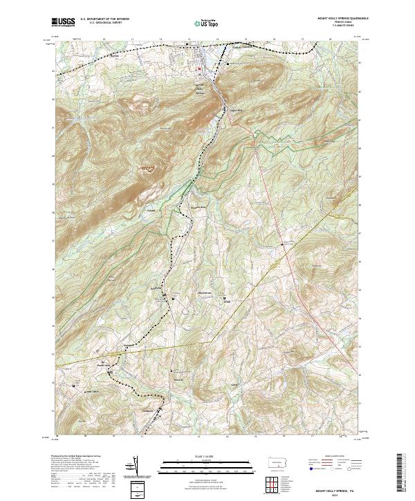 2023 Mount Holly Springs2023 Print · USGSThe Cumberland and Adams County line crosses this 2023 study of the South Mountain foothills and mountain gaps. Trace the Appalachian National Scenic Trail through the Michaux State Forest or locate family sites at Mount Holly Colored Cem and Uriah Church.
End of results
Showing maps 1-2 of 2
Top cities near Franklin Township
- Harrisburg historical maps
- Carlisle historical maps
- Gettysburg historical maps
- New Cumberland historical maps
- Lower Allen historical maps
- Camp Hill historical maps
See more
Top neighborhoods of Franklin Township
Frequently asked questions
- What are the different types of historical maps available for Franklin Township?
- What is the oldest map of Franklin Township?
- Where can I purchase historical maps of Franklin Township for my home or office?
- Where can I download high-res historical maps of Franklin Township?
- Are there historical topographic maps available for Franklin Township?
- Is there historical aerial imagery available for Franklin Township?
- Where are historical maps of Franklin Township sourced from?