2020s Maps of North Codorus Township, Pennsylvania
Explore 5 historic maps of North Codorus Township from the 2020s. These maps offer a rare glimpse into what life looked like during the 2020s — showing old roads, neighborhoods, homes, and landmarks that have changed or disappeared over time.
Whether you're researching your family's past, planning a metal detecting trip, or studying how North Codorus Township's landscape evolved across the 2020s, these high-resolution maps are a powerful tool for exploring the history of this region.
- Focus on a specific era: All maps on this page are from the 2020s, giving you a focused view of this time period.
- See what’s changed: Compare century-old streets, trails, and buildings to today's modern landscape using overlays and satellite layers.
- Research with precision: Use these maps for genealogy, historical research, land use analysis, or educational projects.
- View, download, or print: Maps are fully viewable online in high resolution, and can be downloaded or printed for your own records.
Start exploring North Codorus Township's history through authentic maps from the 2020s. This is your window into the past.
North Codorus Township, PA maps
(5)- 2023 Map of Seven Valleys, 2023 Print
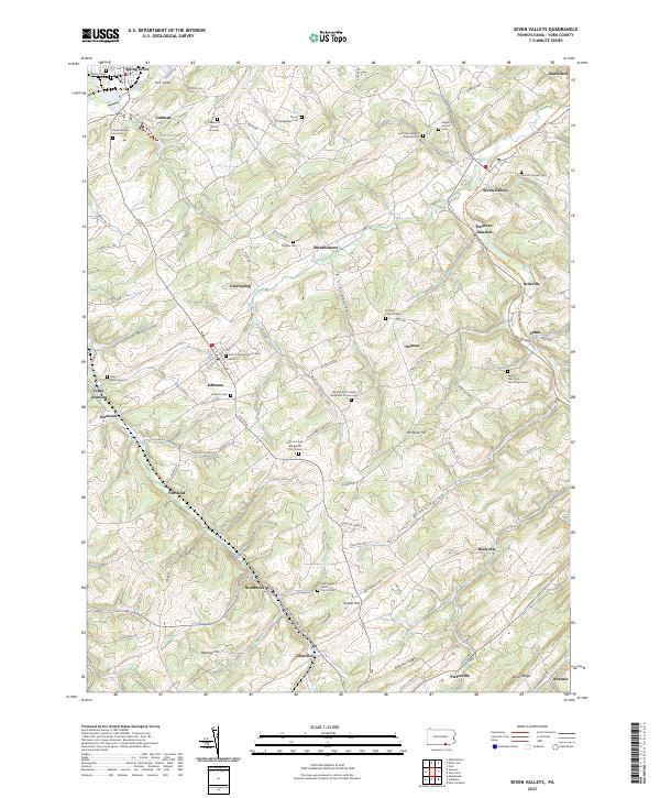 2023 Seven Valleys2023 Print · USGSSouthern York County in the modern era retains the intricate network of villages and family burial grounds established centuries ago. Genealogists and historians can trace local roots through Saint Jacobs Stone Church Cem, Hanover Junction, and the Renoll Burial Grounds.
 - 2023 Map of West York, 2023 Print
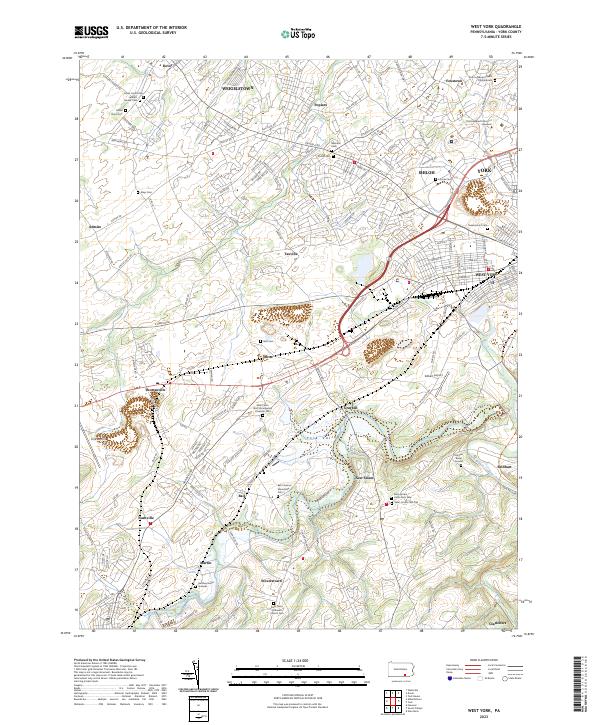 2023 West York2023 Print · USGSThe York Valley landscape near the turn of the twenty-first century shows a fascinating mix of growing suburbs and historic rural crossroads. Trace family history through numerous sites like Dover Union Cem, Bair Codorus Mennonite Cem, and Heindel Burial Ground.
 - 2023 Map of York, 2023 Print
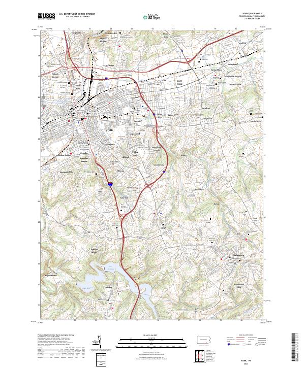 2023 York2023 Print · USGSYork and its surrounding boroughs are shown in 2023 at a moment of modern density mixed with deep colonial-era roots. Genealogists can trace family plots at Prospect Hill Cem or find the intersection of history and recreation along the Heritage Rail Trail County Park.
 - 2023 Map of Glen Rock, 2023 Print
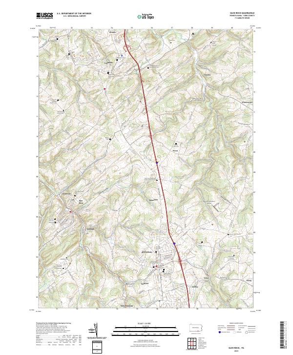 2023 Glen Rock2023 Print · USGSSouthern York County is shown in detail during the early 2020s, centered on the historic corridor between Shrewsbury and New Freedom. Genealogists can trace family names through numerous burial grounds like the Gibson Burial Ground and Joseph Giesey Memorial Cem.
 - 2023 Map of Hanover, 2023 Print
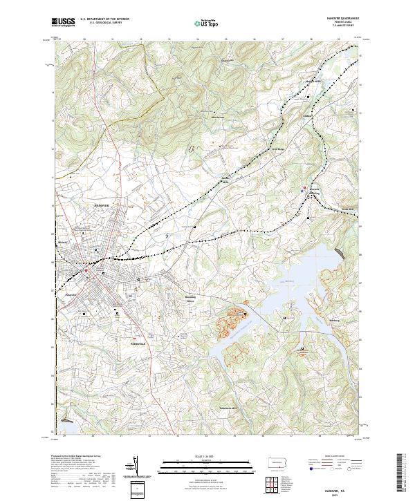 2023 Hanover2023 Print · USGSSettled between the Pigeon Hills and the Codorus Creek basin, this York County landscape reveals a deep network of rural hamlets and cemeteries. Genealogists can trace family names at Mount Olivet Cem or explore the old mill sites at Menges Mills and Kraft Mill.
End of results
Showing maps 1-5 of 5
Top cities near North Codorus Township
- York historical maps
- Hanover historical maps
- Parkville historical maps
- West Manheim Township historical maps
- Shrewsbury historical maps
- Hampstead historical maps
See more
Top neighborhoods of North Codorus Township
- Cold Spring historical maps
- Ambau historical maps
- Hanover Junction historical maps
- Stoverstown historical maps
- Strickhousers historical maps
- Lehman historical maps
Frequently asked questions
- What are the different types of historical maps available for North Codorus Township?
- What is the oldest map of North Codorus Township?
- Where can I purchase historical maps of North Codorus Township for my home or office?
- Where can I download high-res historical maps of North Codorus Township?
- Are there historical topographic maps available for North Codorus Township?
- Is there historical aerial imagery available for North Codorus Township?
- Where are historical maps of North Codorus Township sourced from?