1940s Maps of Scarborough Hills, Narragansett
Explore 5 historic maps of Scarborough Hills from the 1940s. These maps offer a rare glimpse into what life looked like during the 1940s — showing old roads, neighborhoods, homes, and landmarks that have changed or disappeared over time.
Whether you're researching your family's past, planning a metal detecting trip, or studying how Scarborough Hills's landscape evolved across the 1940s, these high-resolution maps are a powerful tool for exploring the history of this region.
- Focus on a specific era: All maps on this page are from the 1940s, giving you a focused view of this time period.
- See what’s changed: Compare century-old streets, trails, and buildings to today's modern landscape using overlays and satellite layers.
- Research with precision: Use these maps for genealogy, historical research, land use analysis, or educational projects.
- View, download, or print: Maps are fully viewable online in high resolution, and can be downloaded or printed for your own records.
Start exploring Scarborough Hills's history through authentic maps from the 1940s. This is your window into the past.
Scarborough Hills, Narragansett maps
(5)- 1942 Map of Newport
 1942 Newport1942 Print · USGSThe Rhode Island coast appears here at a critical wartime moment, showing the heavy fortification of Narragansett Bay. Researchers can trace military sites like Fort Kearny, maritime landmarks like the Point Judith Life Saving Station, and old ferry routes.2 unique versions available
 - 1942 Map of Narragansett Pier, 1957 Print
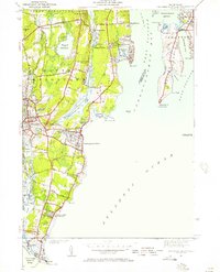 1942 Narragansett Pier1957 Print · USGSCoastal Rhode Island is captured here in the early 1940s, showing the intersection of resort life and maritime defense. Researchers can trace local landmarks from Narragansett Pier to the tactical grounds of Fort Nathaniel Green and Fort Phillip Kearney.
 - 1944 Map of Narragansett Pier
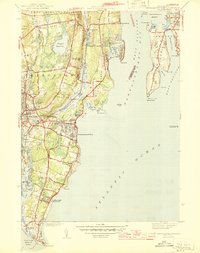 1944 Narragansett Pier1944 Print · USGSThe Rhode Island shoreline during the mid-1940s is shown here in meticulous detail from Wakefield to the tip of Point Judith. Genealogists and historians can trace old homesteads and coastal landmarks like Narragansett Ch, Bridgetown, and the long-established South Ferry.3 unique versions available
 - 1947 Map of Providence, 1948 Print
 1947 Providence1948 Print · USGSSouthern New England is captured in the mid-1940s, showing a landscape defined by busy industrial ports and expanding military installations. Researchers can trace the rail lines of the N.Y. N.H. & H. RR or locate coastal defenses like Fort Adams and Quonset Point.5 unique versions available
 - 1948 Map of Providence, 1951 Print
 1948 Providence1951 Print · USGSSouthern New England’s coastal reaches are captured here in the late 1940s, from the industrial heart of Providence to the tip of Provincetown. Genealogists and historians can trace rail lines like the Central Vermont Railway and locate active military sites such as Otis Air Force Base and Fort Rodman.
End of results
Showing maps 1-5 of 5
Frequently asked questions
- What are the different types of historical maps available for Scarborough Hills?
- What is the oldest map of Scarborough Hills?
- Where can I purchase historical maps of Scarborough Hills for my home or office?
- Where can I download high-res historical maps of Scarborough Hills?
- Are there historical topographic maps available for Scarborough Hills?
- Is there historical aerial imagery available for Scarborough Hills?
- Where are historical maps of Scarborough Hills sourced from?