Old Maps of Scarborough Hills, Narragansett for Metal Detecting
Plan your next treasure hunt with 18 historic maps of Scarborough Hills. Find old homesites, ghost towns, trails, and gathering spots that may be lost to time — perfect for identifying promising metal detecting locations.
- Locate forgotten sites: Uncover places like long-lost settlements, abandoned rail lines, or gathering spots.
- Plan better hunts: Use map overlays combined with LiDAR or satellite views to narrow in on historically rich areas.
- Made for detectorists: Thousands of hobbyists use these maps to discover relics, coins, and hidden history.
Use these historic maps to boost your research and find new opportunities beneath the surface of Scarborough Hills.
Scarborough Hills, Narragansett maps
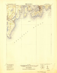
(18)- 1889 Map of Newport
 1889 Newport1889 Print · USGSCovers Scarborough Hills, including South Kingstown, North Kingstown, and other nearby areas
 - 1894 Map of Newport
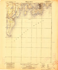
 1894 Newport1894 Print · USGSCovers Scarborough Hills, including South Kingstown, North Kingstown, and other nearby areas3 unique versions available
 - 1904 Map of Newport, 1912 Print
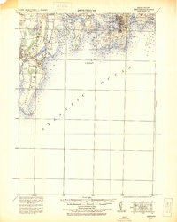
 1904 Newport1912 Print · USGSCovers Scarborough Hills, including South Kingstown, North Kingstown, and other nearby areas
 - 1920 Map of Newport
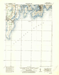
 1920 Newport1920 Print · USGSCovers Scarborough Hills, including South Kingstown, North Kingstown, and other nearby areas2 unique versions available
 - 1922 Map of Newport
 1922 Newport1922 Print · USGSCovers Scarborough Hills, including South Kingstown, North Kingstown, and other nearby areas
 - 1931 Map of Newport
 1931 Newport1931 Print · USGSCovers Scarborough Hills, including South Kingstown, North Kingstown, and other nearby areas
 - 1935 Map of Newport
 1935 Newport1935 Print · USGSCovers Scarborough Hills, including South Kingstown, North Kingstown, and other nearby areas
 - 1942 Map of Newport
 1942 Newport1942 Print · USGSCovers Scarborough Hills, including South Kingstown, North Kingstown, and other nearby areas2 unique versions available
 - 1942 Map of Narragansett Pier, 1957 Print
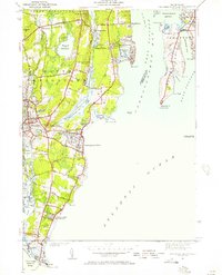 1942 Narragansett Pier1957 Print · USGSCovers Scarborough Hills, including South Kingstown, North Kingstown, and other nearby areas
 - 1944 Map of Narragansett Pier
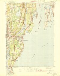 1944 Narragansett Pier1944 Print · USGSCovers Scarborough Hills, including South Kingstown, North Kingstown, and other nearby areas3 unique versions available
 - 1947 Map of Providence, 1948 Print
 1947 Providence1948 Print · USGSCovers Scarborough Hills, including Providence, New Bedford, and other nearby areas5 unique versions available
 - 1948 Map of Providence, 1951 Print
 1948 Providence1951 Print · USGSCovers Scarborough Hills, including Providence, New Bedford, and other nearby areas
 - 1957 Map of Providence
 1957 Providence1957 Print · USGSCovers Scarborough Hills, including Providence, New Bedford, and other nearby areas
 - 1957 Map of Narragansett Pier, 1959 Print
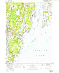 1957 Narragansett Pier1959 Print · USGSCovers Scarborough Hills, including South Kingstown, North Kingstown, and other nearby areas5 unique versions available
 - 1958 Map of Providence
 1958 Providence1958 Print · USGSCovers Scarborough Hills, including Providence, New Bedford, and other nearby areas
 - 1963 Map of Providence
 1963 Providence1963 Print · USGSCovers Scarborough Hills, including Providence, New Bedford, and other nearby areas
 - 1984 Map of Block Island
 1984 Block Island1984 Print · USGSCovers Scarborough Hills, including Groton, South Kingstown, and other nearby areas
 - 2024 Map of Narragansett Pier, 2024 Print
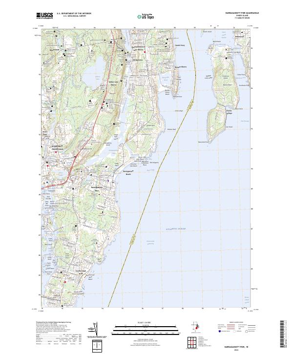 2024 Narragansett Pier2024 Print · USGSCovers Scarborough Hills, including South Kingstown, North Kingstown, and other nearby areas
End of results
Showing maps 1-18 of 18
Frequently asked questions
- What are the different types of historical maps available for Scarborough Hills?
- What is the oldest map of Scarborough Hills?
- Where can I purchase historical maps of Scarborough Hills for my home or office?
- Where can I download high-res historical maps of Scarborough Hills?
- Are there historical topographic maps available for Scarborough Hills?
- Is there historical aerial imagery available for Scarborough Hills?
- Where are historical maps of Scarborough Hills sourced from?