Old Maps of Peacedale, South Kingstown for Genealogy
Trace your family roots with 22 historic maps of Peacedale. These high-res maps reveal old neighborhoods, homesites, landmarks, and streets — helping you uncover where your ancestors lived and how the area evolved over time.
- Explore historic neighborhoods: Identify where your relatives may have lived in the 1800s or 1900s.
- Compare maps over time: Trace the changes in streets, buildings, and landmarks for multi-generational research.
- Perfect for genealogy & ancestry research: Used by family historians and researchers to map out lineage and migration.
These maps are an incredible resource for exploring your personal connection to Peacedale's past.
Peacedale, South Kingstown maps
(22)- 1889 Map of Newport
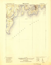
 1889 Newport1889 Print · USGSNewport and the surrounding Narragansett Bay area are captured in the late 1880s, showcasing a landscape of coastal fortifications and maritime commerce. Local historians can trace the foundations of Narragansett Pier, the busy harbor at Fort Adams, and vanished landmarks like Watsons Pier.
 - 1894 Map of Newport
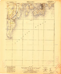
 1894 Newport1894 Print · USGSCoastal Rhode Island was a hive of maritime activity and late-Victorian growth when this survey was conducted. Researchers can trace the legacy of Narragansett Bay through landmarks like Fort Adams, the Narragansett Pier R.R., and Beaver Tail Light.3 unique versions available
 - 1904 Map of Newport, 1912 Print
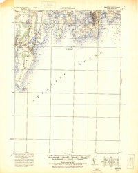
 1904 Newport1912 Print · USGSCoastal Rhode Island thrived at the dawn of the century, with its bustling harbors and strategic military outposts guarding the bay. Trace the early streets of Newport, the defenses at Fort Adams, and the waterfront at Narragansett Pier.
 - 1920 Map of Newport
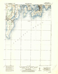
 1920 Newport1920 Print · USGSNarragansett Bay at the end of the Great War reveals a landscape defined by coastal defense and maritime trade. Trace the lines of the Sea View R.R. Co. Electric R.R. or locate historic military sites like Fort Kearney and Fort Adams.2 unique versions available
 - 1922 Map of Newport
 1922 Newport1922 Print · USGSThe Rhode Island coast after the turn of the century shows a landscape of strategic forts and bustling seaside resorts. Trace the path of the Sea View R.R. Co. Electric or locate historic military sites like Fort Adams and Fort Kearney.
 - 1931 Map of Newport
 1931 Newport1931 Print · USGSCoastal Rhode Island just after the Great War shows a landscape of strategic forts and bustling summer colonies. Genealogists and historians can trace the early Sea View R.R. through Narragansett Pier or locate family estates near Ochre Point.
 - 1935 Map of Newport
 1935 Newport1935 Print · USGSNarragansett Bay's military and maritime character is on full display in the mid-1930s. Researchers can trace the Sea View R.R. Co. Electric R.R. or locate coastal fortifications like Fort Adams and Fort Kearney.
 - 1942 Map of Newport
 1942 Newport1942 Print · USGSThe Rhode Island coast appears here at a critical wartime moment, showing the heavy fortification of Narragansett Bay. Researchers can trace military sites like Fort Kearny, maritime landmarks like the Point Judith Life Saving Station, and old ferry routes.2 unique versions available
 - 1942 Map of Narragansett Pier, 1957 Print
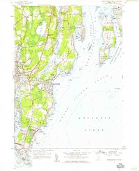
 1942 Narragansett Pier1957 Print · USGSCoastal Rhode Island is captured here in the early 1940s, showing the intersection of resort life and maritime defense. Researchers can trace local landmarks from Narragansett Pier to the tactical grounds of Fort Nathaniel Green and Fort Phillip Kearney.
 - 1944 Map of Narragansett Pier
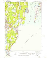
 1944 Narragansett Pier1944 Print · USGSThe Rhode Island shoreline during the mid-1940s is shown here in meticulous detail from Wakefield to the tip of Point Judith. Genealogists and historians can trace old homesteads and coastal landmarks like Narragansett Ch, Bridgetown, and the long-established South Ferry.3 unique versions available
 - 1947 Map of Providence, 1948 Print
 1947 Providence1948 Print · USGSSouthern New England is captured in the mid-1940s, showing a landscape defined by busy industrial ports and expanding military installations. Researchers can trace the rail lines of the N.Y. N.H. & H. RR or locate coastal defenses like Fort Adams and Quonset Point.5 unique versions available
 - 1948 Map of Providence, 1951 Print
 1948 Providence1951 Print · USGSSouthern New England’s coastal reaches are captured here in the late 1940s, from the industrial heart of Providence to the tip of Provincetown. Genealogists and historians can trace rail lines like the Central Vermont Railway and locate active military sites such as Otis Air Force Base and Fort Rodman.
 - 1957 Map of Providence
 1957 Providence1957 Print · USGSCoastal New England at the height of the mid-century era shows a landscape shaped by maritime industry and Cold War defense. Genealogists and historians can trace the reach of the New York, New Haven & Hartford RR and locate legacy sites like Fort Adams and Quonset Point Naval Air Station.
 - 1957 Map of Narragansett Pier, 1959 Print
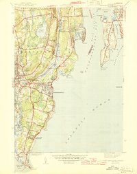
 1957 Narragansett Pier1959 Print · USGSCoastal Rhode Island in the late fifties is defined by its mix of historic shorefront villages and strategic coastal defense sites. Researchers can trace the development of Narragansett Pier, the grounds of Fort Burnside, and landmarks like McSparran Hill.5 unique versions available
 - 1958 Map of Providence
 1958 Providence1958 Print · USGSThe Rhode Island and Massachusetts coastlines are shown in detail during the late 1950s, from the urban cores to the tips of the islands. Researchers can trace the mid-century footprint of Quonset Point Naval Air Station, the defense works at Fort Adams, and the rail network of the New York, New Haven and Hartford RR.
 - 1963 Map of Providence
 1963 Providence1963 Print · USGSSouthern New England's coastal and industrial heartland is captured here in the early sixties, from the Rhode Island mainland to the far reaches of the Cape. Researchers can trace mid-century growth in Providence or locate landmarks on Marthas Vineyard and Nantucket Island.
 - 1984 Map of Block Island
 1984 Block Island1984 Print · USGSThe coastal borderlands of Rhode Island, Connecticut, and New York are captured here in the mid-eighties, from the rail hubs of Westerly to the shores of Block Island. Genealogists and historians can trace the shoreline's evolution through landmarks like the Pequot Indian Res, New Shoreham, and Narragansett Pier.
 - 2012 Map of Narragansett Pier, 2012 Print
 2012 Narragansett Pier2012 Print · USGSCovers Peacedale, including South Kingstown, North Kingstown, and other nearby areas
 - 2015 Map of Narragansett Pier, 2015 Print
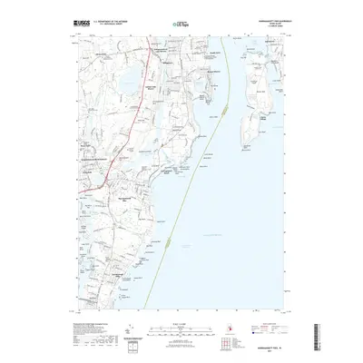
 2015 Narragansett Pier2015 Print · USGSCovers Peacedale, including South Kingstown, North Kingstown, and other nearby areas
 - 2018 Map of Narragansett Pier, 2018 Print
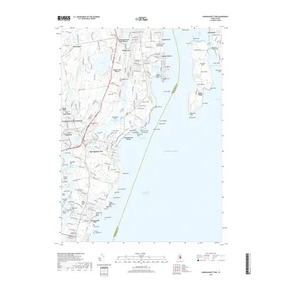 2018 Narragansett Pier2018 Print · USGSCovers Peacedale, including South Kingstown, North Kingstown, and other nearby areas
 - 2021 Map of Narragansett Pier, 2021 Print
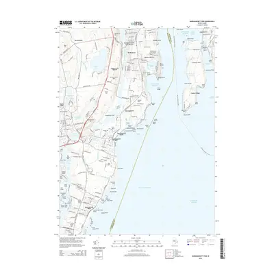
 2021 Narragansett Pier2021 Print · USGSCovers Peacedale, including South Kingstown, North Kingstown, and other nearby areas
 - 2024 Map of Narragansett Pier, 2024 Print
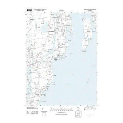
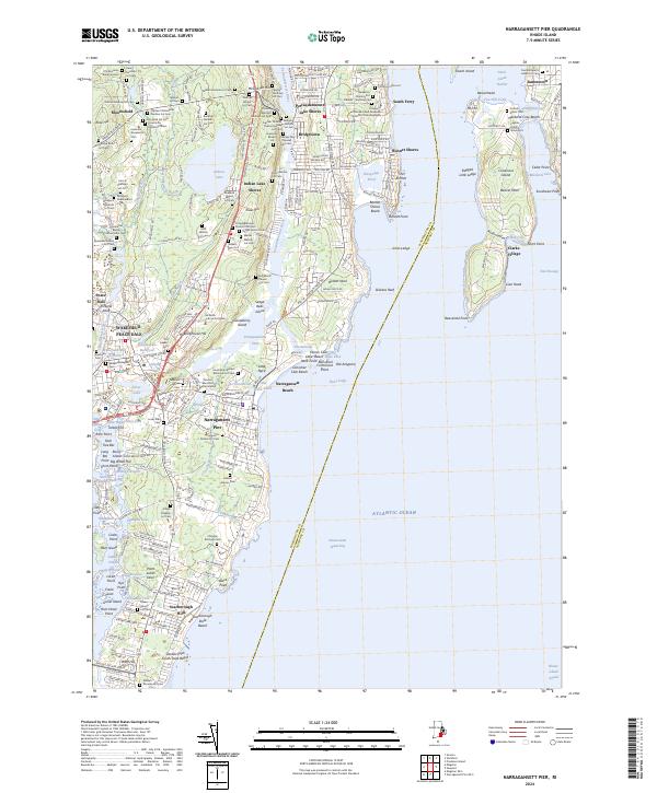 2024 Narragansett Pier2024 Print · USGSNarragansett and its coastal enclaves are mapped here during a period of modern preservation alongside deep family history. Genealogists can locate dozens of ancestral burial sites such as the Old Sherman Burial Ground and Franklin-Gardiner Cem, while maritime researchers can trace the Intracoastal Waterway and landmarks like the Wakefield Mill.
End of results
Showing maps 1-22 of 22
Top cities near Peacedale
- Warwick historical maps
- Coventry historical maps
- West Warwick historical maps
- South Kingstown historical maps
- North Kingstown historical maps
- Bristol historical maps
See more
Frequently asked questions
- What are the different types of historical maps available for Peacedale?
- What is the oldest map of Peacedale?
- Where can I purchase historical maps of Peacedale for my home or office?
- Where can I download high-res historical maps of Peacedale?
- Are there historical topographic maps available for Peacedale?
- Is there historical aerial imagery available for Peacedale?
- Where are historical maps of Peacedale sourced from?