1940s Maps of Aiken County, South Carolina
Explore 13 historic maps of Aiken County from the 1940s. These maps offer a rare glimpse into what life looked like during the 1940s — showing old roads, neighborhoods, homes, and landmarks that have changed or disappeared over time.
Whether you're researching your family's past, planning a metal detecting trip, or studying how Aiken County's landscape evolved across the 1940s, these high-resolution maps are a powerful tool for exploring the history of this region.
- Focus on a specific era: All maps on this page are from the 1940s, giving you a focused view of this time period.
- See what’s changed: Compare century-old streets, trails, and buildings to today's modern landscape using overlays and satellite layers.
- Research with precision: Use these maps for genealogy, historical research, land use analysis, or educational projects.
- View, download, or print: Maps are fully viewable online in high resolution, and can be downloaded or printed for your own records.
Start exploring Aiken County's history through authentic maps from the 1940s. This is your window into the past.
Aiken County, SC maps
(13)- 1941 Map of Clarks Hill, 1957 Print
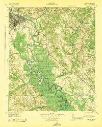
 1941 Clarks Hill1957 Print · USGSThe Savannah River valley remained a landscape of ferries and river-to-rail commerce just before the era of major dam construction. Genealogists and historians can trace family roots through numerous rural landmarks like Cary Hill Ch, Modoc, and Gilchrist Ferry.2 unique versions available
 - 1942 Map of Clarks Hill
 1942 Clarks Hill1942 Print · USGSThe Savannah River valley along the South Carolina and Georgia border comes alive in this survey from the era of river ferries and local rail. Genealogists can trace family landmarks like Hosannah Church, Dents Ferry, and the Flat Rock School.
 - 1943 Map of Aiken
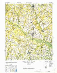
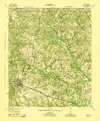 1943 Aiken1943 Print · USGSAiken and its rural outskirts come alive in the 1940s, showing a landscape defined by the Southern railroad and the South Fork Edisto River. Researchers can trace old family schoolhouses and local congregations, from Fountain Academy to the Welcome Traveler Ch.
 - 1943 Map of Greens Cut
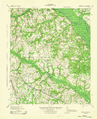 1943 Greens Cut1943 Print · USGSEastern Georgia during the early 1940s remained a landscape of river landings and rural railroad stops. Genealogists can trace family roots through numerous local landmarks like Old Church Sta, Hatchers Mill, and the settlement of Telfairville.
 - 1943 Map of Augusta East
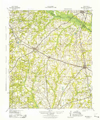
 1943 Augusta East1943 Print · USGSThe Savannah River valley along the Georgia and South Carolina border is shown here in the early 1940s, just before significant regional changes. Genealogists can trace hundreds of rural landmarks, including Ellenton, the Downer Institute, and several mills like Hatchers Mill.
 - 1943 Map of Williston
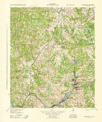
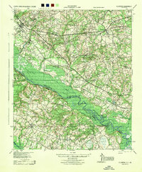
 1943 Williston1943 Print · USGSBarnwell County in the early 1940s was a landscape of rail-linked towns and scattered rural communities. Genealogists can trace family roots through numerous local landmarks, including the Blessed Home Sch, Woodward Mill, and the community of Healing Springs.2 unique versions available
 - 1943 Map of Warrenville
 1943 Warrenville1943 Print · USGSThe industrial corridor of Aiken County is captured here in the early 1940s, highlighting the mill towns along Horse Creek. Genealogists can trace family roots through numerous community landmarks like Bettis Academy, Horn Creek Ch, and the settlement at Vaucluse.
 - 1943 Map of Talatha
 1943 Talatha1943 Print · USGSAiken and Barnwell counties are captured here in the early 1940s, showing a rural landscape organized around deep-rooted churches and small schoolhouses. Researchers can trace ancestral locations near Thalmans Mill, Treadway Ch, or Fairview Sch along the many creek branches.
 - 1943 Map of Augusta
 1943 Augusta1943 Print · USGSThe Savannah River corridor at the Georgia-South Carolina border comes alive in the early 1940s, showing the intricate wetlands and rural communities of Richmond and Aiken Counties. Researchers can locate vanished landmarks like the Downer Institute, the Cottage Cem, and early roads like Tobacco Road.
 - 1944 Map of Ellenton
 1944 Ellenton1944 Print · USGSIn the mid-1940s, this area of the Savannah River valley was a thriving agricultural landscape centered on Ellenton and Dunbarton. Genealogists can trace family footprints through sites like Bethesda Sch, Daisy May Ch, and the local Burton & Myers Store.
 - 1944 Map of Gilbert, 1946 Print
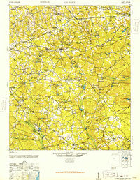 1944 Gilbert1946 Print · USGSMid-century Lexington County is mapped here as a network of rail-side towns and rural mill seats. Researchers can trace family roots at St Matthews Ch, locate the Saxe-Gotha Millpond, or follow the Southern Railway through Gilbert.2 unique versions available
 - 1944 Map of Seivern, 1946 Print
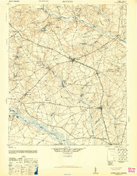 1944 Seivern1946 Print · USGSAiken County during the mid-1940s shows a landscape of river-fed millponds and historic trade routes. Genealogists can trace rural communities through landmarks like the Springfield Rosenwald Sch, Kitchings Mill, and the Ninety-Six Indian Trail.2 unique versions available
 - 1946 Map of Woodford
 1946 Woodford1946 Print · USGSThe mid-century rural landscape of Orangeburg and Lexington Counties is captured here as the Edisto River basin supported a network of small mill towns. Genealogists can trace family connections to numerous local landmarks like Kings Grove Ch, Darian Sch, and Pooles Millpond.3 unique versions available
End of results
Showing maps 1-13 of 13
Top cities of Aiken County
- Aiken historical maps
- North Augusta historical maps
- Burnettown historical maps
- New Ellenton historical maps
- Jackson historical maps
- Wagener historical maps
See more
Frequently asked questions
- What are the different types of historical maps available for Aiken County?
- What is the oldest map of Aiken County?
- Where can I purchase historical maps of Aiken County for my home or office?
- Where can I download high-res historical maps of Aiken County?
- Are there historical topographic maps available for Aiken County?
- Is there historical aerial imagery available for Aiken County?
- Where are historical maps of Aiken County sourced from?