Old Maps of Wagener, South Carolina
Explore 19 old maps of Wagener, spanning from 1944 to today. These high-resolution historic maps reveal how streets, neighborhoods, landmarks, and natural features evolved over time — perfect for genealogy, metal detecting, research, and local history exploration.
What you can do with these maps:
- See how Wagener changed over time: Compare historical maps to modern-day views to trace roads, homesites, rail lines & more.
- View detailed metadata: Each map includes creators, publishers, year, scale, and archive source.
- Overlay maps with satellite & LiDAR: Visualize the past alongside modern tools to explore terrain & human change.
- Trusted historical sources: Maps sourced from the USGS, Library of Congress, and other archives.
- Access maps your way: View online, download high-res files, or order prints for personal or research use.
Start exploring old maps of Wagener to uncover forgotten places, hidden landmarks, and the deep history beneath your feet.
Wagener, SC maps
(19)- 1944 Map of Seivern, 1946 Print
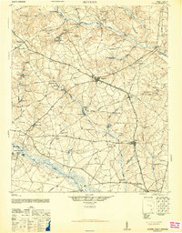 1944 Seivern1946 Print · USGSAiken County during the mid-1940s shows a landscape of river-fed millponds and historic trade routes. Genealogists can trace rural communities through landmarks like the Springfield Rosenwald Sch, Kitchings Mill, and the Ninety-Six Indian Trail.2 unique versions available
 - 1954 Map of Augusta
 1954 Augusta1954 Print · USGSThe Savannah River valley and South Carolina Midlands are captured here during a period of post-war growth. Researchers can trace the rail-and-river economy through the Southern RR corridor and locate historic settlements like Aiken, Orangeburg, and Sumter.
 - 1957 Map of Augusta, 1966 Print
 1957 Augusta1966 Print · USGSThe Savannah River and Santee basins are captured here during a period of massive military and industrial expansion in the late fifties. Genealogists can trace family footprints across Four Hole Swamp or near the Savannah River Plant.3 unique versions available
 - 1958 Map of Augusta
 1958 Augusta1958 Print · USGSThe borderlands between Georgia and South Carolina come alive in the 1950s, showing the early footprint of the Savannah River Plant. Genealogists and historians can trace rail-dependent towns and rural landmarks from Orangeburg to the Fort Jackson Military Reservation.
 - 1961 Map of Augusta
 1961 Augusta1961 Print · USGSThe South Carolina lowcountry and CSRA appear here in the early sixties, during a period of massive military and industrial growth. Researchers can trace the development of the Savannah River Plant or locate legacy landmarks like Nelson Ferry and Magnolia Cemetery.2 unique versions available
 - 1962 Map of Augusta
 1962 Augusta1962 Print · USGSThe South Carolina and Georgia borderlands are seen here in the early sixties, showing the rise of the Savannah River Plant and the expansion of Fort Jackson. Researchers can trace old rail lines like the Southern Railway and find landmarks such as St. Pauls Church or the Santee Canal.
 - 1983 Map of Aiken, 1984 Print
 1983 Aiken1984 Print · USGSThe Savannah River valley and South Carolina sandhills are shown in detail during the early eighties, as industry and education expanded. Researchers can trace the rail corridors of the Southern and Seaboard Coast Line through communities like Graniteville and Leesville.
 - 1986 Map of Seivern
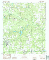
 1986 Seivern1986 Print · USGSThe borderlands of Aiken and Lexington Counties come alive in the mid-eighties, centered on the North Fork Edisto River and the settlement of Seivern. Researchers can locate old family burial grounds, the grounds of Camp Rawl, and local industrial sites like the Clay Pits.
 - 1986 Map of Wagener
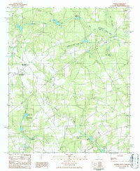
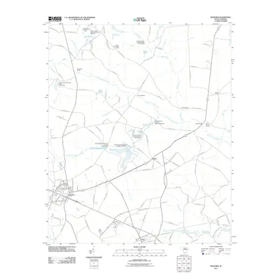
 1986 Wagener1986 Print · USGSThe South Carolina Midlands come into focus during the mid-1980s, centered on the rural crossroads and river bends of Aiken County. Genealogists and local historians can trace the foundations of Wagener and Perry or locate family landmarks like Collums Millpond and Poole Pond.
 - 2011 Map of Seivern, 2011 Print
 2011 Seivern2011 Print · USGSCovers Wagener, including Todd, Camp Rawls, and other nearby areas
 - 2011 Map of Wagener, 2011 Print
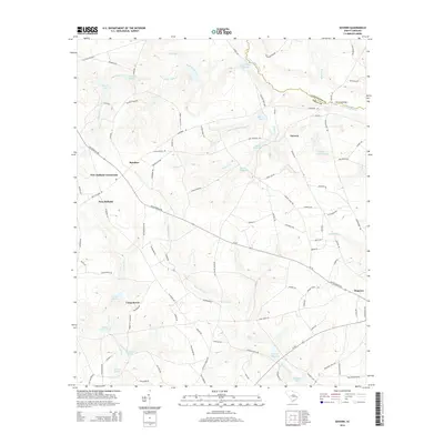
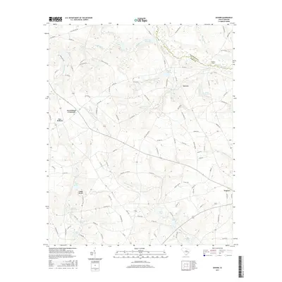
 2011 Wagener2011 Print · USGSCovers Wagener, including Perry, Berlin, and other nearby areas
 - 2014 Map of Seivern, 2014 Print
 2014 Seivern2014 Print · USGSCovers Wagener, including Todd, Camp Rawls, and other nearby areas
 - 2014 Map of Wagener, 2014 Print
 2014 Wagener2014 Print · USGSCovers Wagener, including Perry, Berlin, and other nearby areas
 - 2017 Map of Wagener, 2017 Print
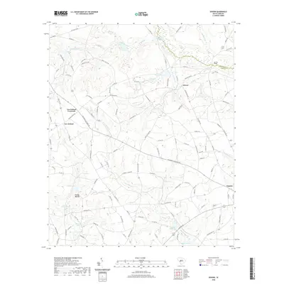
 2017 Wagener2017 Print · USGSCovers Wagener, including Perry, Berlin, and other nearby areas
 - 2017 Map of Seivern, 2017 Print
 2017 Seivern2017 Print · USGSCovers Wagener, including Todd, Camp Rawls, and other nearby areas
 - 2020 Map of Seivern, 2020 Print
 2020 Seivern2020 Print · USGSCovers Wagener, including Todd, Camp Rawls, and other nearby areas
 - 2020 Map of Wagener, 2020 Print
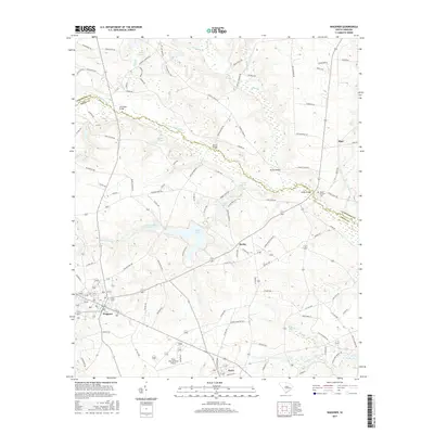
 2020 Wagener2020 Print · USGSCovers Wagener, including Perry, Berlin, and other nearby areas
 - 2024 Map of Seivern, 2024 Print
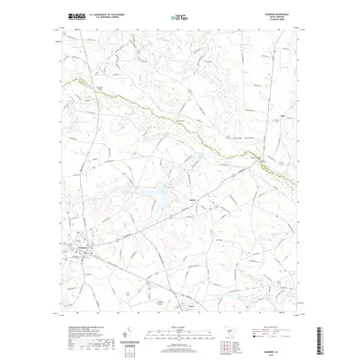
 2024 Seivern2024 Print · USGSThe rural borderlands of Aiken and Lexington counties are captured here in the early twenty-first century as a landscape of interconnected wetlands and crossroads hamlets. Researchers can trace family sites near Seivern Church Graveyard or explore the drainage basins of Chalk Hill Millpond and Dean Swamp Creek.
 - 2024 Map of Wagener, 2024 Print
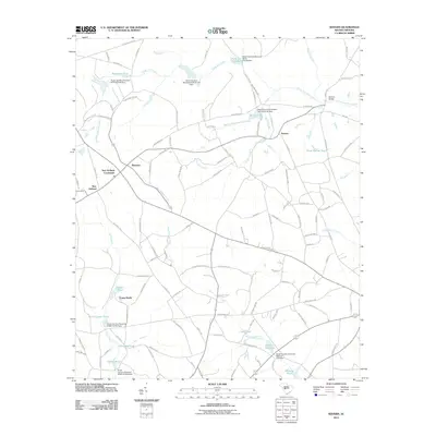
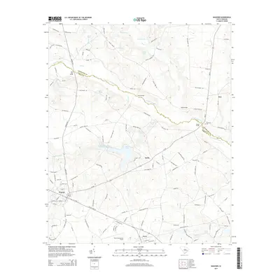
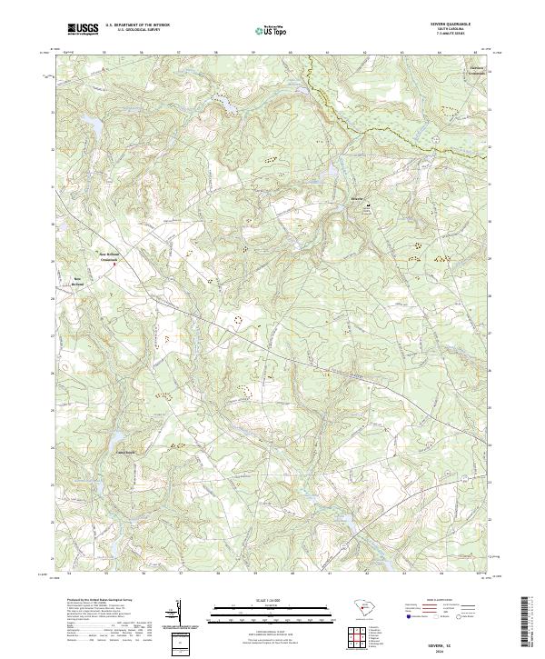
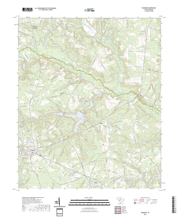 2024 Wagener2024 Print · USGSAiken and Lexington counties meet along the river in this contemporary South Carolina survey. Researchers can trace rural lineages through local landmarks like Mount Herman Graveyard and old settlement sites such as Fairview Crossroads or Thor.
End of results
Showing maps 1-19 of 19
Top cities near Wagener
- Williston historical maps
- Pelion historical maps
- Springfield historical maps
- Salley historical maps
- Perry historical maps
- Windsor historical maps
See more
Frequently asked questions
- What are the different types of historical maps available for Wagener?
- What is the oldest map of Wagener?
- Where can I purchase historical maps of Wagener for my home or office?
- Where can I download high-res historical maps of Wagener?
- Are there historical topographic maps available for Wagener?
- Is there historical aerial imagery available for Wagener?
- Where are historical maps of Wagener sourced from?