Old Maps of Aiken, South Carolina for Academic Research
Study the evolution of Aiken with 44 high-resolution historic maps. Whether you're teaching, researching, or modeling changes in land use, these maps provide essential visual documentation of urban, environmental, and geographic change.
- Analyze long-term change: Track patterns in development, transportation, and natural features.
- Ideal for environmental or urban studies: Support academic projects with primary historical map data.
- Use in the classroom or lab: Educators and researchers rely on these maps to bring historical context to life.
These maps are a powerful tool for teaching, research, and visualizing how Aiken has changed over the decades.
Aiken, SC maps
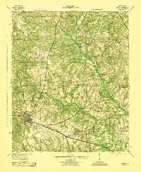
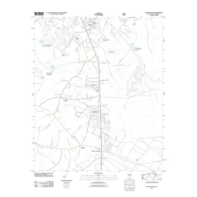
(44)- 1920 Map of Aiken
 1920 Aiken1920 Print · USGSThe rural districts around Aiken are shown in the years following the Great War, when the landscape was a tapestry of small schools and country churches. Researchers can trace the heritage of Montmorenci or locate specific landmarks like Livingstons Mill and the Fountain Academy School.
 - 1920 Map of Talatha
 1920 Talatha1920 Print · USGSAiken and Barnwell Counties are captured here during the era of rural schoolhouses and country parishes. Genealogists can locate specific family landmarks such as Thurmans Mill, Talatha School, and Manoah Church along the historic AUGUSTA road.
 - 1921 Map of Augusta
 1921 Augusta1921 Print · USGSThe riverfronts of South Carolina and Georgia met at a busy rail and water crossroads just after the Great War. Genealogists can trace family landmarks like the Downer Institute, Cottage Cem, and early rural schools including Freeborn School and Spiderweb School.5 unique versions available
 - 1921 Map of Aiken
 1921 Aiken1921 Print · USGSAiken and its surrounding countryside are captured here just after the Great War, showing a landscape of family farms and growing rail towns. Researchers can trace the heritage of local communities through dozens of named sites like Fountain Academy, Livingstons Mill, and the Tory Trail.3 unique versions available
 - 1921 Map of Talatha
 1921 Talatha1921 Print · USGSAiken County is captured here in the early twentieth century as a landscape of rural community centers and winding wagon roads. Genealogists can trace family connections through numerous local landmarks like Thalmans Mill, Zion Fair Church, and Wolfpit School.3 unique versions available
 - 1923 Map of Warrenville
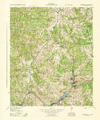
 1923 Warrenville1923 Print · USGSAiken and Edgefield counties thrive during the early twentieth-century textile boom, showing a landscape shaped by mill towns and rural academies. Genealogists can trace family roots through numerous landmarks like Bettis Academy, Eureka Station, and Hammond Grove Church.2 unique versions available
 - 1928 Map of Warrenville
 1928 Warrenville1928 Print · USGSAiken and Edgefield counties are shown in the late 1920s as a thriving corridor of textile mills and rural academies. Researchers can trace the development of historic communities and landmarks like Bettis Academy, Vaucluse, and Meeting Grove Ch.3 unique versions available
 - 1943 Map of Aiken
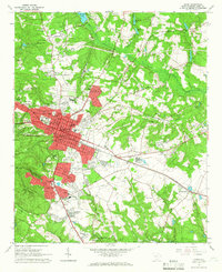
 1943 Aiken1943 Print · USGSAiken and its rural outskirts come alive in the 1940s, showing a landscape defined by the Southern railroad and the South Fork Edisto River. Researchers can trace old family schoolhouses and local congregations, from Fountain Academy to the Welcome Traveler Ch.
 - 1943 Map of Augusta East
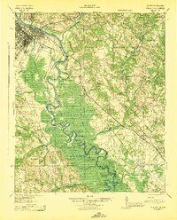
 1943 Augusta East1943 Print · USGSThe Savannah River valley along the Georgia and South Carolina border is shown here in the early 1940s, just before significant regional changes. Genealogists can trace hundreds of rural landmarks, including Ellenton, the Downer Institute, and several mills like Hatchers Mill.
 - 1943 Map of Warrenville
 1943 Warrenville1943 Print · USGSThe industrial corridor of Aiken County is captured here in the early 1940s, highlighting the mill towns along Horse Creek. Genealogists can trace family roots through numerous community landmarks like Bettis Academy, Horn Creek Ch, and the settlement at Vaucluse.
 - 1943 Map of Talatha
 1943 Talatha1943 Print · USGSAiken and Barnwell counties are captured here in the early 1940s, showing a rural landscape organized around deep-rooted churches and small schoolhouses. Researchers can trace ancestral locations near Thalmans Mill, Treadway Ch, or Fairview Sch along the many creek branches.
 - 1943 Map of Augusta
 1943 Augusta1943 Print · USGSThe Savannah River corridor at the Georgia-South Carolina border comes alive in the early 1940s, showing the intricate wetlands and rural communities of Richmond and Aiken Counties. Researchers can locate vanished landmarks like the Downer Institute, the Cottage Cem, and early roads like Tobacco Road.
 - 1954 Map of Augusta
 1954 Augusta1954 Print · USGSThe Savannah River valley and South Carolina Midlands are captured here during a period of post-war growth. Researchers can trace the rail-and-river economy through the Southern RR corridor and locate historic settlements like Aiken, Orangeburg, and Sumter.
 - 1957 Map of Augusta, 1966 Print
 1957 Augusta1966 Print · USGSThe Savannah River and Santee basins are captured here during a period of massive military and industrial expansion in the late fifties. Genealogists can trace family footprints across Four Hole Swamp or near the Savannah River Plant.3 unique versions available
 - 1958 Map of Augusta
 1958 Augusta1958 Print · USGSThe borderlands between Georgia and South Carolina come alive in the 1950s, showing the early footprint of the Savannah River Plant. Genealogists and historians can trace rail-dependent towns and rural landmarks from Orangeburg to the Fort Jackson Military Reservation.
 - 1961 Map of Augusta
 1961 Augusta1961 Print · USGSThe South Carolina lowcountry and CSRA appear here in the early sixties, during a period of massive military and industrial growth. Researchers can trace the development of the Savannah River Plant or locate legacy landmarks like Nelson Ferry and Magnolia Cemetery.2 unique versions available
 - 1962 Map of Augusta
 1962 Augusta1962 Print · USGSThe South Carolina and Georgia borderlands are seen here in the early sixties, showing the rise of the Savannah River Plant and the expansion of Fort Jackson. Researchers can trace old rail lines like the Southern Railway and find landmarks such as St. Pauls Church or the Santee Canal.
 - 1964 Map of Graniteville, 1965 Print
 1964 Graniteville1965 Print · USGSMid-century Graniteville and the Horse Creek Valley are shown here at the height of their industrial era. Researchers can trace family roots through numerous mill villages and local landmarks like Old Langley Cem, Gregg Sch, and the historic Southern Railway corridor.3 unique versions available
 - 1964 Map of Aiken, 1966 Print
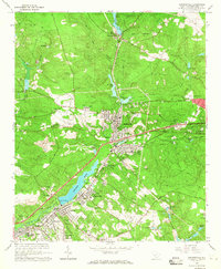
 1964 Aiken1966 Print · USGSAiken at the height of the mid-sixties transition is captured here, balancing its traditional equine culture with new educational and suburban growth. Genealogists and historians can trace family locations near Wayside Ch, Crosland Park, or the campus of the Univ Of S C (Aiken Br).4 unique versions available
 - 1964 Map of Hollow Creek, 1966 Print
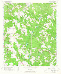 1964 Hollow Creek1966 Print · USGSMid-century Aiken County is captured here at a time when rural life centered around community churches and small schoolhouses. Genealogists can locate family landmarks like Good Hope Cem, the settlement at Spiderweb, and the Sleepy Hollow Sch.3 unique versions available
 - 1965 Map of New Ellenton, 1967 Print
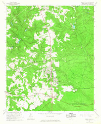 1965 New Ellenton1967 Print · USGSAiken County was undergoing a massive transformation in the mid-sixties due to the nearby Savannah River Plant. Genealogists and local historians can trace the development of New Ellenton and locate community landmarks like Talatha Ch and the Fairfield Ch.3 unique versions available
 - 1971 Map of Graniteville
 1971 Graniteville1971 Print · USGSThe Horse Creek valley textile towns are captured here in the early 1970s during a period of suburban growth. Genealogists can locate family landmarks like Carter Cemetery, St Marys Church, and the Old Langley Cemetery.
 - 1982 Map of Barnwell, 1984 Print
 1982 Barnwell1984 Print · USGSCoastal plain settlements and a massive nuclear infrastructure meet in South Carolina during the early eighties. Genealogists and historians can trace rail-town development along the Southern line and explore the footprint of the Savannah River Plant Department of Energy.
 - 1983 Map of Aiken, 1984 Print
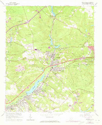
 1983 Aiken1984 Print · USGSThe Savannah River valley and South Carolina sandhills are shown in detail during the early eighties, as industry and education expanded. Researchers can trace the rail corridors of the Southern and Seaboard Coast Line through communities like Graniteville and Leesville.
 - 2011 Map of New Ellenton, 2011 Print
 2011 New Ellenton2011 Print · USGSCovers Aiken, including New Ellenton, Dry Branch, and other nearby areas
Showing maps 1-25 of 44
Top cities near Aiken
- Augusta historical maps
- North Augusta historical maps
- Burnettown historical maps
- New Ellenton historical maps
- Jackson historical maps
- Trenton historical maps
See more
Top neighborhoods of Aiken
- Kalmia Landing historical maps
- Westcliff historical maps
- Ansley Park historical maps
- Conger Woods historical maps
- Crosland Park historical maps
- Dunbarton Oaks historical maps
See more
Frequently asked questions
- What are the different types of historical maps available for Aiken?
- What is the oldest map of Aiken?
- Where can I purchase historical maps of Aiken for my home or office?
- Where can I download high-res historical maps of Aiken?
- Are there historical topographic maps available for Aiken?
- Is there historical aerial imagery available for Aiken?
- Where are historical maps of Aiken sourced from?