1950s Maps of Gibbes Forest, Goose Creek
Explore 6 historic maps of Gibbes Forest from the 1950s. These maps offer a rare glimpse into what life looked like during the 1950s — showing old roads, neighborhoods, homes, and landmarks that have changed or disappeared over time.
Whether you're researching your family's past, planning a metal detecting trip, or studying how Gibbes Forest's landscape evolved across the 1950s, these high-resolution maps are a powerful tool for exploring the history of this region.
- Focus on a specific era: All maps on this page are from the 1950s, giving you a focused view of this time period.
- See what’s changed: Compare century-old streets, trails, and buildings to today's modern landscape using overlays and satellite layers.
- Research with precision: Use these maps for genealogy, historical research, land use analysis, or educational projects.
- View, download, or print: Maps are fully viewable online in high resolution, and can be downloaded or printed for your own records.
Start exploring Gibbes Forest's history through authentic maps from the 1950s. This is your window into the past.
Gibbes Forest, Goose Creek maps
(6)- 1954 Map of Augusta
 1954 Augusta1954 Print · USGSThe Savannah River valley and South Carolina Midlands are captured here during a period of post-war growth. Researchers can trace the rail-and-river economy through the Southern RR corridor and locate historic settlements like Aiken, Orangeburg, and Sumter.
 - 1957 Map of Mount Holly, 1959 Print
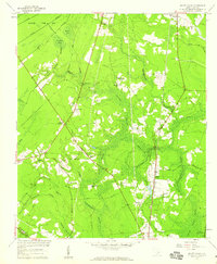 1957 Mount Holly1959 Print · USGSBerkeley County was characterized by dense swamplands and rural railroad hamlets in the mid-1950s. Genealogists can trace family roots through numerous local landmarks, including Varner Sch, Driggerstown, and the Groomsville Cem.4 unique versions available
 - 1957 Map of Augusta, 1966 Print
 1957 Augusta1966 Print · USGSThe Savannah River and Santee basins are captured here during a period of massive military and industrial expansion in the late fifties. Genealogists can trace family footprints across Four Hole Swamp or near the Savannah River Plant.3 unique versions available
 - 1957 Map of Savannah, 1967 Print
 1957 Savannah1967 Print · USGSThe Lowcountry and Georgia coastal plain are shown here in the late fifties, prior to modern expansion. Researchers can trace the rail-and-river economy through the Central of Georgia lines and the Ogeechee River wetlands.4 unique versions available
 - 1958 Map of Augusta
 1958 Augusta1958 Print · USGSThe borderlands between Georgia and South Carolina come alive in the 1950s, showing the early footprint of the Savannah River Plant. Genealogists and historians can trace rail-dependent towns and rural landmarks from Orangeburg to the Fort Jackson Military Reservation.
 - 1958 Map of Ladson, 1959 Print
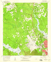 1958 Ladson1959 Print · USGSCoastal South Carolina is captured here in a moment of rapid military and industrial growth during the late fifties. You can trace the expansion of North Charleston and the Charleston Air Force Base alongside historic riverfront landmarks like Magnolia Gardens.4 unique versions available
End of results
Showing maps 1-6 of 6
Frequently asked questions
- What are the different types of historical maps available for Gibbes Forest?
- What is the oldest map of Gibbes Forest?
- Where can I purchase historical maps of Gibbes Forest for my home or office?
- Where can I download high-res historical maps of Gibbes Forest?
- Are there historical topographic maps available for Gibbes Forest?
- Is there historical aerial imagery available for Gibbes Forest?
- Where are historical maps of Gibbes Forest sourced from?