Old Maps of Hollywood, South Carolina for Hiking & Exploration
Hike through history with 47 historic maps of Hollywood. Explore old trails, ghost towns, and forgotten backroads — perfect for outdoor adventurers and local explorers.
- Rediscover forgotten places: Map out old mining camps, roads, and footpaths that no longer exist on modern maps.
- Layer with modern tools: Combine with LiDAR or satellite views to plan hikes through historical terrain.
- Made for exploration: Popular among hikers, overlanders, and local history lovers.
Use these maps to find adventure and explore the hidden past of Hollywood.
Hollywood, SC maps
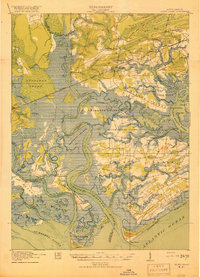
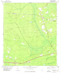
(47)- 1918 Map of Cottageville
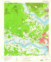
 1918 Cottageville1918 Print · USGSThe Lowcountry river basins of Colleton and Dorchester counties are shown here just after the Great War, when the Edisto River was a central geographic divider. Researchers can trace rural life through dozens of named landmarks like Sullivans Church, Metz Store, and Burnt Church Crossroads.3 unique versions available
 - 1919 Map of Johns Island
 1919 Johns Island1919 Print · USGSCoastal South Carolina at the end of the Great War reveals a landscape of riverfront estates and military remnants. Genealogists and historians can trace family-named stops and rural institutions like Drayton Hall, St Andrews School No 10, and the Bula Mines.2 unique versions available
 - 1919 Map of Edisto Island
 1919 Edisto Island1919 Print · USGSThe South Carolina Lowcountry is depicted here in the years following the Great War, showing a coastal landscape of tidal creeks and island communities. You can trace early 20th-century life through landmarks like Freedman Village, Borough School, and the Old Public Landing.3 unique versions available
 - 1919 Map of Wadmelaw Island
 1919 Wadmelaw Island1919 Print · USGSCoastal South Carolina is mapped here just after the Great War, showing a landscape of sea island plantations and tidal waterways. Researchers can locate remote settlements like Rockville and Legareville, as well as rural landmarks like Crate Mill and St Johns Church.2 unique versions available
 - 1920 Map of Ravenels
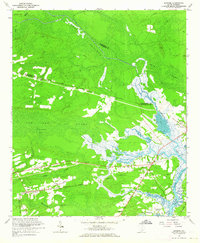
 1920 Ravenels1920 Print · USGSThe Ashley River and its surrounding swamps were the heart of this Lowcountry landscape just after the First World War. Researchers can trace the footprints of Old Dorchester, the operations at Bula Mines, and the unique Tyler Tea Farm.3 unique versions available
 - 1943 Map of Cottageville
 1943 Cottageville1943 Print · USGSThe South Carolina Lowcountry in the early forties reveals a landscape of river landings and remote crossroads between the Edisto and the swamps. Genealogists can trace family landmarks and school sites like Rehoboth Sch or locate the old Sullivans Ferry crossing.
 - 1943 Map of Edisto Island
 1943 Edisto Island1943 Print · USGSThe South Carolina Lowcountry is captured here in the early 1940s, showing a landscape of tidal islands and rail-side settlements. Researchers can trace the layout of Freedman Village, find old school sites like Seaside Sch, and locate the docks at Steamboat Landing.
 - 1944 Map of Ravenels
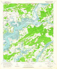
 1944 Ravenels1944 Print · USGSCoastal South Carolina just before the war's end reveals a landscape of tidal rivers and deep-rooted settlements. Trace the footprints of the past at Old Dorchester, locate family homesteads near Poppenheim Crossing, or find long-vanished industry at the Bula Mines.
 - 1944 Map of Wadmelaw Island
 1944 Wadmelaw Island1944 Print · USGSThe South Carolina Lowcountry islands are captured here in the early twentieth century, showing a landscape of tidal creeks and remote coastal settlements. Genealogists can locate family landmarks such as Rockville, Legareville, and several country schools like Bogle School.2 unique versions available
 - 1947 Map of Savannah
 1947 Savannah1947 Print · USGSCoastal Georgia and South Carolina are captured here in the mid-forties, showing the rail-and-river networks of the Lowcountry. Genealogists and researchers can trace old crossroads and river towns from Statesboro to Beaufort, alongside military sites like Camp Stewart and Parris Island.
 - 1948 Map of Johns Island
 1948 Johns Island1948 Print · USGSThe Ashley and Stono River corridors appear here during the late 1940s, showing a landscape defined by historic estates and heavy rail traffic. Genealogists can trace family landmarks and early communities like Eightmile House, Drayton, and Bull Chapel.3 unique versions available
 - 1948 Map of Savannah
 1948 Savannah1948 Print · USGSThe Georgia and South Carolina Lowcountry comes alive in this post-war survey of the coast and its river-fed hinterlands. Genealogists and historians can trace rail lines like the Central of Georgia RR and find established settlements such as Isle of Hope and Sylvania.
 - 1957 Map of Savannah, 1967 Print
 1957 Savannah1967 Print · USGSThe Lowcountry and Georgia coastal plain are shown here in the late fifties, prior to modern expansion. Researchers can trace the rail-and-river economy through the Central of Georgia lines and the Ogeechee River wetlands.4 unique versions available
 - 1958 Map of Johns Island, 1959 Print
 1958 Johns Island1959 Print · USGSThe Lowcountry landscape west of Charleston comes to life in the late fifties, showing a mix of historic river estates and postwar growth. Genealogists and historians can trace local landmarks like Drayton Hall, Fort Bull, and the Stono Sta rail stop.5 unique versions available
 - 1960 Map of Savannah
 1960 Savannah1960 Print · USGSCoastal Georgia and the South Carolina Lowcountry are captured in the late fifties, showcasing the intricate web of islands and tidal rivers before modern expansion. Researchers can trace the rail lines of the Atlantic Coast Line or locate sites like Parris Island, Beaufort, and the Tybee Lighthouse.
 - 1960 Map of Ravenel, 1964 Print
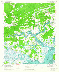
 1960 Ravenel1964 Print · USGSCoastal South Carolina's Lowcountry is captured here in the early 1960s, showing a landscape defined by rail lines and tidal swamps. Researchers can locate family landmarks like Miley Hill Sch, St Pauls Ch Cem, and the crossing at Rantowles.4 unique versions available
 - 1960 Map of Wadmalaw Island, 1964 Print
 1960 Wadmalaw Island1964 Print · USGSCoastal South Carolina in the early sixties reveals a landscape of tidal islands and rail-connected settlements before modern development. Genealogists can trace family roots through numerous local landmarks like Wadmalaw Sch, St Marys Ch, and Chaplin Cem.2 unique versions available
 - 1960 Map of Adams Run, 1964 Print
 1960 Adams Run1964 Print · USGSThe South Carolina Lowcountry is captured here in the early sixties, showing a tidal landscape of river junctions and rural hamlets. Genealogists and historians can trace family locations through numerous landmarks like Prices Cem, Baptist Hill, and St Pauls Sch & Ch.3 unique versions available
 - 1961 Map of Savannah
 1961 Savannah1961 Print · USGSThe Georgia and South Carolina Lowcountry comes alive in this mid-century survey of coastal marshes, barrier islands, and river networks. Genealogists and historians can trace the paths of the Seaboard Air Line RR, locate family sites near Isle of Hope, or study the grounds of Fort Stewart Military Reservation.2 unique versions available
 - 1979 Map of Osborn, 1980 Print
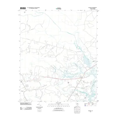
 1979 Osborn1980 Print · USGSCoastal South Carolina wetlands and crossroads settlements come to life in the late 1970s. Genealogists can trace family landmarks like Mt Nebo Ch, Delemar Crossroads, and the historic path of Parkers Ferry Road.
 - 1986 Map of Walterboro
 1986 Walterboro1986 Print · USGSThe South Carolina Lowcountry in the mid-eighties remains a world of expansive wetlands and historic river crossings. Genealogists and historians can trace the rural communities and landmarks of Colleton and Charleston counties, from the Baptist Church at Adams Run to the coastal reaches of Edisto Beach State Park.
 - 1990 Map of Walterboro
 1990 Walterboro1990 Print · USGSCoastal South Carolina and its dense river networks are documented here in the early nineties as the Charleston suburbs expanded westward. Genealogists and historians can trace old community hubs like Clubhouse Crossroads, the site of Givhans Ferry, and several Strip Mines north of the Stono River.
 - 2011 Map of Ravenel, 2011 Print
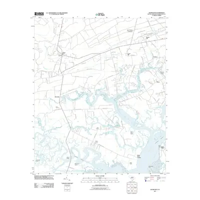
 2011 Ravenel2011 Print · USGSCovers Hollywood, including Charleston, Ravenel, and other nearby areas
 - 2011 Map of Osborn, 2011 Print
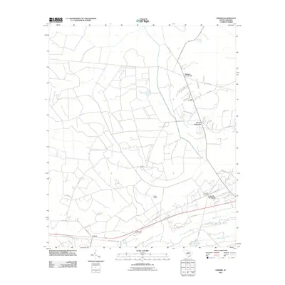 2011 Osborn2011 Print · USGSCovers Hollywood, including Ravenel, Delemar Crossroads, and other nearby areas
 - 2011 Map of Adams Run, 2011 Print
 2011 Adams Run2011 Print · USGSCovers Hollywood, including Meggett, Gibson, and other nearby areas
Showing maps 1-25 of 47
Top cities near Hollywood
- Charleston historical maps
- North Charleston historical maps
- Summerville historical maps
- Goose Creek historical maps
- Hanahan historical maps
- Ravenel historical maps
See more
Top neighborhoods of Hollywood
Frequently asked questions
- What are the different types of historical maps available for Hollywood?
- What is the oldest map of Hollywood?
- Where can I purchase historical maps of Hollywood for my home or office?
- Where can I download high-res historical maps of Hollywood?
- Are there historical topographic maps available for Hollywood?
- Is there historical aerial imagery available for Hollywood?
- Where are historical maps of Hollywood sourced from?