1900s (20th Century) Maps of Chester County, South Carolina
Explore 27 historic maps of Chester County from the 1900s (20th Century). These maps offer a rare glimpse into what life looked like during the 1900s — showing old roads, neighborhoods, homes, and landmarks that have changed or disappeared over time.
Whether you're researching your family's past, planning a metal detecting trip, or studying how Chester County's landscape evolved across the 1900s, these high-resolution maps are a powerful tool for exploring the history of this region.
- Focus on a specific era: All maps on this page are from the 1900s, giving you a focused view of this time period.
- See what’s changed: Compare century-old streets, trails, and buildings to today's modern landscape using overlays and satellite layers.
- Research with precision: Use these maps for genealogy, historical research, land use analysis, or educational projects.
- View, download, or print: Maps are fully viewable online in high resolution, and can be downloaded or printed for your own records.
Start exploring Chester County's history through authentic maps from the 1900s. This is your window into the past.
Chester County, SC maps
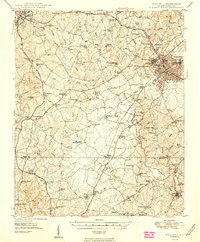
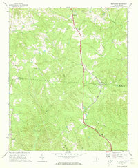
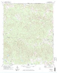
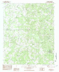
(27)- 1907 Map of Sharon
 1907 Sharon1907 Print · USGSUpstate South Carolina at the turn of the century shows a region deeply connected by river ferries and new rail lines. Genealogists can trace early homesteads near Sharon, Hickory Grove, and the historic Pinckney Ferry on the Broad River.3 unique versions available
 - 1941 Map of Spartanburg
 1941 Spartanburg1941 Print · USGSSouth Carolina’s Piedmont and Sandhills regions are shown here during the mid-century peak of the rail era. Researchers can trace the sprawling Fort Jackson Military Reservation and the industrial growth of hubs like Spartanburg and Rock Hill.
 - 1949 Map of Rock Hill
 1949 Rock Hill1949 Print · USGSThe Piedmont of South Carolina appears here in the years following the war, showing a landscape of growing towns and deep-rooted rural communities. Genealogists can locate family landmarks such as the Rosenwald Sch, Freedom Cem, and McConnellsville along the Fishing Creek basin.3 unique versions available
 - 1953 Map of Spartanburg, 1966 Print
 1953 Spartanburg1966 Print · USGSMid-century South Carolina comes into focus through this survey of the Piedmont and the Sand Hills at a time of significant reservoir expansion. Researchers can trace the legacy of industrial transit and resource extraction from the Haile Gold Mine to the rail hubs of the Seaboard Air Line.4 unique versions available
 - 1960 Map of Spartanburg
 1960 Spartanburg1960 Print · USGSThe South Carolina Piedmont and North Carolina borderlands come alive in this mid-century survey of the region between Spartanburg and Columbia. Researchers can trace the Seaboard Air Line railroad and explore landmarks like Anderson Quarry, Lake Murray, and Mount Croghan.2 unique versions available
 - 1963 Map of Spartanburg
 1963 Spartanburg1963 Print · USGSMid-century South Carolina comes alive in this survey, showing the rail-linked corridor between the Upstate and the Midlands. Genealogists can trace family lands near old hubs like Union and Lancaster, or along the banks of the Broad River and Pee Dee River.
 - 1964 Map of Spartanburg
 1964 Spartanburg1964 Print · USGSMid-century South Carolina comes alive in this survey of the Piedmont and Upcountry, stretching from the Blue Ridge foothills to the Sandhills. Genealogists and historians can trace the rail-and-river economy through Monarch Mills, Glenn Springs, and the Southern Railway corridor.
 - 1968 Map of Van Wyck, 1970 Print
 1968 Van Wyck1970 Print · USGSUpper Lancaster County comes into focus in the late sixties as the rail lines and river valleys shaped local life. Genealogists can locate family landmarks like White Oak Ch, Fosters Crossroads, and the Andrew Jackson Memorial.2 unique versions available
 - 1968 Map of Catawba, 1970 Print
 1968 Catawba1970 Print · USGSCatawba and the river valley are captured here in the late sixties as industry met the traditional rural landscape. Researchers can trace the footprints of community life at Lando Sch, the Worthy Boys Camp, and numerous country churches like Bethel Ch.
 - 1968 Map of Lancaster SE, 1971 Print
 1968 Lancaster SE1971 Print · USGSUpper South Carolina in the late sixties remains a landscape of rural crossroads and riverfront industry along the Catawba River. Genealogists and historians can trace family locations near Cauthens Crossroads, New Hope Ch, and Mount Carmel Cem.2 unique versions available
 - 1968 Map of Blackstock, 1973 Print
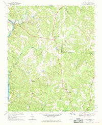
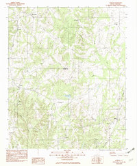
 1968 Blackstock1973 Print · USGSThe borderlands of Chester and Fairfield Counties are shown here in the late sixties as the SOUTHERN rail line still connects rural hubs. Genealogists can trace local roots through numerous country sanctuaries like Armenia Ch and the crossroads at Blackstock.2 unique versions available
 - 1969 Map of Lancaster, 1971 Print
 1969 Lancaster1971 Print · USGSLancaster and its surrounding Piedmont countryside are shown at a peak of mid-century industrial and civic growth. Researchers can trace family sites at Bell Town, locate rural landmarks like Mt Moriah Ch, or study the rail layout of the Lancaster and Chester.3 unique versions available
 - 1969 Map of Fort Lawn, 1971 Print
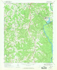
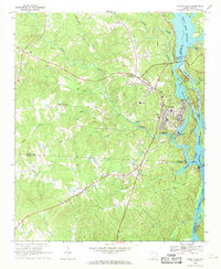
 1969 Fort Lawn1971 Print · USGSThe Catawba River valley in the late sixties is defined by its busy rail junctions and rural congregations. Genealogists can trace family landmarks and local church history at Love-Charity Ch, Elmwood Cem, and the settlement of Bascomville.
 - 1969 Map of Great Falls, 1971 Print
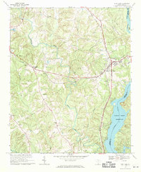
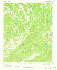
 1969 Great Falls1971 Print · USGSGreat Falls and the Catawba River corridor are captured here in the late sixties as the region’s industrial and hydroelectric network matured. Genealogists and local historians can trace family locations near Beckhamville, Mitford, and rural sanctuaries like Heath Chapel.
 - 1969 Map of Stover, 1973 Print
 1969 Stover1973 Print · USGSThe rural Piedmont landscape near the Chester and Fairfield County line is captured here in the late sixties. Researchers can find generational landmarks including Gold Mine Cem, Aimwell Ch Cem, and the small community of Stover.2 unique versions available
 - 1969 Map of Richburg, 1973 Print
 1969 Richburg1973 Print · USGSRichburg and the surrounding Piedmont country are captured here in the late sixties, just as the regional road network was maturing. Researchers can trace rural church history and family burial grounds at Union Ch, Black Rock Ch, and the Anderson Cem.
 - 1969 Map of Carlisle, 1973 Print
 1969 Carlisle1973 Print · USGSCarlisle and the Broad River valley are shown here in the late sixties at the crossroads of two major railroads. Genealogists and historians can trace family locations near Hill Cem, the settlement of Tuckertown, and the St Lukes Ch.2 unique versions available
 - 1969 Map of Baton Rouge, 1973 Print
 1969 Baton Rouge1973 Print · USGSChester County at the close of the sixties reveals a landscape of small rural settlements and established family-named landmarks. Researchers can locate several country churches and schools like New Hope Ch and West Chester Sch or trace the Seaboard Coast Line railroad past Baton Rouge.
 - 1969 Map of Chester, 1973 Print
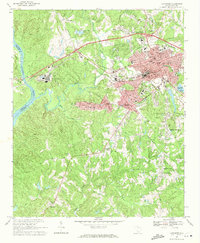
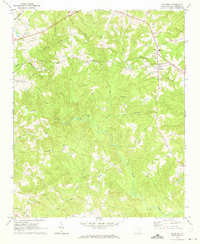
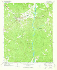
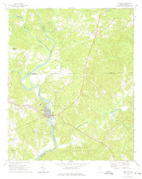
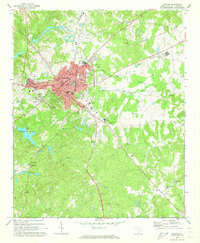 1969 Chester1973 Print · USGSChester sat at the heart of a dense South Carolina rail network in the late sixties, where four different lines intersected. Researchers can trace local lineage through Old Purity Cem, visit Wylie Park, or locate landmarks like the Drive-in Theater and County Hospital.2 unique versions available
 - 1969 Map of Carlisle SE, 1973 Print
 1969 Carlisle SE1973 Print · USGSThe rural landscapes of Chester and Fairfield Counties are captured here in the late 1960s, centered on the settlement of Feasterville. Genealogists can trace a remarkable concentration of country churches and cemeteries, including Sweet Hope Ch, New Hope Ch, and Purity Cem.
 - 1969 Map of Leeds, 1974 Print
 1969 Leeds1974 Print · USGSChester and Union Counties appear here in the late sixties as the Broad River valley was managed for timber and utility. Researchers can locate family landmarks like Wilksburg, Ebenezer Ch, and the Seaboard Coast Line railroad corridor.2 unique versions available
 - 1972 Map of Armenia, 1974 Print
 1972 Armenia1974 Print · USGSThe Chester County countryside near the York County line is captured here in the early seventies, centered on the communities of Armenia and Lowrys. Genealogists can trace numerous local landmarks including Old Providence Ch Cem, North Chester Sch, and Bethlehem Ch.
 - 1972 Map of Lockhart, 1975 Print
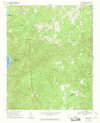
 1972 Lockhart1975 Print · USGSThe river-driven economies of the Carolina Piedmont are on display in the early 1970s at the confluence of the Broad River and Pacolet River. Genealogists and local historians can trace family-named landmarks and rural congregations like Mt Hopewell Ch, Bullock Creek, and the historic site of Pinckneyville.2 unique versions available
 - 1982 Map of Edgemoor, 1983 Print
 1982 Edgemoor1983 Print · USGSChester and York counties come together in the early eighties as rural life revolves around the Fishing Creek drainage. Researchers can trace family roots through the many local landmarks including Lando, Rodman, and Mt Holly Ch.
 - 1982 Map of Lowrys, 1983 Print
 1982 Lowrys1983 Print · USGSNorthern Chester County is captured in the early eighties as a landscape of rural parishes and quiet rail lines. Genealogists can trace family landmarks like Zion Cem, Browns Chapel, and the community of Brattonsville along the SOUTHERN railroad.
Showing maps 1-25 of 27
Top cities of Chester County
- Chester historical maps
- Great Falls historical maps
- Fort Lawn historical maps
- Richburg historical maps
- Lowrys historical maps
Frequently asked questions
- What are the different types of historical maps available for Chester County?
- What is the oldest map of Chester County?
- Where can I purchase historical maps of Chester County for my home or office?
- Where can I download high-res historical maps of Chester County?
- Are there historical topographic maps available for Chester County?
- Is there historical aerial imagery available for Chester County?
- Where are historical maps of Chester County sourced from?