1900s (20th Century) Maps of Darlington County, South Carolina
Explore 35 historic maps of Darlington County from the 1900s (20th Century). These maps offer a rare glimpse into what life looked like during the 1900s — showing old roads, neighborhoods, homes, and landmarks that have changed or disappeared over time.
Whether you're researching your family's past, planning a metal detecting trip, or studying how Darlington County's landscape evolved across the 1900s, these high-resolution maps are a powerful tool for exploring the history of this region.
- Focus on a specific era: All maps on this page are from the 1900s, giving you a focused view of this time period.
- See what’s changed: Compare century-old streets, trails, and buildings to today's modern landscape using overlays and satellite layers.
- Research with precision: Use these maps for genealogy, historical research, land use analysis, or educational projects.
- View, download, or print: Maps are fully viewable online in high resolution, and can be downloaded or printed for your own records.
Start exploring Darlington County's history through authentic maps from the 1900s. This is your window into the past.
Darlington County, SC maps
(35)- 1940 Map of Florence West
 1940 Florence West1940 Print · USGSThe rural landscapes and rail towns west of Florence appear here just before the mid-century, as the local economy revolved around the river and the tracks. Genealogists can trace family roots through numerous country churches like Snow Hill Ch and old settlements like Timmonsville and Ebenezer.2 unique versions available
 - 1941 Map of Spartanburg
 1941 Spartanburg1941 Print · USGSSouth Carolina’s Piedmont and Sandhills regions are shown here during the mid-century peak of the rail era. Researchers can trace the sprawling Fort Jackson Military Reservation and the industrial growth of hubs like Spartanburg and Rock Hill.
 - 1942 Map of Rockingham, 1944 Print
 1942 Rockingham1944 Print · USGSThe North Carolina and South Carolina borderlands come alive in this wartime survey of the Pee Dee River valley. Researchers can trace historic mill sites like Burnt Factory Pond or locate family landmarks such as Roberdell and Old Sneedsboro.
 - 1943 Map of Gum Swamp
 1943 Gum Swamp1943 Print · USGSCoastal plain settlements and river islands define the Pee Dee region during the early years of World War II. Researchers can locate rural hubs like Bethea Cross Roads and trace family history through landmarks like Lower Marlboro High School and Annarate Church.2 unique versions available
 - 1945 Map of Florence West
 1945 Florence West1945 Print · USGSInland South Carolina during the mid-1940s is defined here by the converging rails of the Atlantic Coast Line and a network of rural crossroads. Researchers can trace ancestral locations through dozens of landmarks like Anderson Cem, Muldrow Mill, and Syracuse.2 unique versions available
 - 1953 Map of Florence, 1964 Print
 1953 Florence1964 Print · USGSThe Carolina borderlands in the mid-fifties were a landscape of vast river swamps and rising rail towns. Trace the legacy of the Seaboard Air Line through Florence or explore the wetlands surrounding Lake Waccamaw and the Green Swamp.3 unique versions available
 - 1953 Map of Spartanburg, 1966 Print
 1953 Spartanburg1966 Print · USGSMid-century South Carolina comes into focus through this survey of the Piedmont and the Sand Hills at a time of significant reservoir expansion. Researchers can trace the legacy of industrial transit and resource extraction from the Haile Gold Mine to the rail hubs of the Seaboard Air Line.4 unique versions available
 - 1954 Map of Florence
 1954 Florence1954 Print · USGSThe Carolinas borderlands come alive in the early fifties, showing the vital rail-and-river networks of the coastal plain. Genealogists can trace family footprints across the Green Swamp or through settlements like Red Springs, Chadbourn, and McColl.
 - 1960 Map of Spartanburg
 1960 Spartanburg1960 Print · USGSThe South Carolina Piedmont and North Carolina borderlands come alive in this mid-century survey of the region between Spartanburg and Columbia. Researchers can trace the Seaboard Air Line railroad and explore landmarks like Anderson Quarry, Lake Murray, and Mount Croghan.2 unique versions available
 - 1963 Map of Spartanburg
 1963 Spartanburg1963 Print · USGSMid-century South Carolina comes alive in this survey, showing the rail-linked corridor between the Upstate and the Midlands. Genealogists can trace family lands near old hubs like Union and Lancaster, or along the banks of the Broad River and Pee Dee River.
 - 1963 Map of Dovesville, 1964 Print
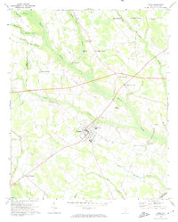
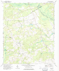
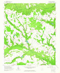 1963 Dovesville1964 Print · USGSDovesville and the surrounding Darlington County farmlands are captured in the early sixties, showing a landscape defined by the railroad and forest. Local historians can trace family locations at Birdstown Crossroads, Bethlehem Ch, or cemeteries like Centerville Cem and Van Cem.
 - 1963 Map of Mont Clare, 1964 Print
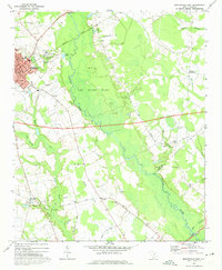
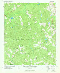
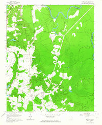 1963 Mont Clare1964 Print · USGSThe Pee Dee River basin in the 1960s reveals a rural Darlington County landscape of family cemeteries and crossroad settlements. Researchers can locate the Rosenwald Consolidated Sch, trace the Old Grade Railroad, and find markers like Round O Cem.
 - 1963 Map of Darlington East, 1965 Print
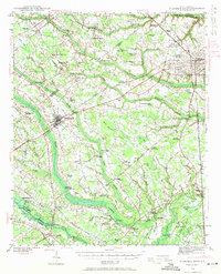
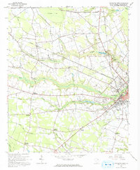
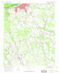
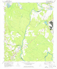
 1963 Darlington East1965 Print · USGSDarlington and the surrounding Pee Dee lowlands are captured here in the early sixties as a bustling rail and agricultural hub. Trace the junction of the Atlantic Coast Line and find local landmarks like Grove Hill Cem or Howards Crossroads.2 unique versions available
 - 1963 Map of Darlington West, 1965 Print
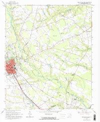
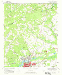
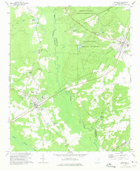
 1963 Darlington West1965 Print · USGSDarlington and its western rural hinterlands are captured in the early sixties as the region transitioned from a rail-dependent landscape to an automotive one. Researchers can trace historic family crossroads and sites like the Darlington Raceway, McCowns Millpond, and Earlys Crossroads.2 unique versions available
 - 1964 Map of Spartanburg
 1964 Spartanburg1964 Print · USGSMid-century South Carolina comes alive in this survey of the Piedmont and Upcountry, stretching from the Blue Ridge foothills to the Sandhills. Genealogists and historians can trace the rail-and-river economy through Monarch Mills, Glenn Springs, and the Southern Railway corridor.
 - 1968 Map of Hartsville North, 1970 Print
 1968 Hartsville North1970 Print · USGSDarlington County's industrial and academic hub is captured here in the late sixties, showing the growth of Hartsville near Lake Prestwood. Genealogists can locate family landmarks like Old Kilgore Millpond, Coker College, and the rural New Providence Ch.
 - 1968 Map of Lake Robinson, 1971 Print
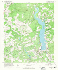 1968 Lake Robinson1971 Print · USGSThe area near McBee is shown just as the landscape was being reshaped by the waters of LAKE ROBINSON in the late 1960s. Researchers can locate historic churches like Shady Grove Ch and New Hope Ch alongside the diagonal tracks of the SEABOARD COAST LINE.2 unique versions available
 - 1968 Map of Kellytown, 1971 Print
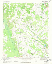 1968 Kellytown1971 Print · USGSCoastal plain communities in Darlington and Lee counties are captured here in the late sixties, just as the rural landscape was maturing. Researchers can trace family history through sites like Westview Cem, Stokes Bridge, and numerous local churches from Ashland Ch to Mt Elon Ch.
 - 1968 Map of Hartsville South, 1971 Print
 1968 Hartsville South1971 Print · USGSDarlington County's rural crossroads and urban fringes are frozen in time here during the late sixties. Researchers can locate family-named sites like Flinns Crossroads and Polson Crossroads, or trace ancestral ties to St Johns Ch and Magnolia Cem.
 - 1969 Map of Lamar, 1974 Print
 1969 Lamar1974 Print · USGSLamar and its surrounding crossroads communities are captured here in the late sixties, showcasing the rural heart of South Carolina's coastal plain. Genealogists can trace family landmarks and local institutions including Spaulding High Sch, Andrews Millpond, and Zion Ch.
 - 1969 Map of Bishopville East, 1974 Print
 1969 Bishopville East1974 Print · USGSLee County and the Lynches River basin are captured here in the late sixties as the region balanced its agricultural roots with new infrastructure. Genealogists and local historians can trace family sites at McCutchens Crossroads or locate rural landmarks like St Pauls No 1 Ch and Wisacky.2 unique versions available
 - 1970 Map of Bethune, 1975 Print
 1970 Bethune1975 Print · USGSThe rural sandhills of Kershaw and Chesterfield counties come into focus during the early seventies, centered on the railroad towns of Bethune and McBee. Genealogists can locate family landmarks like Sandy Level Cem, Providence Ch, and old sites like Hough Millpond.
 - 1970 Map of Lucknow, 1975 Print
 1970 Lucknow1975 Print · USGSThe rural Lee County countryside comes into focus in the early 1970s, showing a landscape shaped by the Lynches River and scattered farming settlements. Genealogists can locate family landmarks like St Matthews Ch, Bethany Cem, and the quiet hamlet of Lucknow.
 - 1971 Map of Society Hill, 1977 Print
 1971 Society Hill1977 Print · USGSSociety Hill and the surrounding river lowlands are captured here in the early seventies as a hub of rail and river transit. Genealogists and local historians can trace family sites at St Marks Ch, the Rosenwald Sch, and the old community of Cash.
 - 1972 Map of Cash, 1973 Print
 1972 Cash1973 Print · USGSChesterfield and Darlington counties are captured here in the early seventies, showing a landscape of managed state forests and quiet rural crossroads. Genealogists can trace family connections at Macedonia Ch and Piney Grove Cem, while researchers can find the historic Old Wire Rd and the Seaboard Coast Line tracks.
Showing maps 1-25 of 35
Top cities of Darlington County
- Hartsville historical maps
- Darlington historical maps
- Lamar historical maps
- Society Hill historical maps
Frequently asked questions
- What are the different types of historical maps available for Darlington County?
- What is the oldest map of Darlington County?
- Where can I purchase historical maps of Darlington County for my home or office?
- Where can I download high-res historical maps of Darlington County?
- Are there historical topographic maps available for Darlington County?
- Is there historical aerial imagery available for Darlington County?
- Where are historical maps of Darlington County sourced from?