
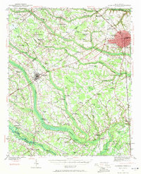
1940 Map of Florence West
USGS Topo · Published 1940About this map
The Pee Dee region of South Carolina unfolds across this 1940 survey, centered on the agricultural and rail landscapes west of the burgeoning city of Florence. The era's transportation network is defined by the Atlantic Coast Line and Seaboard Coast Line railroads, which spurred growth in towns like Timmonsville. Beyond the tracks, the landscape is heavily influenced by the drainage patterns of Sparrow Swamp and the Lynches River, where local industry was once anchored by sites such as Lynches Mill and Muldrow Mill.
Find a feature on this map
93 named features on this map. Tap any name to fly to it.
Don’t see what you’re looking for? This feature index may not catch every label — zoom into the map to look around manually.
Map Details
Editions of this 1940 Florence West Map
2 editions found
Other maps of this area

1920 · Mayesville
USGS Topo · 1:48,000

1921 · Mayesville
USGS Topo · 1:62,500

1940 · Florence East
USGS Topo · 1:62,500

1941 · Spartanburg
USGS Topo · 1:250,000

1943 · Gum Swamp
USGS Topo · 1:62,500

1943 · Mayesville
USGS Topo · 1:62,500

1945 · Florence East
USGS Topo · 1:62,500

1945 · Florence West
USGS Topo · 1:62,500

1946 · Hyman
USGS Topo · 1:62,500

1946 · Lake City
USGS Topo · 1:62,500