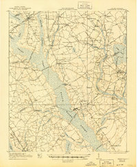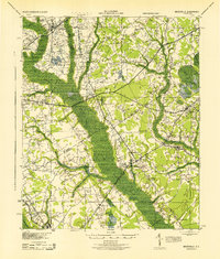
1943 Map of Mayesville
USGS Topo · Published 1943About this map
Mayesville and the surrounding coastal plain of Sumter and Clarendon counties are defined here by a dense network of country churches and small schools during the early 1940s. The landscape is dominated by the wide, swampy basin of the Black River, which separates the more established settlements like Turbeville and New Zion from the rail-oriented growth near the Atlantic Coast Line Railroad. Many family-named landmarks such as Brunsons Store and McBride Corners are visible, alongside numerous local institutions like Goodwill Ch and the Pleasant Grove Sch. This survey, revised using 1940s aerial photography, reveals the rural transition from traditional crossroads like Sardinia and Shiloh to more concentrated developments along the Sumter Road and Manning Road.
Find a feature on this map
52 named features on this map. Tap any name to fly to it.
Don’t see what you’re looking for? This feature index may not catch every label — zoom into the map to look around manually.
Map Details
Editions of this 1943 Mayesville Map
This is the sole edition of this map. No revisions or reprints were ever made.
Historical Maps of Mayesville Through Time
9 maps found