1900s (20th Century) Maps of Gregg Camp, South Carolina
Explore 6 historic maps of Gregg Camp from the 1900s (20th Century). These maps offer a rare glimpse into what life looked like during the 1900s — showing old roads, neighborhoods, homes, and landmarks that have changed or disappeared over time.
Whether you're researching your family's past, planning a metal detecting trip, or studying how Gregg Camp's landscape evolved across the 1900s, these high-resolution maps are a powerful tool for exploring the history of this region.
- Focus on a specific era: All maps on this page are from the 1900s, giving you a focused view of this time period.
- See what’s changed: Compare century-old streets, trails, and buildings to today's modern landscape using overlays and satellite layers.
- Research with precision: Use these maps for genealogy, historical research, land use analysis, or educational projects.
- View, download, or print: Maps are fully viewable online in high resolution, and can be downloaded or printed for your own records.
Start exploring Gregg Camp's history through authentic maps from the 1900s. This is your window into the past.
Gregg Camp, SC maps
(6)- 1940 Map of Florence East, 1971 Print
 1940 Florence East1971 Print · USGSThe Pee Dee region just before the Second World War shows a landscape defined by riverside landings and rural rail stops. Genealogists can locate family-named landmarks and community hubs like Browns Old Mill, Tabernacle Sch, and Hewitt Cem.
 - 1945 Map of Florence East
 1945 Florence East1945 Print · USGSThe Pee Dee region of South Carolina was a web of rail lines and river landings in the years following the second World War. Researchers can trace the heritage of local communities at Browns Old Mill, Mars Bluff, and rural schoolhouses like Red Hill Sch.2 unique versions available
 - 1953 Map of Florence, 1964 Print
 1953 Florence1964 Print · USGSThe Carolina borderlands in the mid-fifties were a landscape of vast river swamps and rising rail towns. Trace the legacy of the Seaboard Air Line through Florence or explore the wetlands surrounding Lake Waccamaw and the Green Swamp.3 unique versions available
 - 1954 Map of Florence
 1954 Florence1954 Print · USGSThe Carolinas borderlands come alive in the early fifties, showing the vital rail-and-river networks of the coastal plain. Genealogists can trace family footprints across the Green Swamp or through settlements like Red Springs, Chadbourn, and McColl.
 - 1983 Map of Florence, 1985 Print
 1983 Florence1985 Print · USGSThe Pee Dee region in the early eighties shows a landscape shaped by river commerce and rail expansion. Researchers can trace historic river crossings at Galivants Ferry or locate vanished rail stops like Willow Creek Siding and Blue Brick.
 - 1986 Map of Florence East, 1987 Print
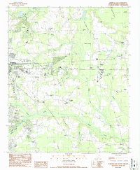 1986 Florence East1987 Print · USGSThe eastern outskirts of Florence and the wetlands of the Pee Dee region are shown here in the late seventies and eighties. Researchers can trace the development of Francis Marion College or find family history at McPherson Cem and Price Crossroads.
End of results
Showing maps 1-6 of 6
Top cities near Gregg Camp
- Florence historical maps
- Marion historical maps
- Pamplico historical maps
- Quinby historical maps
- Coward historical maps
- Sellers historical maps
Frequently asked questions
- What are the different types of historical maps available for Gregg Camp?
- What is the oldest map of Gregg Camp?
- Where can I purchase historical maps of Gregg Camp for my home or office?
- Where can I download high-res historical maps of Gregg Camp?
- Are there historical topographic maps available for Gregg Camp?
- Is there historical aerial imagery available for Gregg Camp?
- Where are historical maps of Gregg Camp sourced from?