Old Maps of Georgetown County, South Carolina for Hiking & Exploration
Hike through history with 181 historic maps of Georgetown County. Explore old trails, ghost towns, and forgotten backroads — perfect for outdoor adventurers and local explorers.
- Rediscover forgotten places: Map out old mining camps, roads, and footpaths that no longer exist on modern maps.
- Layer with modern tools: Combine with LiDAR or satellite views to plan hikes through historical terrain.
- Made for exploration: Popular among hikers, overlanders, and local history lovers.
Use these maps to find adventure and explore the hidden past of Georgetown County.
Georgetown County, SC maps
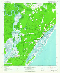
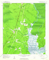
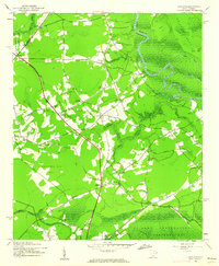
(181)- 1937 Map of Myrtle Beach
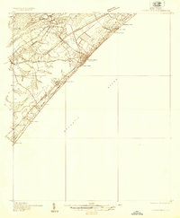 1937 Myrtle Beach1937 Print · USGSThe Grand Strand is seen here in the late 1930s as a developing coastal corridor transitioning from swampy lowlands to a vacation destination. Trace early infrastructure including the Intracoastal Waterway, Myrtle Beach State Park, and the CCC Camp.3 unique versions available
 - 1940 Map of Myrtle Beach
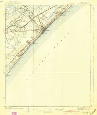 1940 Myrtle Beach1940 Print · USGSBefore the rise of modern resorts, the Grand Strand was a network of swashes and small coastal outposts. Genealogists and historians can trace the early footprints of Socastee, Myrtle Ridge, and the Ocean Forest Club along the historic Kings Highway.3 unique versions available
 - 1942 Map of Cedar Creek, 1962 Print
 1942 Cedar Creek1962 Print · USGSThe coastal plains of Georgetown and Berkeley counties are documented here in the early 1940s, showcasing a landscape of dense swamps and scattered landings. Genealogists and historians can trace rail-side life in Lambert or explore the riverfront at Price Landing and Trinity Ch.2 unique versions available
 - 1942 Map of Cape Romain, 1962 Print
 1942 Cape Romain1962 Print · USGSThe South Carolina coast near the Santee Delta is shown here in the early 1940s, capturing a pristine network of barrier islands and salt marshes. Maritime researchers can trace the historic Intracoastal Waterway and locate landmarks like Lighthouse Island and Deepwater Point.4 unique versions available
 - 1942 Map of Santee Point, 1962 Print
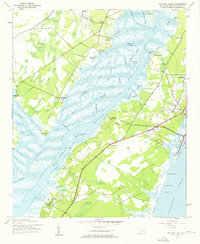
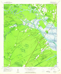
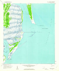 1942 Santee Point1962 Print · USGSThe Georgetown County coastline at the start of the 1940s reveals a wild marshland landscape dominated by Winyah Bay and its ocean entrance. Genealogists and maritime historians can trace the grounds of Cat Island Plantation and the historic Quarantine station.3 unique versions available
 - 1942 Map of North Island, 1962 Print
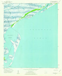
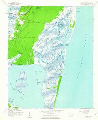 1942 North Island1962 Print · USGSThe Georgetown coast during the early 1940s is a world of sprawling rice plantations and tidal estuaries. Genealogists and historians can trace the grounds of Bellefield Plantation, find the landing at Clambank, or navigate the winding reaches of Old Man Creek.3 unique versions available
 - 1942 Map of Honey Hill, 1962 Print
 1942 Honey Hill1962 Print · USGSBerkeley County was still largely defined by its river-and-swamp geography during the early 1940s. Local researchers can trace old crossroads like Honey Hill and Charley Bridges, or locate river access points including Pleasant Hill Landing and Pitch Landing.3 unique versions available
 - 1942 Map of Magnolia Beach, 1962 Print
 1942 Magnolia Beach1962 Print · USGSThe Georgetown County coast in the early 1940s shows a landscape of tidal creeks and rising beach communities. Genealogists and local researchers can trace the early footprints of Georgieville, Annieville, and the historic barrier of Pawleys Island.2 unique versions available
 - 1942 Map of Waverly Mills, 1962 Print
 1942 Waverly Mills1962 Print · USGSThe Waccamaw and Pee Dee rivers meet in this wartime survey, showing a landscape of riverfront estates and early coastal settlements. Genealogists and historians can trace the grounds of Arundel Plantation, locate All Saints Ch, and see Marysville before the era of modern development.3 unique versions available
 - 1943 Map of Olin
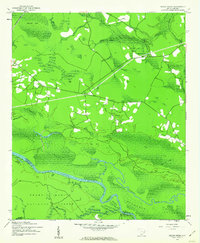
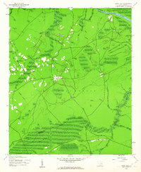
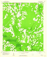
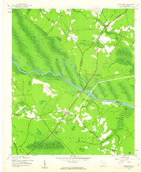
 1943 Olin1943 Print · USGSGeorgetown County during the early 1940s is defined by its winding river systems and isolated inland settlements. Genealogists and historians can trace family locations near Bethlehem Church, find the Bethel Cem, and locate the old Sampit Station along the railroad.3 unique versions available
 - 1943 Map of Yauhannah, 1958 Print
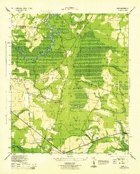
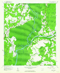
 1943 Yauhannah1958 Print · USGSThe South Carolina lowcountry is captured here in the mid-1940s, showing a river-driven landscape of swamps and isolated settlements. Researchers can trace rural life through landmarks like Gravel Gully School, the Yauhannah Church and Cem, and the old Lucas Bay Plantation.4 unique versions available
 - 1943 Map of Trio, 1962 Print
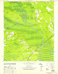
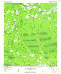
 1943 Trio1962 Print · USGSCoastal South Carolina at the height of the Second World War was a land defined by its Carolina bays and logging heritage. Researchers can trace the path of the Logging RR or locate family landmarks like the Faireloth Plantation and St John Ch.2 unique versions available
 - 1943 Map of Henry, 1962 Print
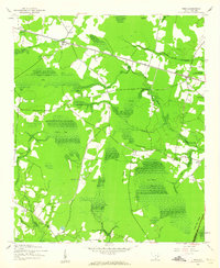
 1943 Henry1962 Print · USGSWilliamsburg County during the early 1940s reveals a landscape defined by the Black River Swamp and the Seaboard Air Line. Researchers can locate old community landmarks like Bethel Sch, Harmon Cem, and Snow Junction.2 unique versions available
 - 1943 Map of Bucksville, 1962 Print
 1943 Bucksville1962 Print · USGSThe Lowcountry river system and its transition into a modern waterway define this wartime era map of the Horry County swamplands. Researchers can trace old schoolhouses and rural parishes like Richardson Sch and Hebron Ch along the Waccamaw River.3 unique versions available
 - 1943 Map of Carvers Bay, 1962 Print
 1943 Carvers Bay1962 Print · USGSGeorgetown County during the 1940s was a landscape of river landings and rural outposts. You can trace the historic Roland Hall Plantation and locate community landmarks like Hopewell Ch, Dunbar, and the expansive U S Army Reservation.3 unique versions available
 - 1943 Map of Brookgreen, 1962 Print
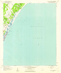
 1943 Brookgreen1962 Print · USGSThe South Carolina Lowcountry comes to life during the early 1940s, showing the intricate wetlands and river landings of the Waccamaw region. Genealogists and historians can trace family locations near Brookgreen Gardens or locate old community hubs like St Peters Ch and Burgess.5 unique versions available
 - 1943 Map of Plantersville, 1962 Print
 1943 Plantersville1962 Print · USGSThe Lowcountry riverfronts of Georgetown County are captured here during the 1940s, showing a landscape of traditional estates and tidal waterways. Genealogists can trace family footprints through numerous river estates like Hasty Point Plantation and rural landmarks such as Prince Frederick Ch or Birdfield Sch.3 unique versions available
 - 1943 Map of Kilsock Bay, 1962 Print
 1943 Kilsock Bay1962 Print · USGSGeorgetown County's coastal wetlands are captured here in the early 1940s, showing a landscape defined by the Sampit River and large elliptical bays. Genealogists can locate rural community hubs like St Paul Ch and small settlements including Cumberland and Lodge Hall.2 unique versions available
 - 1943 Map of Rhems, 1962 Print
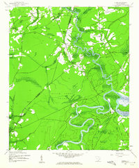 1943 Rhems1962 Print · USGSThe rural lowlands of Georgetown and Williamsburg Counties are captured here during the early 1940s as the river-based economy evolved. Genealogists and local historians can trace family roots through sites like Dorsey Town Sch, Rhems Plantation, and the Old Railroad Grade.2 unique versions available
 - 1943 Map of Andrews, 1962 Print
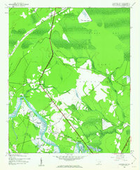
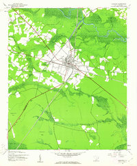 1943 Andrews1962 Print · USGSThe Andrews area in the early 1940s is captured here at the junction of the SEABOARD railroad and rural crossroads. Researchers can trace family sites at Mt Lebanon Cem and Harmony Ch or explore the swampy borders of Johnsons Swamp.3 unique versions available
 - 1943 Map of Jamestown, 1962 Print
 1943 Jamestown1962 Print · USGSBerkeley and Williamsburg counties are shown here during the early 1940s as the rail-and-river economy shifted toward modern transit. Genealogists can trace family settlements at Beufordtown, Gumville, and Palmerville, or locate the site of Lanes Ferry (Abandoned).2 unique versions available
 - 1943 Map of Santee, 1962 Print
 1943 Santee1962 Print · USGSThe Santee River delta was a landscape of historic estates and vast wetlands in the early 1940s. Genealogists and historians can trace the grounds of Hampton Plantation, Fairfield Plantation, and local landmarks like St James Ch.3 unique versions available
 - 1943 Map of Georgetown North, 1962 Print
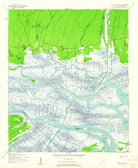
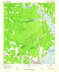 1943 Georgetown North1962 Print · USGSGeorgetown and the surrounding Lowcountry plantations are captured during the mid-1940s as the river-based economy met new wartime demands. Genealogists and historians can trace family-named sites like Lark Hill Plantation, Johnson Corner, and Mt Zion Ch.3 unique versions available
 - 1943 Map of Minim Island, 1962 Print
 1943 Minim Island1962 Print · USGSCoastal Georgetown County in the early 1940s is defined here by its massive river deltas and historic waterfront estates. Researchers can trace the boundaries of Rice Hope Plantation or locate Bethel Ch and the Estherville Minim Creek Canal.5 unique versions available
 - 1943 Map of Outland, 1962 Print
 1943 Outland1962 Print · USGSGeorgetown County at the height of the war years reveals a landscape of river landings and rural crossroads. You can trace family roots through numerous sites like Hucks Field Cem, Huggins Crossroads, and Jerusalem Ch.2 unique versions available
Showing maps 1-25 of 181
Top cities of Georgetown County
- Georgetown historical maps
- Murrells Inlet historical maps
- Litchfield Beach historical maps
- Andrews historical maps
- DeBordieu Colony historical maps
- Pawleys Island historical maps
Frequently asked questions
- What are the different types of historical maps available for Georgetown County?
- What is the oldest map of Georgetown County?
- Where can I purchase historical maps of Georgetown County for my home or office?
- Where can I download high-res historical maps of Georgetown County?
- Are there historical topographic maps available for Georgetown County?
- Is there historical aerial imagery available for Georgetown County?
- Where are historical maps of Georgetown County sourced from?