Old Maps of Pawleys Island, South Carolina for Genealogy
Trace your family roots with 16 historic maps of Pawleys Island. These high-res maps reveal old neighborhoods, homesites, landmarks, and streets — helping you uncover where your ancestors lived and how the area evolved over time.
- Explore historic neighborhoods: Identify where your relatives may have lived in the 1800s or 1900s.
- Compare maps over time: Trace the changes in streets, buildings, and landmarks for multi-generational research.
- Perfect for genealogy & ancestry research: Used by family historians and researchers to map out lineage and migration.
These maps are an incredible resource for exploring your personal connection to Pawleys Island's past.
Pawleys Island, SC maps
(16)- 1942 Map of Magnolia Beach, 1962 Print
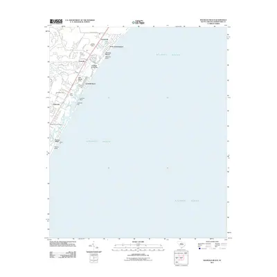
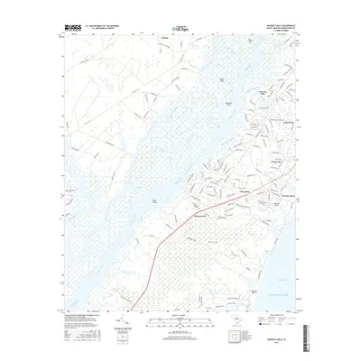
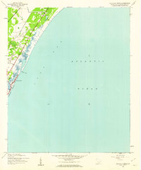 1942 Magnolia Beach1962 Print · USGSThe Georgetown County coast in the early 1940s shows a landscape of tidal creeks and rising beach communities. Genealogists and local researchers can trace the early footprints of Georgieville, Annieville, and the historic barrier of Pawleys Island.2 unique versions available
 - 1942 Map of Waverly Mills, 1962 Print
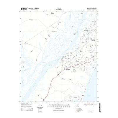
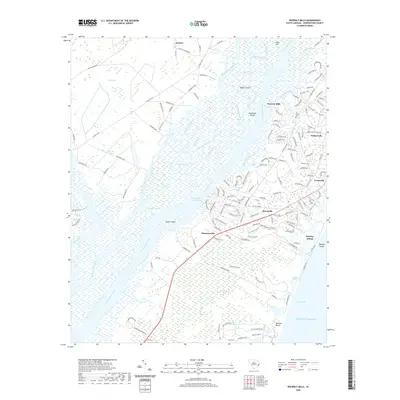
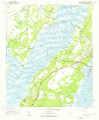 1942 Waverly Mills1962 Print · USGSThe Waccamaw and Pee Dee rivers meet in this wartime survey, showing a landscape of riverfront estates and early coastal settlements. Genealogists and historians can trace the grounds of Arundel Plantation, locate All Saints Ch, and see Marysville before the era of modern development.3 unique versions available
 - 1949 Map of Georgetown, 1953 Print
 1949 Georgetown1953 Print · USGSThe South Carolina coast and North Carolina borderlands appear here in the mid-century, prior to the major modern development of the Grand Strand. Genealogists and historians can trace the rail networks of the Seaboard Air Line Railroad and locate coastal landmarks from Fort Caswell to McClellanville.
 - 1967 Map of Georgetown
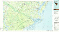
 1967 Georgetown1967 Print · USGSThe South Carolina Lowcountry and Grand Strand meet in the late sixties, showcasing a coastal landscape transitioning from river-based industry to seaside tourism. Researchers can trace the Intracoastal Waterway past Georgetown or locate historical sites like Fort Fisher and Murrells Inlet.
 - 1974 Map of Georgetown, 1978 Print
 1974 Georgetown1978 Print · USGSThe Carolina coast and Pee Dee region are shown here in the mid-seventies, just as the Grand Strand was maturing into a premier destination. Researchers can trace the inland rail corridors of the Seaboard Coast Line Railroad or explore the coastal reaches of the Cape Romain National Wildlife Refuge and Myrtle Beach State Park.2 unique versions available
 - 1986 Map of Georgetown
 1986 Georgetown1986 Print · USGSThe South Carolina Lowcountry is captured here in the mid-1980s, centered on the historic port of Georgetown and its surrounding wetlands. Researchers can trace the river-fed economy and land patterns of Waccamaw Neck, Hampton Plantation State Park, and the timber-rich Francis Marion National Forest.2 unique versions available
 - 2011 Map of Waverly Mills, 2011 Print
 2011 Waverly Mills2011 Print · USGSCovers Pawleys Island, including Heritage, Simmonsville, and other nearby areas
 - 2011 Map of Magnolia Beach, 2011 Print
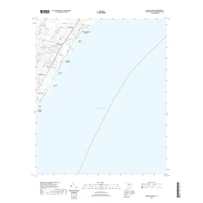
 2011 Magnolia Beach2011 Print · USGSCovers Pawleys Island, including Litchfield Beach, Georgieville, and other nearby areas
 - 2014 Map of Magnolia Beach, 2014 Print
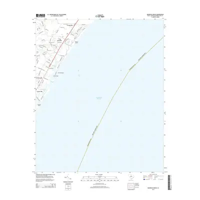 2014 Magnolia Beach2014 Print · USGSCovers Pawleys Island, including Litchfield Beach, Georgieville, and other nearby areas
 - 2014 Map of Waverly Mills, 2014 Print
 2014 Waverly Mills2014 Print · USGSCovers Pawleys Island, including Heritage, Simmonsville, and other nearby areas
 - 2017 Map of Magnolia Beach, 2017 Print
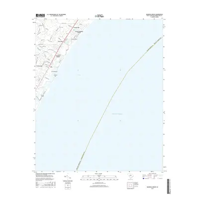 2017 Magnolia Beach2017 Print · USGSCovers Pawleys Island, including Litchfield Beach, Georgieville, and other nearby areas
 - 2017 Map of Waverly Mills, 2017 Print
 2017 Waverly Mills2017 Print · USGSCovers Pawleys Island, including Heritage, Simmonsville, and other nearby areas
 - 2020 Map of Magnolia Beach, 2020 Print
 2020 Magnolia Beach2020 Print · USGSCovers Pawleys Island, including Litchfield Beach, Georgieville, and other nearby areas
 - 2020 Map of Waverly Mills, 2020 Print
 2020 Waverly Mills2020 Print · USGSCovers Pawleys Island, including Heritage, Simmonsville, and other nearby areas
 - 2024 Map of Magnolia Beach, 2024 Print
 2024 Magnolia Beach2024 Print · USGSThe South Carolina coast near Georgetown comes to life in this contemporary survey of the Waccamaw Neck region. Researchers can trace the modern boundaries of residential settlements like Georgieville, Annieville, and Pawleys Island alongside landmarks like Flagg Pond.
 - 2024 Map of Waverly Mills, 2024 Print
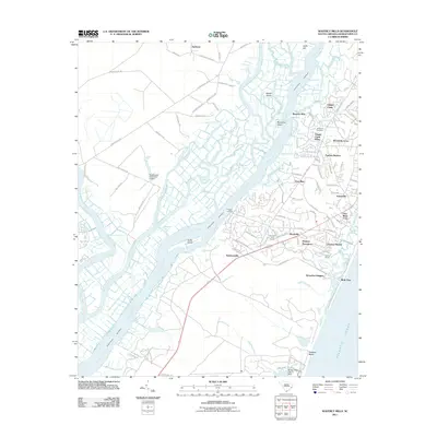
 2024 Waverly Mills2024 Print · USGSCoastal Georgetown County thrives where the Waccamaw River meets the Atlantic, showing a landscape defined by wetlands and historic waterfront communities. You can trace local roots through All Saints Cem or explore the river-and-road connections of Waverly Mills and Marysville.
End of results
Showing maps 1-16 of 16
Top cities near Pawleys Island
- Garden City Beach historical maps
- Georgetown historical maps
- Murrells Inlet historical maps
- Litchfield Beach historical maps
- Surfside Beach historical maps
- DeBordieu Colony historical maps
Top neighborhoods of Pawleys Island
Frequently asked questions
- What are the different types of historical maps available for Pawleys Island?
- What is the oldest map of Pawleys Island?
- Where can I purchase historical maps of Pawleys Island for my home or office?
- Where can I download high-res historical maps of Pawleys Island?
- Are there historical topographic maps available for Pawleys Island?
- Is there historical aerial imagery available for Pawleys Island?
- Where are historical maps of Pawleys Island sourced from?