
1942 Map of Magnolia Beach
USGS Topo · Published 1962About this map
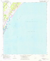
Brookgreen Gardens anchors the northern coastal landscape of this Georgetown County survey, where the Waccamaw Neck narrows between the marshes and the Atlantic. The shoreline transition is defined by Magnolia Beach and the developed barrier of Pawleys Island, separated from the mainland by the winding Pawleys Island Creek. Inland, a series of small residential clusters including Georgieville, Annieville, and Parkersville follow the corridor of Route 17. This mid-century view reveals a landscape defined by tidal hydrology, with Clubhouse Creek and Midway Inlet shaping the shifting sands of the coast. The map preserves the spatial arrangement of these coastal communities before the extensive modern expansion of the Grand Strand area, documenting the early footprints of Fraserville and the quiet reaches of Flagg Pond.
Find a feature on this map
15 named features on this map. Tap any name to fly to it.
Don’t see what you’re looking for? This feature index may not catch every label — zoom into the map to look around manually.
Map Details
Editions of this 1942 Magnolia Beach Map
2 editions found
Other maps of this area

1937 · Myrtle Beach
USGS Topo · 1:48,000

1940 · Myrtle Beach
USGS Topo · 1:62,500

1942 · North Island
USGS Topo · 1:24,000

1942 · Waverly Mills
USGS Topo · 1:24,000

1943 · Brookgreen
USGS Topo · 1:24,000

1943 · Plantersville
USGS Topo · 1:24,000

1949 · Georgetown
USGS Topo · 1:250,000

1967 · Georgetown
USGS Topo · 1:250,000

1974 · Georgetown
USGS Topo · 1:250,000
1984 · Surfside Beach
USGS Topo · 1:24,000
Featured Places
- Litchfield Beach, SC
- Pawleys Island, SC
- Georgieville, SC
- North Litchfield Beach, SC
- Litchfield by the Sea, SC