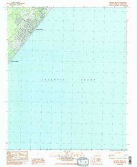
1984 Map of Surfside Beach
USGS Topo · Published 1985About this map
Surfside Beach and Garden City Beach dominate this coastal survey, reflecting the intensive development of the South Carolina Grand Strand during the mid-1980s. The landscape is characterized by a dense grid of vacation homes and local infrastructure, centered around the Town Hall and the coastal Pier. Recreational land use is prominent, with the Ocean Lakes Family Campground occupying a significant portion of the northern shoreline, alongside an Amusement Park, a Golf Course, and Fuller Park. Inland from Ocean Blvd, small bodies of water like Dogwood Lake and Floral Lake are integrated into the residential layout. This record illustrates the transition of the area into a major tourism hub, as evidenced by the numerous named drives such as Melody Lane and Lakeside Drive that serve the growing beach community.
Find a feature on this map
23 named features on this map. Tap any name to fly to it.
Don’t see what you’re looking for? This feature index may not catch every label — zoom into the map to look around manually.
Map Details
Editions of this 1984 Surfside Beach Map
2 editions found
Other maps of this area

1937 · Myrtle Beach
USGS Topo · 1:48,000

1940 · Myrtle Beach
USGS Topo · 1:62,500

1942 · Magnolia Beach
USGS Topo · 1:24,000

1943 · Bucksville
USGS Topo · 1:24,000

1943 · Brookgreen
USGS Topo · 1:24,000

1949 · Georgetown
USGS Topo · 1:250,000

1967 · Georgetown
USGS Topo · 1:250,000

1974 · Georgetown
USGS Topo · 1:250,000
1984 · Ocean Forest
USGS Topo · 1:24,000
1984 · Myrtle Beach
USGS Topo · 1:24,000