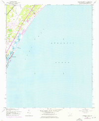
1942 Map of Magnolia Beach
USGS Topo · Published 1976About this map
Pawleys Island stands as the centerpiece of this coastal survey, appearing just as it was being updated with 1973 revisions to reflect post-war development along the South Carolina shore. The landscape is defined by the thin barrier strand of Magnolia Beach and the intricate tidal waterways including Clubhouse Creek and Midway Inlet. Inland, the map documents several distinct settlements such as Georgieville, Annieville, Parkersville, and Fraserville, which suggest the historic community patterns of Georgetown County before modern suburban expansion. A large portion of the northern quadrangle is dedicated to Brookgreen Gardens, while landmarks like Flagg Pond and a local Golf Course mark the transition from natural wetlands to recreational land use. The topography reveals the delicate balance between the Long Bay coastline and the mainland marsh, captured through a combination of 1942 photogrammetry and later aerial updates.
Find a feature on this map
16 named features on this map. Tap any name to fly to it.
Don’t see what you’re looking for? This feature index may not catch every label — zoom into the map to look around manually.
Map Details
Editions of this 1942 Magnolia Beach Map
2 editions found
Other maps of this area

1937 · Myrtle Beach
USGS Topo · 1:48,000

1940 · Myrtle Beach
USGS Topo · 1:62,500

1942 · North Island
USGS Topo · 1:24,000

1942 · Magnolia Beach
USGS Topo · 1:24,000

1942 · Waverly Mills
USGS Topo · 1:24,000

1943 · Brookgreen
USGS Topo · 1:24,000

1943 · Plantersville
USGS Topo · 1:24,000

1949 · Georgetown
USGS Topo · 1:250,000

1967 · Georgetown
USGS Topo · 1:250,000

1974 · Georgetown
USGS Topo · 1:250,000
Featured Places
- Litchfield Beach, SC
- Pawleys Island, SC
- Georgieville, SC
- North Litchfield Beach, SC
- Litchfield by the Sea, SC