Old Maps of Greenwood County, South Carolina for Genealogy
Trace your family roots with 139 historic maps of Greenwood County. These high-res maps reveal old neighborhoods, homesites, landmarks, and streets — helping you uncover where your ancestors lived and how the area evolved over time.
- Explore historic neighborhoods: Identify where your relatives may have lived in the 1800s or 1900s.
- Compare maps over time: Trace the changes in streets, buildings, and landmarks for multi-generational research.
- Perfect for genealogy & ancestry research: Used by family historians and researchers to map out lineage and migration.
These maps are an incredible resource for exploring your personal connection to Greenwood County's past.
Greenwood County, SC maps
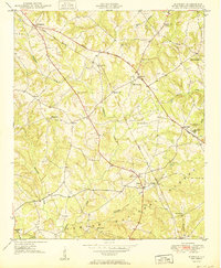
(139)- 1892 Map of Mc Cormick
 1892 Mc Cormick1892 Print · USGSThe Savannah River borderlands in the 1890s reveal a network of historic ferries and early mills connecting Georgia and South Carolina. Genealogists can trace family roots through landmarks like Dunn Chapel, Searle Mill, and the crossings at Barksdale Ferry.5 unique versions available
 - 1892 Map of Abbeville
 1892 Abbeville1892 Print · USGSSouth Carolina’s Upstate during the late 1800s reveals a landscape defined by critical river crossings and the arrival of the steam era. Genealogists can trace family roots through localized sites like Smith Ferry, Maddox Mill, and the bustling rail hub of Greenwood.6 unique versions available
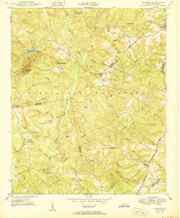
 - 1908 Map of Kirksey, 1942 Print
 1908 Kirksey1942 Print · USGSMid-century Greenwood County is captured here during a time when rural schoolhouses and small settlements like Phoenix and Kirksey still anchored local life. Researchers can trace the Georgia and Florida railroad and find defunct local schools like Brick House Sch or Sand Ridge Sch.
 - 1912 Map of Mc Cormick, 1913 Print
 1912 Mc Cormick1913 Print · USGSThe Georgia and South Carolina borderlands come alive in the 1890s, centered on the rail junction at Mc Cormick and the Savannah River. Genealogists can trace family footprints across numerous river crossings like Fury Ferry and through rural centers such as Appling and Sharon Church.
 - 1941 Map of Spartanburg
 1941 Spartanburg1941 Print · USGSSouth Carolina’s Piedmont and Sandhills regions are shown here during the mid-century peak of the rail era. Researchers can trace the sprawling Fort Jackson Military Reservation and the industrial growth of hubs like Spartanburg and Rock Hill.
 - 1948 Map of Abbeville East
 1948 Abbeville East1948 Print · USGSAbbeville and its eastern rural fringes are documented here in the late 1940s before the continued growth of the national forest. Genealogists and local historians can trace family-named sites like Aiken Cem, the County Training Sch, and Millers Mill.
 - 1948 Map of Verdery, 1974 Print
 1948 Verdery1974 Print · USGSThe rural Upstate during the late 1940s is detailed here as the timber and rail economy shaped the borderlands of Abbeville and Greenwood. Researchers can trace family sites near Clatworthy Crossroads or visit local landmarks like Long Cane Ch and the Bradley Bridge.
 - 1949 Map of Ninety-Six
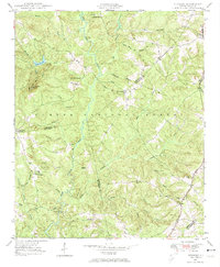
 1949 Ninety-Six1949 Print · USGSThe crossroads town of Ninety-Six is shown at the peak of its rail-era influence in the late 1940s. Genealogists and historians can trace family locations near Youngs Chapel School, Lebanon Church, and the Site of Old Star Fort.2 unique versions available
 - 1949 Map of Greenwood
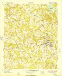
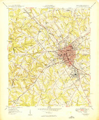 1949 Greenwood1949 Print · USGSGreenwood flourished as a major rail and textile crossroads in the late forties, its landscape defined by industrial villages and extensive trackage. Genealogists and historians can trace neighborhood roots through Lander College, the Connie Maxwell Childrens Home, and several mill villages.2 unique versions available
 - 1950 Map of Bradley
 1950 Bradley1950 Print · USGSMid-century Greenwood County was a land of small rail-stops and forest-fringed farms connected by the Charleston and Western Carolina railroad. Genealogists and historians can trace local family landmarks like the Old Rock House, Old Pine Grove Cem, and Cedar Grove Sch.2 unique versions available
 - 1950 Map of Kirksey
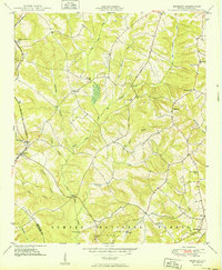
 1950 Kirksey1950 Print · USGSMid-century Greenwood County reveals a rural landscape defined by the Sumter National Forest and a web of schoolhouse-centered communities. Genealogists can locate family landmarks like Dominicks and Gaines, or trace the old paths near Kinard Chapel and the Epworth Camp.
 - 1950 Map of Verdery
 1950 Verdery1950 Print · USGSMid-century Abbeville and Greenwood counties were defined by a dense network of country churches and forest management within the Sumter National Forest. Genealogists can trace family landmarks like Chisholm Cem, Cedar Springs Ch, and Clatworthy Crossroads.2 unique versions available
 - 1950 Map of Abbeville East
 1950 Abbeville East1950 Print · USGSAbbeville and the eastern Piedmont rural landscape are documented here at the midpoint of the century. Genealogists and local historians can trace family-named sites like Millers Mill, locate several rural schools such as Long Cane Sch, and find cemeteries including Aiken Cem and Big Adams Cem.2 unique versions available
 - 1953 Map of Athens, 1966 Print
 1953 Athens1966 Print · USGSGeorgia's Piedmont and Savannah River borderlands come alive in this mid-century survey of the region surrounding Athens and Augusta. Trace the rail-and-river economy through the Georgia RR and landmarks like the Fort Gordon Military Reservation.3 unique versions available
 - 1953 Map of Spartanburg, 1966 Print
 1953 Spartanburg1966 Print · USGSMid-century South Carolina comes into focus through this survey of the Piedmont and the Sand Hills at a time of significant reservoir expansion. Researchers can trace the legacy of industrial transit and resource extraction from the Haile Gold Mine to the rail hubs of the Seaboard Air Line.4 unique versions available
 - 1954 Map of Augusta
 1954 Augusta1954 Print · USGSThe Savannah River valley and South Carolina Midlands are captured here during a period of post-war growth. Researchers can trace the rail-and-river economy through the Southern RR corridor and locate historic settlements like Aiken, Orangeburg, and Sumter.
 - 1954 Map of Greenville, 1965 Print
 1954 Greenville1965 Print · USGSThe Upstate and Northeast Georgia are captured here during a decade of massive transformation as new reservoirs reshaped the Piedmont. Genealogists and hikers can trace the Appalachian Trail over Brasstown Bald or locate old community centers like Demorest, Westminster, and Royston.3 unique versions available
 - 1957 Map of Augusta, 1966 Print
 1957 Augusta1966 Print · USGSThe Savannah River and Santee basins are captured here during a period of massive military and industrial expansion in the late fifties. Genealogists can trace family footprints across Four Hole Swamp or near the Savannah River Plant.3 unique versions available
 - 1958 Map of Greenville
 1958 Greenville1958 Print · USGSThe Piedmont and Blue Ridge foothills come alive in this mid-century survey of the Upstate and Northeast Georgia. Trace the regional rail-and-river economy through the Southern Railway corridors and early reservoir developments like Lake Sidney Lanier.
 - 1958 Map of Augusta
 1958 Augusta1958 Print · USGSThe borderlands between Georgia and South Carolina come alive in the 1950s, showing the early footprint of the Savannah River Plant. Genealogists and historians can trace rail-dependent towns and rural landmarks from Orangeburg to the Fort Jackson Military Reservation.
 - 1958 Map of Athens
 1958 Athens1958 Print · USGSNorth-central Georgia and the Savannah River valley are captured in the late fifties, showing the region as the new reservoirs were filling. Researchers can trace historic rail lines like the Georgia RR and locate rural landmarks such as Social Circle, Graves Mountain, and the Fort Gordon Military Reservation.
 - 1959 Map of Athens
 1959 Athens1959 Print · USGSNortheast Georgia and the South Carolina borderlands appear here in the mid-fifties, during a decade of infrastructure growth. Genealogists and historians can trace the rail-and-river geography of towns like Social Circle, the sprawl of Fort Gordon Military Reservation, and the newly formed Clark Hill Reservoir.
 - 1960 Map of Spartanburg
 1960 Spartanburg1960 Print · USGSThe South Carolina Piedmont and North Carolina borderlands come alive in this mid-century survey of the region between Spartanburg and Columbia. Researchers can trace the Seaboard Air Line railroad and explore landmarks like Anderson Quarry, Lake Murray, and Mount Croghan.2 unique versions available
 - 1961 Map of Augusta
 1961 Augusta1961 Print · USGSThe South Carolina lowcountry and CSRA appear here in the early sixties, during a period of massive military and industrial growth. Researchers can trace the development of the Savannah River Plant or locate legacy landmarks like Nelson Ferry and Magnolia Cemetery.2 unique versions available
 - 1962 Map of Augusta
 1962 Augusta1962 Print · USGSThe South Carolina and Georgia borderlands are seen here in the early sixties, showing the rise of the Savannah River Plant and the expansion of Fort Jackson. Researchers can trace old rail lines like the Southern Railway and find landmarks such as St. Pauls Church or the Santee Canal.
Showing maps 1-25 of 139
Top cities of Greenwood County
- Greenwood historical maps
- Ninety Six historical maps
- Hodges historical maps
- Troy historical maps
- P C Jean historical maps
Frequently asked questions
- What are the different types of historical maps available for Greenwood County?
- What is the oldest map of Greenwood County?
- Where can I purchase historical maps of Greenwood County for my home or office?
- Where can I download high-res historical maps of Greenwood County?
- Are there historical topographic maps available for Greenwood County?
- Is there historical aerial imagery available for Greenwood County?
- Where are historical maps of Greenwood County sourced from?