2020s Maps of Little River, South Carolina
Explore 7 historic maps of Little River from the 2020s. These maps offer a rare glimpse into what life looked like during the 2020s — showing old roads, neighborhoods, homes, and landmarks that have changed or disappeared over time.
Whether you're researching your family's past, planning a metal detecting trip, or studying how Little River's landscape evolved across the 2020s, these high-resolution maps are a powerful tool for exploring the history of this region.
- Focus on a specific era: All maps on this page are from the 2020s, giving you a focused view of this time period.
- See what’s changed: Compare century-old streets, trails, and buildings to today's modern landscape using overlays and satellite layers.
- Research with precision: Use these maps for genealogy, historical research, land use analysis, or educational projects.
- View, download, or print: Maps are fully viewable online in high resolution, and can be downloaded or printed for your own records.
Start exploring Little River's history through authentic maps from the 2020s. This is your window into the past.
Little River, SC maps
(7)- 2020 Map of Little River, 2020 Print
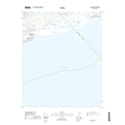 2020 Little River2020 Print · USGSCovers Little River, including North Myrtle Beach, Sunset Beach, and other nearby areas
 - 2020 Map of Longs, 2020 Print
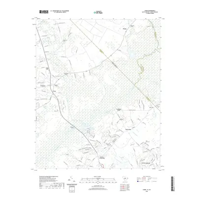 2020 Longs2020 Print · USGSCovers Little River, including Worthams Ferry, Brooksville, and other nearby areas
 - 2020 Map of Wampee, 2020 Print
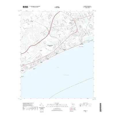 2020 Wampee2020 Print · USGSCovers Little River, including North Myrtle Beach, Briarcliffe Acres, and other nearby areas
 - 2022 Map of Calabash, 2022 Print
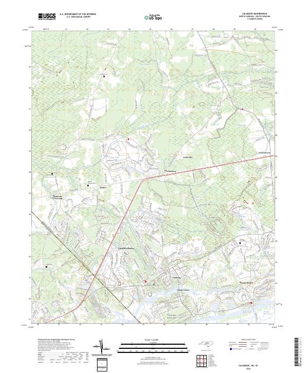 2022 Calabash2022 Print · USGSThe coastal borderlands of the Carolinas are shown here in modern detail, from the marshlands to the beach. Genealogists can locate several family sites like Manley Bennett Cem and Wilson Cem amidst the reaches of Cawcaw Swamp.
 - 2024 Map of Wampee, 2024 Print
 2024 Wampee2024 Print · USGSThe Grand Strand coastline and its inland swamps are mapped in detail during this contemporary era. Genealogists and researchers can trace family landmarks like Forest Lawn Cem and Cedar Creek Cem alongside modern developments in Wampee and Briarcliffe Acres.
 - 2024 Map of Little River, 2024 Print
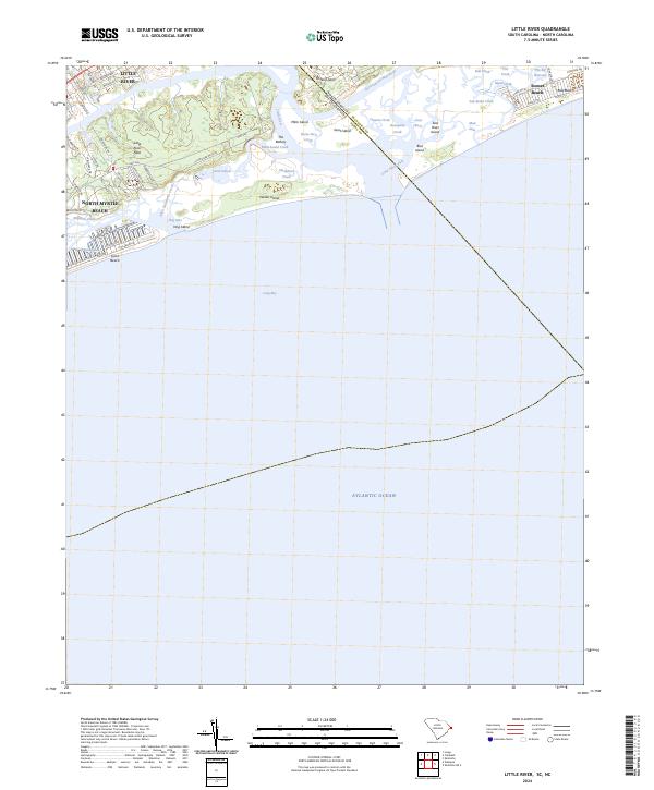 2024 Little River2024 Print · USGSThe Carolinas state line divides this coastal landscape in the modern era, where the Intracoastal Waterway flows into the sea. Genealogists and historians can trace the development of Little River and North Myrtle Beach near landmarks like the Battery and Waties Island.
 - 2024 Map of Longs, 2024 Print
 2024 Longs2024 Print · USGSHorry County and the Carolina borderlands appear in this recent survey of the coastal plain's riverine landscape. Researchers can trace family history through sites like Butler Cem, the crossing at Worthams Ferry, and the community at Stephens Crossroads.
End of results
Showing maps 1-7 of 7
Top cities near Little River
- Myrtle Beach historical maps
- North Myrtle Beach historical maps
- Sunset Beach historical maps
- Carolina Shores historical maps
- Shallotte historical maps
- Calabash historical maps
See more
Top neighborhoods of Little River
- Bridgewater historical maps
- Nixons Crossroads historical maps
- River Hills historical maps
- Gardens at Cypress Bay historical maps
- Tybre Downs historical maps
- Hidden Lakes Village historical maps
See more
Frequently asked questions
- What are the different types of historical maps available for Little River?
- What is the oldest map of Little River?
- Where can I purchase historical maps of Little River for my home or office?
- Where can I download high-res historical maps of Little River?
- Are there historical topographic maps available for Little River?
- Is there historical aerial imagery available for Little River?
- Where are historical maps of Little River sourced from?