Old Maps of Little River, South Carolina for Academic Research
Study the evolution of Little River with 37 high-resolution historic maps. Whether you're teaching, researching, or modeling changes in land use, these maps provide essential visual documentation of urban, environmental, and geographic change.
- Analyze long-term change: Track patterns in development, transportation, and natural features.
- Ideal for environmental or urban studies: Support academic projects with primary historical map data.
- Use in the classroom or lab: Educators and researchers rely on these maps to bring historical context to life.
These maps are a powerful tool for teaching, research, and visualizing how Little River has changed over the decades.
Little River, SC maps
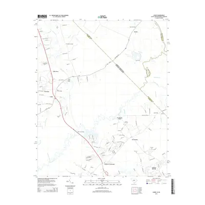
(37)- 1943 Map of Little River
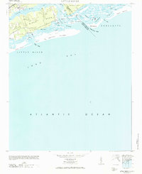
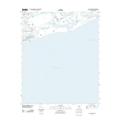
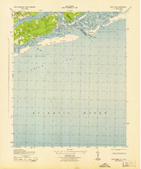 1943 Little River1943 Print · USGSThe coastal border between Horry County and Brunswick County is captured here in the early 1940s, highlighting a landscape of tidal marshes and barrier islands. Researchers can trace the early layout of Little River and find landmarks like The Battery, Goat Island, and Futch Beach.
 - 1943 Map of Calabash
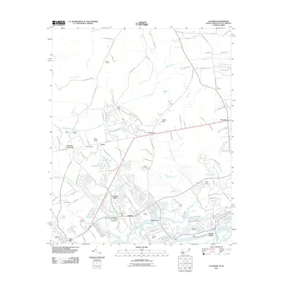
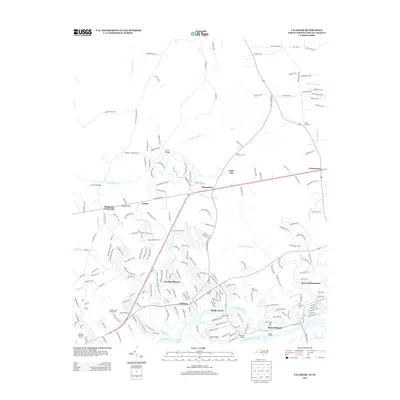
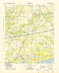 1943 Calabash1943 Print · USGSThe coastal borderlands of North Carolina and South Carolina are captured here during the early forties, showing a landscape of dense swamps and timber bays. Genealogists can locate family landmarks like Philadelphia Wesley Church, Hickmans Crossroads, and the school at La Savannah Sch.
 - 1943 Map of Wampee, 1947 Print
 1943 Wampee1947 Print · USGSCoastal Horry County during the Second World War reveals a landscape shifting from rural swamps to military training grounds and early beach resorts. Genealogists can locate family landmarks like the Matthew Dolan Church or trace the early footprints of Ocean Drive and Wampee.
 - 1944 Map of Longs
 1944 Longs1944 Print · USGSCoastal South Carolina and North Carolina were defined by river ferries and swamp agriculture during the mid-forties. Genealogists can trace local family landmarks such as Butler Cem, Buck Creek Church, and the former Olyphic PO.
 - 1949 Map of Georgetown, 1953 Print
 1949 Georgetown1953 Print · USGSThe South Carolina coast and North Carolina borderlands appear here in the mid-century, prior to the major modern development of the Grand Strand. Genealogists and historians can trace the rail networks of the Seaboard Air Line Railroad and locate coastal landmarks from Fort Caswell to McClellanville.
 - 1953 Map of Little River
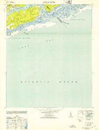 1953 Little River1953 Print · USGSThe Carolinas border region near Little River appears here in the mid-twentieth century as a landscape of shifting inlets and tidal sounds. Genealogists and coastal historians can trace the early road to The Battery, the location of Horse Ford, and the wild reaches of Waiter Island.
 - 1953 Map of Longs
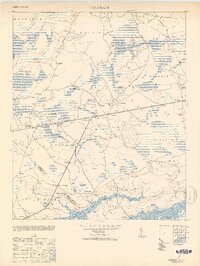
 1953 Longs1953 Print · USGSHorry County at the mid-century was a landscape of winding river swamps and quiet crossroads settlements along the North Carolina border. Genealogists and local historians can trace family locations through Butler Cem, Worthams Ferry, and the Olyphic PO.2 unique versions available
 - 1953 Map of Calabash
 1953 Calabash1953 Print · USGSThe coastal borderlands of North and South Carolina are frozen in time just after the war, showing the area as it transitioned into the mid-century. Researchers can trace the layout of early settlements like Calabash and Thomasboro or locate rural landmarks such as Philadelphia Wesley Church and the La Savannah Sch.2 unique versions available
 - 1967 Map of Georgetown
 1967 Georgetown1967 Print · USGSThe South Carolina Lowcountry and Grand Strand meet in the late sixties, showcasing a coastal landscape transitioning from river-based industry to seaside tourism. Researchers can trace the Intracoastal Waterway past Georgetown or locate historical sites like Fort Fisher and Murrells Inlet.
 - 1971 Map of Little River
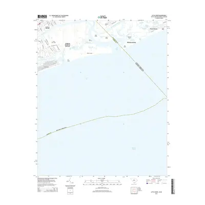
 1971 Little River1971 Print · USGSThe coastal border of South Carolina and North Carolina is captured here in the mid-century, before the rise of major seaside resorts. Trace the maritime history of Little River and the winding reaches of Dunn Sound, The Battery, and the Eden Saltworks Cr.
 - 1974 Map of Georgetown, 1978 Print
 1974 Georgetown1978 Print · USGSThe Carolina coast and Pee Dee region are shown here in the mid-seventies, just as the Grand Strand was maturing into a premier destination. Researchers can trace the inland rail corridors of the Seaboard Coast Line Railroad or explore the coastal reaches of the Cape Romain National Wildlife Refuge and Myrtle Beach State Park.2 unique versions available
 - 1986 Map of Myrtle Beach
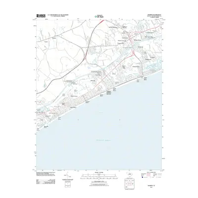
 1986 Myrtle Beach1986 Print · USGSThe Grand Strand and Brunswick County coast are captured in the mid-eighties before the late-century development boom. Researchers can trace the footprint of the Myrtle Beach Air Force Base and old coastal settlements like Atlantic Beach and Socastee.
 - 1990 Map of Myrtle Beach
 1990 Myrtle Beach1990 Print · USGSThe Grand Strand and the North Carolina borderlands are captured here in the decade before the base closure. Genealogists and historians can trace the development of Myrtle Beach and North Myrtle Beach alongside rural landmarks like Star Bluff Crossroads and Fort Caswell.
 - 1990 Map of Calabash, 1991 Print
 1990 Calabash1991 Print · USGSThe North Carolina coast at the turn of the nineties reveals a landscape of quiet crossroads and expanding waterfront communities. Researchers can trace family history through Old Shallotte, Hickmans Crossroads, and numerous burial sites like Manley Bennett Cem.
 - 1990 Map of Wampee, 1991 Print
 1990 Wampee1991 Print · USGSThe Grand Strand coastline is mapped here in the early nineties, revealing a balance between burgeoning resort towns and deep-rooted rural communities. Trace local history through the numerous sites like Wampee Ch, Cedar Creek Cem, and the Grand Strand Airport.
 - 1990 Map of Little River, 1991 Print
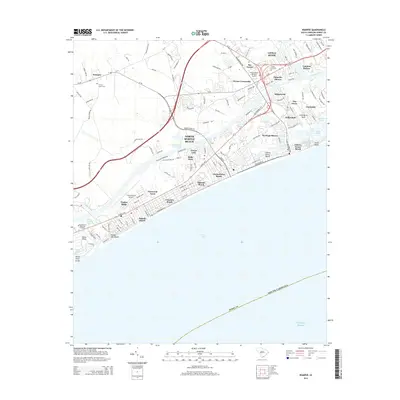
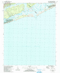 1990 Little River1991 Print · USGSThe South Carolina and North Carolina borderlands come alive in the early nineties, showcasing the coastal transition between Little River and Sunset Beach. Local researchers can trace the developed waterfronts of North Myrtle Beach and the shifting sands of Waties Island.
 - 1990 Map of Longs, 1991 Print
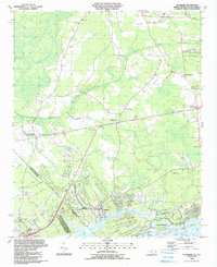
 1990 Longs1991 Print · USGSCoastal plains and river wetlands define the border of North and South Carolina in the late twentieth century. Genealogists and researchers can trace the locations of Worthams Ferry, numerous family cemeteries like Butler Cem, and rural hubs such as Longs and Brooksville.
 - 2011 Map of Longs, 2011 Print
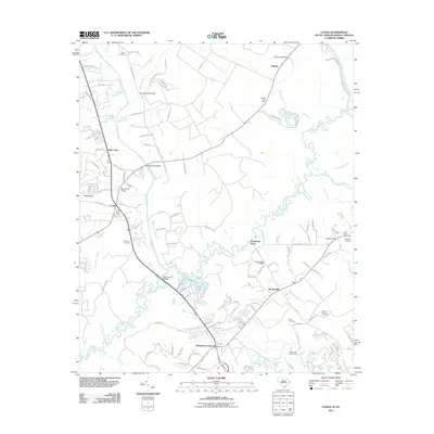 2011 Longs2011 Print · USGSCovers Little River, including Worthams Ferry, Brooksville, and other nearby areas
 - 2011 Map of Little River, 2011 Print
 2011 Little River2011 Print · USGSCovers Little River, including North Myrtle Beach, Sunset Beach, and other nearby areas
 - 2011 Map of Wampee, 2011 Print
 2011 Wampee2011 Print · USGSCovers Little River, including North Myrtle Beach, Briarcliffe Acres, and other nearby areas
 - 2011 Map of Calabash, 2011 Print
 2011 Calabash2011 Print · USGSCovers Little River, including Sunset Beach, Carolina Shores, and other nearby areas
 - 2013 Map of Calabash, 2013 Print
 2013 Calabash2013 Print · USGSCovers Little River, including Sunset Beach, Carolina Shores, and other nearby areas
 - 2014 Map of Longs, 2014 Print
 2014 Longs2014 Print · USGSCovers Little River, including Worthams Ferry, Brooksville, and other nearby areas
 - 2014 Map of Little River, 2014 Print
 2014 Little River2014 Print · USGSCovers Little River, including North Myrtle Beach, Sunset Beach, and other nearby areas
 - 2014 Map of Wampee, 2014 Print
 2014 Wampee2014 Print · USGSCovers Little River, including North Myrtle Beach, Briarcliffe Acres, and other nearby areas
Showing maps 1-25 of 37
Top cities near Little River
- Myrtle Beach historical maps
- North Myrtle Beach historical maps
- Sunset Beach historical maps
- Carolina Shores historical maps
- Shallotte historical maps
- Calabash historical maps
See more
Top neighborhoods of Little River
- Bridgewater historical maps
- Nixons Crossroads historical maps
- River Hills historical maps
- Gardens at Cypress Bay historical maps
- Tybre Downs historical maps
- Hidden Lakes Village historical maps
See more
Frequently asked questions
- What are the different types of historical maps available for Little River?
- What is the oldest map of Little River?
- Where can I purchase historical maps of Little River for my home or office?
- Where can I download high-res historical maps of Little River?
- Are there historical topographic maps available for Little River?
- Is there historical aerial imagery available for Little River?
- Where are historical maps of Little River sourced from?