1970s Maps of Laurens County, South Carolina
Explore 12 historic maps of Laurens County from the 1970s. These maps offer a rare glimpse into what life looked like during the 1970s — showing old roads, neighborhoods, homes, and landmarks that have changed or disappeared over time.
Whether you're researching your family's past, planning a metal detecting trip, or studying how Laurens County's landscape evolved across the 1970s, these high-resolution maps are a powerful tool for exploring the history of this region.
- Focus on a specific era: All maps on this page are from the 1970s, giving you a focused view of this time period.
- See what’s changed: Compare century-old streets, trails, and buildings to today's modern landscape using overlays and satellite layers.
- Research with precision: Use these maps for genealogy, historical research, land use analysis, or educational projects.
- View, download, or print: Maps are fully viewable online in high resolution, and can be downloaded or printed for your own records.
Start exploring Laurens County's history through authentic maps from the 1970s. This is your window into the past.
Laurens County, SC maps
(12)- 1970 Map of Bush River, 1973 Print
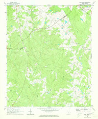 1970 Bush River1973 Print · USGSThe rural Piedmont of Newberry and Laurens Counties is captured here in the early seventies, just as modern forestry and agriculture shaped the landscape. Researchers can locate family landmarks like the Little River Ch, the Bush River School, and the Silverstreet Lookout Tower.2 unique versions available
 - 1970 Map of Cross Hill, 1973 Print
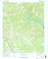
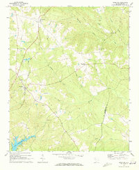 1970 Cross Hill1973 Print · USGSLaurens County in the early seventies shows a landscape where the Seaboard Coast Line railroad and the rising waters of Lake Greenwood meet. Researchers can trace rural lineages through landmarks like Bethabara Ch, Midway Sch, and the old settlement at Milton.
 - 1971 Map of Joanna, 1973 Print
 1971 Joanna1973 Print · USGSThe Laurens County countryside in the early seventies shows the intersection of textile mill culture and institutional growth. Genealogists and local historians can locate several rural landmarks including Hopewell Ch, Bethlehem Ch Cem, and the Whitten Village State Training School.
 - 1971 Map of Dyson, 1973 Print
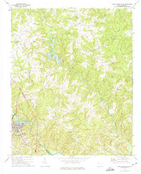
 1971 Dyson1973 Print · USGSThe Piedmont landscape of the early seventies is dominated by the broad reaches of Lake Greenwood and the rural communities of the South Carolina backcountry. You can trace early church locations like Enoree Zion Ch and Salem Ch, or follow the Southern rail line through Dyson.
 - 1971 Map of Cokesbury, 1974 Print
 1971 Cokesbury1974 Print · USGSThe rural Upstate of the early 1970s is centered here around Cokesbury and its historic Old Cokesbury College campus. Researchers can trace family roots at Old Tabernacle Cem or locate community landmarks like North Hodges Sch and the Hodges Lookout Tower.2 unique versions available
 - 1971 Map of Ware Shoals East, 1975 Print
 1971 Ware Shoals East1975 Print · USGSLaurens County and the surrounding river country are documented here in the early seventies, centered on the industrial and community hubs of the Piedmont. Genealogists can trace family locations near Bethel Ch, Poplar Springs, and the Boyd Millpond shoreline.
 - 1971 Map of Laurens South, 1975 Print
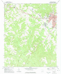
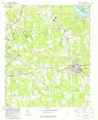
 1971 Laurens South1975 Print · USGSThe city of Laurens and its southern rural outskirts are captured in the early 1970s, showing a landscape defined by the Seaboard Coast Line railroad and the Little River. Genealogists and historians can trace community landmarks like Holy Spirit Ch, the Sanders Sch, and the Jersey Cem.
 - 1971 Map of Waterloo, 1975 Print
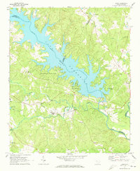
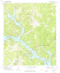 1971 Waterloo1975 Print · USGSThe Laurens and Greenwood County borderlands are defined by the rising waters of Lake Greenwood in the early seventies. Researchers can trace rural church history and rail transport through Waterloo, Cross Hill, and the Seaboard Coast Line corridor.
 - 1971 Map of Ware Shoals West, 1975 Print
 1971 Ware Shoals West1975 Print · USGSThe Saluda River valley in the early seventies shows a landscape defined by crossing county lines and rail connections. Researchers can trace family roots through the Turkey Creek Cem, visit the settlement of Blue Heaven, or locate the old Drive-in Theater.
 - 1971 Map of Clinton, 1975 Print
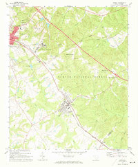
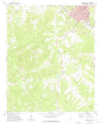
 1971 Clinton1975 Print · USGSUpstate South Carolina textile and college life are captured here during a period of steady growth. Genealogists and local historians can trace the foundations of Clinton and Laurens, locating Presbyterian College, Lydia Mills, and rural churches like Rock Bridge Ch.
 - 1978 Map of Ninety-Six, 1979 Print
 1978 Ninety-Six1979 Print · USGSThe town of Ninety Six and the surrounding backcountry are captured in the late 1970s, showing a landscape defined by rail and river. Genealogists can trace family landmarks and sites like the Old Star Fort (Site), Irvines Landing, and Siloam Ch.
 - 1979 Map of Abbeville, 1980 Print
 1979 Abbeville1980 Print · USGSThe South Carolina and Georgia borderlands are captured here during a period of significant hydroelectric development and regional growth. Researchers can trace the rail-and-river economy through the Seaboard Coast Line and landmarks like Hartwell Dam or the Silk Mills.2 unique versions available
End of results
Showing maps 1-12 of 12
Top cities of Laurens County
- Laurens historical maps
- Clinton historical maps
- Joanna historical maps
- Gray Court historical maps
- Cross Hill historical maps
- Waterloo historical maps
See more
Frequently asked questions
- What are the different types of historical maps available for Laurens County?
- What is the oldest map of Laurens County?
- Where can I purchase historical maps of Laurens County for my home or office?
- Where can I download high-res historical maps of Laurens County?
- Are there historical topographic maps available for Laurens County?
- Is there historical aerial imagery available for Laurens County?
- Where are historical maps of Laurens County sourced from?