Old Maps of Laurens County, South Carolina for Metal Detecting
Plan your next treasure hunt with 157 historic maps of Laurens County. Find old homesites, ghost towns, trails, and gathering spots that may be lost to time — perfect for identifying promising metal detecting locations.
- Locate forgotten sites: Uncover places like long-lost settlements, abandoned rail lines, or gathering spots.
- Plan better hunts: Use map overlays combined with LiDAR or satellite views to narrow in on historically rich areas.
- Made for detectorists: Thousands of hobbyists use these maps to discover relics, coins, and hidden history.
Use these historic maps to boost your research and find new opportunities beneath the surface of Laurens County.
Laurens County, SC maps
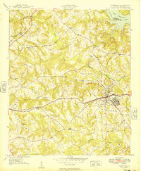
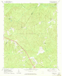
(157)- 1892 Map of Abbeville
 1892 Abbeville1892 Print · USGSSouth Carolina’s Upstate during the late 1800s reveals a landscape defined by critical river crossings and the arrival of the steam era. Genealogists can trace family roots through localized sites like Smith Ferry, Maddox Mill, and the bustling rail hub of Greenwood.6 unique versions available
 - 1935 Map of Greer
 1935 Greer1935 Print · USGSThe industrial textile hubs and rural communities of the South Carolina Piedmont thrive along the rail lines during the mid-thirties. Genealogists and local historians can trace family locations near Victor Mills, Hanson Academy, and numerous country churches like Woods Chapel.
 - 1938 Map of Greer
 1938 Greer1938 Print · USGSUpstate South Carolina during the mid-1930s was a landscape of bustling textile centers and quiet rural crossroads. Genealogists and historians can trace family roots through numerous local landmarks like Woods Chapel, Jackson Mill, and the CCC Camp near Switzer.3 unique versions available
 - 1941 Map of Spartanburg
 1941 Spartanburg1941 Print · USGSSouth Carolina’s Piedmont and Sandhills regions are shown here during the mid-century peak of the rail era. Researchers can trace the sprawling Fort Jackson Military Reservation and the industrial growth of hubs like Spartanburg and Rock Hill.
 - 1949 Map of Ninety-Six
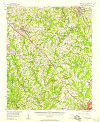
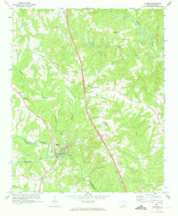
 1949 Ninety-Six1949 Print · USGSThe crossroads town of Ninety-Six is shown at the peak of its rail-era influence in the late 1940s. Genealogists and historians can trace family locations near Youngs Chapel School, Lebanon Church, and the Site of Old Star Fort.2 unique versions available
 - 1953 Map of Spartanburg, 1966 Print
 1953 Spartanburg1966 Print · USGSMid-century South Carolina comes into focus through this survey of the Piedmont and the Sand Hills at a time of significant reservoir expansion. Researchers can trace the legacy of industrial transit and resource extraction from the Haile Gold Mine to the rail hubs of the Seaboard Air Line.4 unique versions available
 - 1954 Map of Greenville, 1965 Print
 1954 Greenville1965 Print · USGSThe Upstate and Northeast Georgia are captured here during a decade of massive transformation as new reservoirs reshaped the Piedmont. Genealogists and hikers can trace the Appalachian Trail over Brasstown Bald or locate old community centers like Demorest, Westminster, and Royston.3 unique versions available
 - 1957 Map of Fountain Inn, 1958 Print
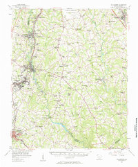
 1957 Fountain Inn1958 Print · USGSThe South Carolina upstate's rural textile and transit corridor is captured here in the late fifties, following the rail line through Fountain Inn and Gray Court. Genealogists can trace family landmarks and rural life at Hickory Tavern, Knighton Chapel, and Bryson High Sch.
 - 1957 Map of Williamston, 1958 Print
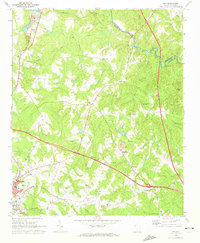
 1957 Williamston1958 Print · USGSMid-century South Carolina comes into focus as textile towns and military installations expand across the Piedmont landscape. Genealogists can trace family roots through dozens of rural landmarks like McKelvey Crossroads, Standing Springs Ch, and Traynham Cem.2 unique versions available
 - 1957 Map of Greer, 1959 Print
 1957 Greer1959 Print · USGSThe Upstate South Carolina textile corridor comes to life in this mid-century survey of the Tyger River valleys. Researchers can trace the industrial footprint of Victor Mills, locate early country churches like Old Pilgrim Ch, and explore the residential growth around Greer and Lyman.2 unique versions available
 - 1958 Map of Greenville
 1958 Greenville1958 Print · USGSThe Piedmont and Blue Ridge foothills come alive in this mid-century survey of the Upstate and Northeast Georgia. Trace the regional rail-and-river economy through the Southern Railway corridors and early reservoir developments like Lake Sidney Lanier.
 - 1960 Map of Spartanburg
 1960 Spartanburg1960 Print · USGSThe South Carolina Piedmont and North Carolina borderlands come alive in this mid-century survey of the region between Spartanburg and Columbia. Researchers can trace the Seaboard Air Line railroad and explore landmarks like Anderson Quarry, Lake Murray, and Mount Croghan.2 unique versions available
 - 1963 Map of Spartanburg
 1963 Spartanburg1963 Print · USGSMid-century South Carolina comes alive in this survey, showing the rail-linked corridor between the Upstate and the Midlands. Genealogists can trace family lands near old hubs like Union and Lancaster, or along the banks of the Broad River and Pee Dee River.
 - 1964 Map of Spartanburg
 1964 Spartanburg1964 Print · USGSMid-century South Carolina comes alive in this survey of the Piedmont and Upcountry, stretching from the Blue Ridge foothills to the Sandhills. Genealogists and historians can trace the rail-and-river economy through Monarch Mills, Glenn Springs, and the Southern Railway corridor.
 - 1969 Map of Ora, 1972 Print
 1969 Ora1972 Print · USGSLaurens County in the late sixties shows a transition from rural crossroads to industrializing outskirts. Genealogists can locate family landmarks like Sandy Springs Ch and Leesville Ch or trace the old SEABOARD COAST LINE railroad.2 unique versions available
 - 1969 Map of Newberry NW, 1972 Print
 1969 Newberry NW1972 Print · USGSThe South Carolina Piedmont comes alive in the late sixties as forest and farm overlap at the Laurens and Newberry county line. Researchers can locate family landmarks like Stomp Springs, Brickhouse Crossroads, and rural pulpits at Flint Hill Ch.2 unique versions available
 - 1969 Map of Enoree, 1973 Print
 1969 Enoree1973 Print · USGSThe Piedmont landscape of Spartanburg and Laurens counties is captured in the late sixties, centered on the river-and-rail hub of Enoree. Genealogists can trace family footprints through numerous rural landmarks like Cedar Shoals Ch, Antioch Ch, and the settlement at Lanford.
 - 1969 Map of Sedalia, 1973 Print
 1969 Sedalia1973 Print · USGSThe South Carolina Piedmont comes into focus in the late sixties as the Enoree and Tyger rivers converge near the borders of Union, Laurens, and Newberry counties. Genealogists can trace family footprints at Old Quaker Cem, Padgetts Creek Ch, and the rural community of Sedalia.2 unique versions available
 - 1969 Map of Philson Crossroads, 1973 Print
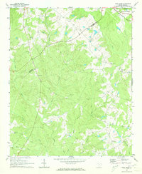
 1969 Philson Crossroads1973 Print · USGSThe rural Upstate of South Carolina is captured here in the late sixties, where the borders of Spartanburg, Laurens, and Union counties meet. Researchers can trace family roots through several local congregations and burial sites, including Antioch Ch, Bethany Ch, and Macedonia Cem.2 unique versions available
 - 1970 Map of Bush River, 1973 Print
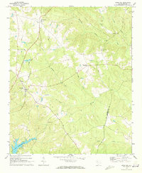
 1970 Bush River1973 Print · USGSThe rural Piedmont of Newberry and Laurens Counties is captured here in the early seventies, just as modern forestry and agriculture shaped the landscape. Researchers can locate family landmarks like the Little River Ch, the Bush River School, and the Silverstreet Lookout Tower.2 unique versions available
 - 1970 Map of Cross Hill, 1973 Print
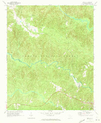
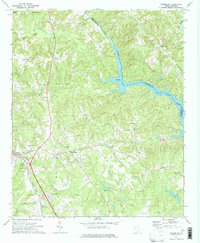
 1970 Cross Hill1973 Print · USGSLaurens County in the early seventies shows a landscape where the Seaboard Coast Line railroad and the rising waters of Lake Greenwood meet. Researchers can trace rural lineages through landmarks like Bethabara Ch, Midway Sch, and the old settlement at Milton.
 - 1971 Map of Joanna, 1973 Print
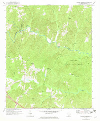
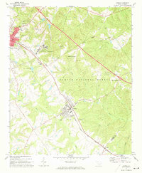 1971 Joanna1973 Print · USGSThe Laurens County countryside in the early seventies shows the intersection of textile mill culture and institutional growth. Genealogists and local historians can locate several rural landmarks including Hopewell Ch, Bethlehem Ch Cem, and the Whitten Village State Training School.
 - 1971 Map of Dyson, 1973 Print
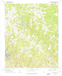
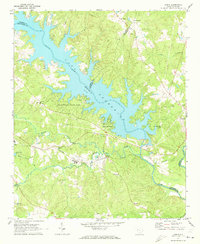 1971 Dyson1973 Print · USGSThe Piedmont landscape of the early seventies is dominated by the broad reaches of Lake Greenwood and the rural communities of the South Carolina backcountry. You can trace early church locations like Enoree Zion Ch and Salem Ch, or follow the Southern rail line through Dyson.
 - 1971 Map of Cokesbury, 1974 Print
 1971 Cokesbury1974 Print · USGSThe rural Upstate of the early 1970s is centered here around Cokesbury and its historic Old Cokesbury College campus. Researchers can trace family roots at Old Tabernacle Cem or locate community landmarks like North Hodges Sch and the Hodges Lookout Tower.2 unique versions available
 - 1971 Map of Ware Shoals East, 1975 Print
 1971 Ware Shoals East1975 Print · USGSLaurens County and the surrounding river country are documented here in the early seventies, centered on the industrial and community hubs of the Piedmont. Genealogists can trace family locations near Bethel Ch, Poplar Springs, and the Boyd Millpond shoreline.
Showing maps 1-25 of 157
Top cities of Laurens County
- Laurens historical maps
- Clinton historical maps
- Joanna historical maps
- Gray Court historical maps
- Cross Hill historical maps
- Waterloo historical maps
See more
Frequently asked questions
- What are the different types of historical maps available for Laurens County?
- What is the oldest map of Laurens County?
- Where can I purchase historical maps of Laurens County for my home or office?
- Where can I download high-res historical maps of Laurens County?
- Are there historical topographic maps available for Laurens County?
- Is there historical aerial imagery available for Laurens County?
- Where are historical maps of Laurens County sourced from?