1970s Maps of Marlboro County, South Carolina
Explore 22 historic maps of Marlboro County from the 1970s. These maps offer a rare glimpse into what life looked like during the 1970s — showing old roads, neighborhoods, homes, and landmarks that have changed or disappeared over time.
Whether you're researching your family's past, planning a metal detecting trip, or studying how Marlboro County's landscape evolved across the 1970s, these high-resolution maps are a powerful tool for exploring the history of this region.
- Focus on a specific era: All maps on this page are from the 1970s, giving you a focused view of this time period.
- See what’s changed: Compare century-old streets, trails, and buildings to today's modern landscape using overlays and satellite layers.
- Research with precision: Use these maps for genealogy, historical research, land use analysis, or educational projects.
- View, download, or print: Maps are fully viewable online in high resolution, and can be downloaded or printed for your own records.
Start exploring Marlboro County's history through authentic maps from the 1970s. This is your window into the past.
Marlboro County, SC maps
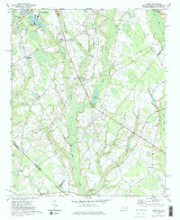
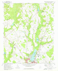
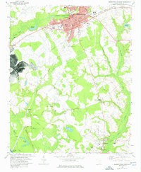
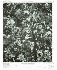
(22)- 1971 Map of Diggs, 1973 Print
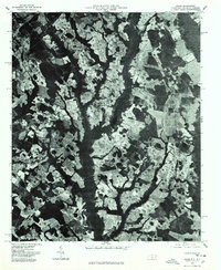
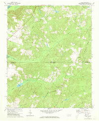 1971 Diggs1973 Print · USGSThe North and South Carolina borderlands come to life in the early 1970s, showing a landscape of railroad towns and rural parishes. Genealogists can trace family footprints at St Stephens Cem, Fulton, and along the historic Old Wire Road.2 unique versions available
 - 1971 Map of Morven East, 1973 Print
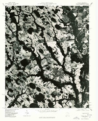
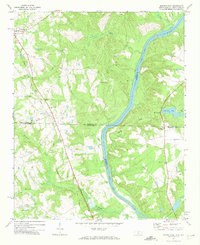 1971 Morven East1973 Print · USGSThe North Carolina and South Carolina borderlands meet along the river in the early 1970s. Genealogists can trace family footprints through rural landmarks like Old Sneedsboro, Galilee Ch, and the mills at Brocks Mill and Everetts Mill.2 unique versions available
 - 1971 Map of Wallace, 1975 Print
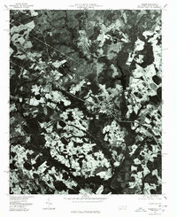
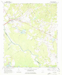 1971 Wallace1975 Print · USGSMarlboro County in the early 1970s shows a landscape of river-bottom lands and small rail-side communities like Wallace. Researchers can trace old family cemeteries like Quick Cem and McQuage Cem or locate historic schools and mills along Wolf Creek.2 unique versions available
 - 1971 Map of Minturn, 1975 Print
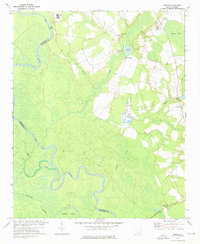
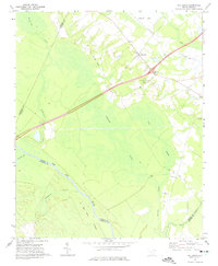
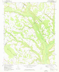 1971 Minturn1975 Print · USGSThe Carolina borderlands near the start of the 1970s show a landscape shaped by river crossings and rural parish life. Genealogists and historians can trace family locations through landmarks like Minturn, Sinclair Crossroads, and the Seaboard Coast Line railroad.
 - 1971 Map of Johns, 1975 Print
 1971 Johns1975 Print · USGSThe borderlands of North and South Carolina in the early seventies are captured here during a period of steady rural development. Genealogists and local historians can trace the foundations of St Andrews College or locate family sites near Stewartsville Cem and Zion Hill Ch.2 unique versions available
 - 1971 Map of Cheraw, 1976 Print
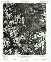
 1971 Cheraw1976 Print · USGSCheraw and its surrounding riverfront landscapes are captured here in the early seventies, a time when the town thrived as a regional center along the Pee Dee River. Researchers can locate family landmarks like St Pauls Ch, trace the Old Plank Road, and explore the layout of Cheraw State Park.
 - 1971 Map of Society Hill, 1977 Print
 1971 Society Hill1977 Print · USGSSociety Hill and the surrounding river lowlands are captured here in the early seventies as a hub of rail and river transit. Genealogists and local historians can trace family sites at St Marks Ch, the Rosenwald Sch, and the old community of Cash.
 - 1972 Map of Drake, 1975 Print
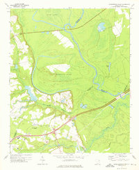
 1972 Drake1975 Print · USGSMarlboro County rural life in the early seventies centered on the river bottoms and crossroads communities along the Pee Dee River. Researchers can locate family landmarks such as Cedar Falls Ch, Blenheim Sch, and the settlement of Drake.
 - 1972 Map of Clio, 1975 Print
 1972 Clio1975 Print · USGSCoastal plain agriculture and rail-side commerce define this South Carolina landscape during the early seventies. Genealogists can trace family footprints through numerous rural landmarks like Old Clio Ch, Lucas Cem, and the crossroads at Five Forks.
 - 1972 Map of Bennettsville North, 1975 Print
 1972 Bennettsville North1975 Print · USGSUpper Marlboro County in the early seventies shows the growing edge of Bennettsville as it meets a landscape of old millponds and rural parishes. Researchers can trace family roots at Oak Ridge Cem or locate community hubs like Newtonville and Old Smyrna Ch.
 - 1972 Map of Mc Coll, 1975 Print
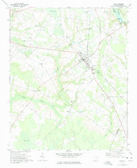
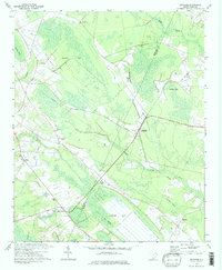
 1972 Mc Coll1975 Print · USGSMarlboro County’s borderlands are shown here in the 1970s, centered on the railroad town of McColl and the agricultural hub of Tatum. Genealogists can trace family landmarks like Newton Cemetery, McLaurins Millpond, and Fletchers Chapel.2 unique versions available
 - 1972 Map of Oak Grove, 1975 Print
 1972 Oak Grove1975 Print · USGSDillon County at the start of the 1970s is a landscape of expansive wetlands and river-bottom timber defined by the winding Pee Dee River. Researchers can trace old transportation corridors along the Old RR Grade and locate rural landmarks like Bethesda Ch or Haselden Cem.2 unique versions available
 - 1972 Map of Bingham, 1975 Print
 1972 Bingham1975 Print · USGSThe wetlands and rural settlements of the Marlboro and Dillon county border are detailed here during the early seventies. Genealogists and local historians can trace the Old Railroad Grade and locate family landmarks like Victory Temple and Bingham.2 unique versions available
 - 1972 Map of Bennettsville South, 1976 Print
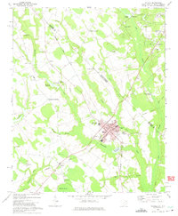
 1972 Bennettsville South1976 Print · USGSBennettsville and the southern Marlboro County countryside are shown in detail during the early 1970s. Genealogists and researchers can trace family-named sites such as Driggers Chapel, McCall Cem, and Covington Millpond across this river-and-rail landscape.
 - 1972 Map of Witherspoon Island, 1976 Print
 1972 Witherspoon Island1976 Print · USGSThe Pee Dee River lowlands come to life in the early 1970s, showcasing the intricate water systems surrounding Witherspoon Island. Researchers can trace local family landmarks near Blacks, including Century Ch and Cem, or locate industrial sites like the Fish Hatchery.2 unique versions available
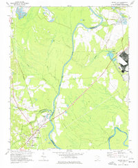
 - 1976 Map of Diggs, 1978 Print
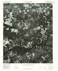 1976 Diggs1978 Print · USGSThe rural landscapes of Richmond County are seen here in the mid-1970s through a detailed aerial orthophoto. Researchers can pinpoint specific farmsteads and rural crossroads near Diggs, Ellerbe Grove, and Osborne during this era.
 - 1976 Map of Minturn, 1978 Print
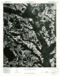 1976 Minturn1978 Print · USGSThe Carolina borderlands come into focus in the mid-seventies through this detailed aerial orthophoto. Local historians and genealogists can trace property lines and land use patterns around Minturn, Crossroads, and the Little Pee Dee River.
 - 1976 Map of Johns, 1978 Print
 1976 Johns1978 Print · USGSScotland County's agrarian landscape is captured in the mid-seventies, showing the intersection of rural life and regional transport. Genealogists and historians can trace old property lines and farmsteads near Laurinburg, Johns, and Mc Arthur Crossroads.
 - 1976 Map of Morven East, 1978 Print
 1976 Morven East1978 Print · USGSAnson County and the borderlands of the Carolinas are captured in the mid-1970s as the Pee Dee River winds through rural farmland. Local historians can trace the footprints of established settlements like Morven and Mc Farlan alongside Everetts Lake.
 - 1976 Map of Mc Coll, 1978 Print
 1976 Mc Coll1978 Print · USGSMarlboro County near the state line comes into sharp focus in the mid-1970s through this aerial-based survey. Researchers can trace land boundaries and farmsteads near Mc Coll and Tatum, or identify the rural junctions at Masons Crossroads.
 - 1976 Map of Gibson, 1978 Print
 1976 Gibson1978 Print · USGSScotland County's rural landscape is frozen in time during the mid-seventies in this detailed aerial perspective. Genealogists and researchers can trace the exact footprints of settlements like Gibson and Laurel Hill or locate the shoreline of Richmond Mill Lake.
 - 1976 Map of Ghio, 1978 Print
 1976 Ghio1978 Print · USGSThe North Carolina-South Carolina border region comes to life in the mid-1970s through this detailed orthophoto. Researchers can trace the rural layouts of New Town and Ghio or locate landmarks like Krinshaw Pond among the timber and farm fields.
End of results
Showing maps 1-22 of 22
Top cities of Marlboro County
- Bennettsville historical maps
- McColl historical maps
- Clio historical maps
- Blenheim historical maps
- Tatum historical maps
Frequently asked questions
- What are the different types of historical maps available for Marlboro County?
- What is the oldest map of Marlboro County?
- Where can I purchase historical maps of Marlboro County for my home or office?
- Where can I download high-res historical maps of Marlboro County?
- Are there historical topographic maps available for Marlboro County?
- Is there historical aerial imagery available for Marlboro County?
- Where are historical maps of Marlboro County sourced from?