1900s (20th Century) Maps of McCormick County, South Carolina
Explore 34 historic maps of McCormick County from the 1900s (20th Century). These maps offer a rare glimpse into what life looked like during the 1900s — showing old roads, neighborhoods, homes, and landmarks that have changed or disappeared over time.
Whether you're researching your family's past, planning a metal detecting trip, or studying how McCormick County's landscape evolved across the 1900s, these high-resolution maps are a powerful tool for exploring the history of this region.
- Focus on a specific era: All maps on this page are from the 1900s, giving you a focused view of this time period.
- See what’s changed: Compare century-old streets, trails, and buildings to today's modern landscape using overlays and satellite layers.
- Research with precision: Use these maps for genealogy, historical research, land use analysis, or educational projects.
- View, download, or print: Maps are fully viewable online in high resolution, and can be downloaded or printed for your own records.
Start exploring McCormick County's history through authentic maps from the 1900s. This is your window into the past.
McCormick County, SC maps
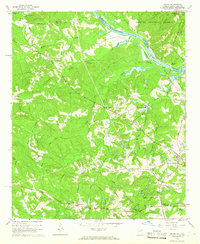
(34)- 1906 Map of Crawfordville
 1906 Crawfordville1906 Print · USGSUpper Georgia and the South Carolina border come alive in this early century survey, showing a landscape defined by river ferries and mining sites. Genealogists can trace family roots through old post offices like Triplett P.O. or find historic crossings like Fishdam Ferry and the Columbia Mines.3 unique versions available
 - 1912 Map of Mc Cormick, 1913 Print
 1912 Mc Cormick1913 Print · USGSThe Georgia and South Carolina borderlands come alive in the 1890s, centered on the rail junction at Mc Cormick and the Savannah River. Genealogists can trace family footprints across numerous river crossings like Fury Ferry and through rural centers such as Appling and Sharon Church.
 - 1920 Map of Clarks Hill
 1920 Clarks Hill1920 Print · USGSThe Savannah River border between South Carolina and Georgia comes alive in this survey, showing the region as it was before the creation of the massive Clarks Hill Lake. Genealogists can trace family landmarks like Gilchrist Ferry, Hosannah Church, and Flat Rock School during the heyday of the Charleston and Western Carolina railroad.
 - 1921 Map of Clarks Hill
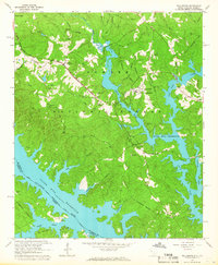
 1921 Clarks Hill1921 Print · USGSThe Savannah River valley in the early twenties was a landscape of ferries and railroad sidings before the creation of modern reservoirs. Genealogists can trace family footprints through dozens of rural landmarks like Hosannah Church, Dorn School, and Gilchrist Ferry.3 unique versions available
 - 1941 Map of Clarks Hill, 1957 Print
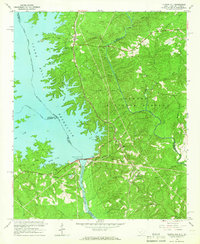
 1941 Clarks Hill1957 Print · USGSThe Savannah River valley remained a landscape of ferries and river-to-rail commerce just before the era of major dam construction. Genealogists and historians can trace family roots through numerous rural landmarks like Cary Hill Ch, Modoc, and Gilchrist Ferry.2 unique versions available
 - 1942 Map of Clarks Hill
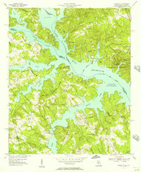
 1942 Clarks Hill1942 Print · USGSThe Savannah River valley along the South Carolina and Georgia border comes alive in this survey from the era of river ferries and local rail. Genealogists can trace family landmarks like Hosannah Church, Dents Ferry, and the Flat Rock School.
 - 1948 Map of Verdery, 1974 Print
 1948 Verdery1974 Print · USGSThe rural Upstate during the late 1940s is detailed here as the timber and rail economy shaped the borderlands of Abbeville and Greenwood. Researchers can trace family sites near Clatworthy Crossroads or visit local landmarks like Long Cane Ch and the Bradley Bridge.
 - 1949 Map of Calhoun Creek
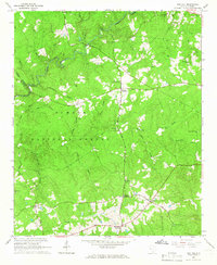
 1949 Calhoun Creek1949 Print · USGSAbbeville and McCormick Counties are shown here just after the war, when the rural landscape was still dotted with one-room schoolhouses and local mills. Genealogists can trace family roots through sites like Calhoun Mill, Rock Buffalo Ch, and St Pauls Sch.
 - 1950 Map of Bradley
 1950 Bradley1950 Print · USGSMid-century Greenwood County was a land of small rail-stops and forest-fringed farms connected by the Charleston and Western Carolina railroad. Genealogists and historians can trace local family landmarks like the Old Rock House, Old Pine Grove Cem, and Cedar Grove Sch.2 unique versions available
 - 1950 Map of Verdery
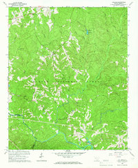
 1950 Verdery1950 Print · USGSMid-century Abbeville and Greenwood counties were defined by a dense network of country churches and forest management within the Sumter National Forest. Genealogists can trace family landmarks like Chisholm Cem, Cedar Springs Ch, and Clatworthy Crossroads.2 unique versions available
 - 1953 Map of Athens, 1966 Print
 1953 Athens1966 Print · USGSGeorgia's Piedmont and Savannah River borderlands come alive in this mid-century survey of the region surrounding Athens and Augusta. Trace the rail-and-river economy through the Georgia RR and landmarks like the Fort Gordon Military Reservation.3 unique versions available
 - 1954 Map of Greenville, 1965 Print
 1954 Greenville1965 Print · USGSThe Upstate and Northeast Georgia are captured here during a decade of massive transformation as new reservoirs reshaped the Piedmont. Genealogists and hikers can trace the Appalachian Trail over Brasstown Bald or locate old community centers like Demorest, Westminster, and Royston.3 unique versions available
 - 1955 Map of Chennault, 1956 Print
 1955 Chennault1956 Print · USGSThe Georgia-South Carolina border was undergoing a massive transformation in the mid-fifties as the Clark Hill Reservoir filled. Researchers can trace rural life in settlements like Chennault and Graball or locate family landmarks like Mt Pleasant Ch and New Tabernacle Sch.3 unique versions available
 - 1958 Map of Greenville
 1958 Greenville1958 Print · USGSThe Piedmont and Blue Ridge foothills come alive in this mid-century survey of the Upstate and Northeast Georgia. Trace the regional rail-and-river economy through the Southern Railway corridors and early reservoir developments like Lake Sidney Lanier.
 - 1958 Map of Athens
 1958 Athens1958 Print · USGSNorth-central Georgia and the Savannah River valley are captured in the late fifties, showing the region as the new reservoirs were filling. Researchers can trace historic rail lines like the Georgia RR and locate rural landmarks such as Social Circle, Graves Mountain, and the Fort Gordon Military Reservation.
 - 1959 Map of Athens
 1959 Athens1959 Print · USGSNortheast Georgia and the South Carolina borderlands appear here in the mid-fifties, during a decade of infrastructure growth. Genealogists and historians can trace the rail-and-river geography of towns like Social Circle, the sprawl of Fort Gordon Military Reservation, and the newly formed Clark Hill Reservoir.
 - 1963 Map of Athens
 1963 Athens1963 Print · USGSGeorgia's Piedmont and the Savannah River valley are captured in the early sixties as major reservoirs and military installations reshaped the landscape. Researchers can trace the development of Clark Hill Reservoir, locate the Fort Gordon Military Reservation, and find historic towns like Social Circle and Eatonton.
 - 1964 Map of Calhoun Falls, 1965 Print
 1964 Calhoun Falls1965 Print · USGSCalhoun Falls and the Savannah River valley are documented here in the mid-sixties as the reservoir transformed the landscape. Trace rail history and family roots via the Atlantic Coast Line, McAllister Chapel, and the Ellison Sch.3 unique versions available
 - 1964 Map of Lincolnton, 1966 Print
 1964 Lincolnton1966 Print · USGSLincolnton and the Georgia-South Carolina borderlands appear here in the mid-sixties, just as the reservoir system reshaped the Savannah River valley. Genealogists can trace family landmarks and rural congregations like Smith Chapel Cem, Price Grove Ch, and the settlement of Leverett.2 unique versions available
 - 1964 Map of Martinez, 1966 Print
 1964 Martinez1966 Print · USGSThe Savannah River borderlands in the mid-1960s reveal a mix of hydroelectric engineering and growing Georgia suburbs. Genealogists and historians can trace family sites at Abilene Ch, Martinez Sch, and the riverside Augusta City Lock and Dam.4 unique versions available
 - 1964 Map of Evans, 1966 Print
 1964 Evans1966 Print · USGSColumbia County and the South Carolina borderlands are captured in the mid-1960s, showing a landscape of river islands and rural crossroad communities. Genealogists can locate family landmarks like Snellings Memorial Acre, Ropers Crossroads, and the remote Second Mt Carmel Ch.3 unique versions available
 - 1964 Map of Willington, 1966 Print
 1964 Willington1966 Print · USGSThe McCormick County borderlands and the Savannah River valley are captured here in the mid-sixties, showcasing the rising waters of the Clark Hill Reservoir. Trace local history at the De La Howe State School and old rural sites like Little Mill Ch Cem.3 unique versions available
 - 1964 Map of Red Hill, 1966 Print
 1964 Red Hill1966 Print · USGSEdgefield County in the early sixties is a landscape of established crossroads and deep-seated family history within the Sumter National Forest. Researchers can trace the roots of rural communities at Cleora or West Store Crossroads and locate ancestral sites like Moores Cem and Antioch Ch.2 unique versions available
 - 1964 Map of Colliers, 1966 Print
 1964 Colliers1966 Print · USGSEdgefield and McCormick Counties are shown here in the mid-1960s, a landscape defined by the wooded reaches of the Sumter National Forest. Genealogists can trace family names at Poplar Spring Cem, Carey Hill, and Millers Crossroads.2 unique versions available
 - 1964 Map of Clarks Hill, 1966 Print
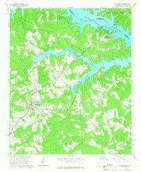
 1964 Clarks Hill1966 Print · USGSThe Savannah River borderlands are captured here in the mid-sixties, just as the newly formed reservoir was reshaping the South Carolina-Georgia line. Genealogists can trace family landmarks like Jones Cem, Bethany Ch, and the Clarks Hill Sch.3 unique versions available
Showing maps 1-25 of 34
Top cities of McCormick County
Frequently asked questions
- What are the different types of historical maps available for McCormick County?
- What is the oldest map of McCormick County?
- Where can I purchase historical maps of McCormick County for my home or office?
- Where can I download high-res historical maps of McCormick County?
- Are there historical topographic maps available for McCormick County?
- Is there historical aerial imagery available for McCormick County?
- Where are historical maps of McCormick County sourced from?