1960s Maps of Newberry County, South Carolina
Explore 11 historic maps of Newberry County from the 1960s. These maps offer a rare glimpse into what life looked like during the 1960s — showing old roads, neighborhoods, homes, and landmarks that have changed or disappeared over time.
Whether you're researching your family's past, planning a metal detecting trip, or studying how Newberry County's landscape evolved across the 1960s, these high-resolution maps are a powerful tool for exploring the history of this region.
- Focus on a specific era: All maps on this page are from the 1960s, giving you a focused view of this time period.
- See what’s changed: Compare century-old streets, trails, and buildings to today's modern landscape using overlays and satellite layers.
- Research with precision: Use these maps for genealogy, historical research, land use analysis, or educational projects.
- View, download, or print: Maps are fully viewable online in high resolution, and can be downloaded or printed for your own records.
Start exploring Newberry County's history through authentic maps from the 1960s. This is your window into the past.
Newberry County, SC maps
(11)- 1960 Map of Spartanburg
 1960 Spartanburg1960 Print · USGSThe South Carolina Piedmont and North Carolina borderlands come alive in this mid-century survey of the region between Spartanburg and Columbia. Researchers can trace the Seaboard Air Line railroad and explore landmarks like Anderson Quarry, Lake Murray, and Mount Croghan.2 unique versions available
 - 1963 Map of Spartanburg
 1963 Spartanburg1963 Print · USGSMid-century South Carolina comes alive in this survey, showing the rail-linked corridor between the Upstate and the Midlands. Genealogists can trace family lands near old hubs like Union and Lancaster, or along the banks of the Broad River and Pee Dee River.
 - 1964 Map of Spartanburg
 1964 Spartanburg1964 Print · USGSMid-century South Carolina comes alive in this survey of the Piedmont and Upcountry, stretching from the Blue Ridge foothills to the Sandhills. Genealogists and historians can trace the rail-and-river economy through Monarch Mills, Glenn Springs, and the Southern Railway corridor.
 - 1968 Map of Newberry East, 1973 Print
 1968 Newberry East1973 Print · USGSNewberry and the surrounding South Carolina backcountry are captured here in the late sixties as the town expanded near the edge of the Sumter National Forest. Researchers can trace the grounds of Newberry College and find numerous rural landmarks like St Phillips and Bachman Chapel.2 unique versions available
 - 1969 Map of Whitmire South, 1972 Print
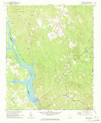
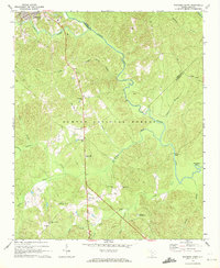 1969 Whitmire South1972 Print · USGSThe Enoree River backcountry of Newberry and Union counties is captured here in the late sixties, just as the national forest interior was being developed. Researchers can trace rural landmarks like Long Lane, Oxner Airfield, and Kings Creek Ch.
 - 1969 Map of Pomaria, 1972 Print
 1969 Pomaria1972 Print · USGSThe rural landscapes of Newberry County are captured here in the late sixties, centered on the railroad town of Pomaria. Genealogists and local historians can trace family locations through numerous sites like Taylors Crossroads, Germany Sch, and Stone Cem.
 - 1969 Map of Blair, 1972 Print
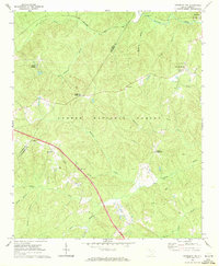
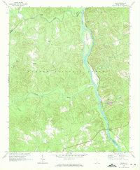 1969 Blair1972 Print · USGSThe riverfront and timberlands of Newberry and Fairfield counties are captured here in the late sixties as the Southern railroad winds through the Sumter National Forest. Genealogists can trace rural communities like Maybinton and Glymphville alongside historic congregations at Ebenezer Ch and Mt Pleasant Ch.2 unique versions available
 - 1969 Map of Jenkinsville, 1972 Print
 1969 Jenkinsville1972 Print · USGSFairfield and Newberry counties are captured here in the late sixties as the river-and-rail economy shaped rural life along the Broad River. Genealogists can trace family roots through numerous local landmarks like Old Brick Ch, White Hall Sch, and the Parr Shoals Dam.2 unique versions available
 - 1969 Map of Newberry NW, 1972 Print
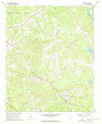
 1969 Newberry NW1972 Print · USGSThe South Carolina Piedmont comes alive in the late sixties as forest and farm overlap at the Laurens and Newberry county line. Researchers can locate family landmarks like Stomp Springs, Brickhouse Crossroads, and rural pulpits at Flint Hill Ch.2 unique versions available
 - 1969 Map of Sedalia, 1973 Print
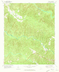 1969 Sedalia1973 Print · USGSThe South Carolina Piedmont comes into focus in the late sixties as the Enoree and Tyger rivers converge near the borders of Union, Laurens, and Newberry counties. Genealogists can trace family footprints at Old Quaker Cem, Padgetts Creek Ch, and the rural community of Sedalia.2 unique versions available
 - 1969 Map of Newberry West, 1973 Print
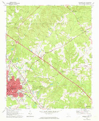
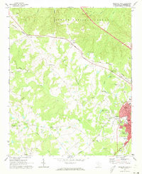 1969 Newberry West1973 Print · USGSNewberry and the neighboring rail junction of Helena are shown in the late sixties as the city expanded westward toward the Sumter National Forest. Genealogists and historians can trace family-named churches and rural centers like St James Ch, Smyrna, and the Bush River Community Center.2 unique versions available
End of results
Showing maps 1-11 of 11
Top cities of Newberry County
- Newberry historical maps
- Whitmire historical maps
- Prosperity historical maps
- Helena historical maps
- Little Mountain historical maps
- Silverstreet historical maps
See more
Frequently asked questions
- What are the different types of historical maps available for Newberry County?
- What is the oldest map of Newberry County?
- Where can I purchase historical maps of Newberry County for my home or office?
- Where can I download high-res historical maps of Newberry County?
- Are there historical topographic maps available for Newberry County?
- Is there historical aerial imagery available for Newberry County?
- Where are historical maps of Newberry County sourced from?