Old Maps of Oconee County, South Carolina
Explore 59 old maps of Oconee County, spanning from 1886 to today. These high-resolution historic maps reveal how streets, neighborhoods, landmarks, and natural features evolved over time — perfect for genealogy, metal detecting, research, and local history exploration.
What you can do with these maps:
- See how Oconee County changed over time: Compare historical maps to modern-day views to trace roads, homesites, rail lines & more.
- View detailed metadata: Each map includes creators, publishers, year, scale, and archive source.
- Overlay maps with satellite & LiDAR: Visualize the past alongside modern tools to explore terrain & human change.
- Trusted historical sources: Maps sourced from the USGS, Library of Congress, and other archives.
- Access maps your way: View online, download high-res files, or order prints for personal or research use.
Start exploring old maps of Oconee County to uncover forgotten places, hidden landmarks, and the deep history beneath your feet.
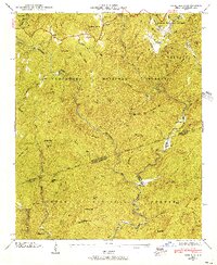
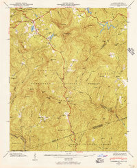
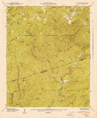
Oconee County, SC maps
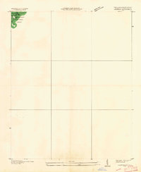
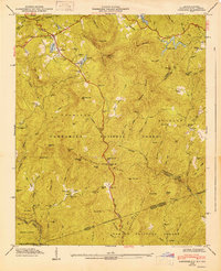
(59)- 1886 Map of Walhalla
 1886 Walhalla1886 Print · USGSCovers Oconee County, including Toccoa, Walhalla, and other nearby areas
 - 1888 Map of Pickens
 1888 Pickens1888 Print · USGSCovers Oconee County, including Anderson, Easley, and other nearby areas
 - 1891 Map of Cowee
 1891 Cowee1891 Print · USGSCovers Oconee County, including Waynesville, Cullowhee, and other nearby areas
 - 1891 Map of Carnesville
 1891 Carnesville1891 Print · USGSCovers Oconee County, including Athens, Commerce, and other nearby areas6 unique versions available
 - 1892 Map of Walhalla
 1892 Walhalla1892 Print · USGSCovers Oconee County, including Toccoa, Walhalla, and other nearby areas8 unique versions available
 - 1893 Map of Elberton
 1893 Elberton1893 Print · USGSCovers Oconee County, including Anderson, Elberton, and other nearby areas5 unique versions available
 - 1894 Map of Pickens
 1894 Pickens1894 Print · USGSCovers Oconee County, including Anderson, Easley, and other nearby areas5 unique versions available
 - 1896 Map of Walhalla
 1896 Walhalla1896 Print · USGSCovers Oconee County, including Toccoa, Walhalla, and other nearby areas
 - 1897 Map of Cowee
 1897 Cowee1897 Print · USGSCovers Oconee County, including Waynesville, Cullowhee, and other nearby areas4 unique versions available
 - 1905 Map of Pisgah, 1956 Print
 1905 Pisgah1956 Print · USGSCovers Oconee County, including Asheville, Hendersonville, and other nearby areas
 - 1906 Map of Pisgah, 1934 Print
 1906 Pisgah1934 Print · USGSCovers Oconee County, including Asheville, Hendersonville, and other nearby areas2 unique versions available
 - 1907 Map of Cowee
 1907 Cowee1907 Print · USGSCovers Oconee County, including Waynesville, Cullowhee, and other nearby areas5 unique versions available
 - 1935 Map of Cashiers
 1935 Cashiers1935 Print · USGSCovers Oconee County, including Cashiers, Grimshawes, and other nearby areas2 unique versions available
 - 1935 Map of Reid
 1935 Reid1935 Print · USGSCovers Oconee County, including Whitewater Pines, Toxaway Falls, and other nearby areas
 - 1946 Map of Reid, 1956 Print
 1946 Reid1956 Print · USGSCovers Oconee County, including Whitewater Pines, Toxaway Falls, and other nearby areas4 unique versions available
 - 1946 Map of Cashiers, 1957 Print
 1946 Cashiers1957 Print · USGSCovers Oconee County, including Cashiers, Grimshawes, and other nearby areas5 unique versions available
 - 1947 Map of Reid
 1947 Reid1947 Print · USGSCovers Oconee County, including Whitewater Pines, Toxaway Falls, and other nearby areas
 - 1947 Map of Cashiers
 1947 Cashiers1947 Print · USGSCovers Oconee County, including Cashiers, Grimshawes, and other nearby areas2 unique versions available
 - 1950 Map of La France, 1964 Print
 1950 La France1964 Print · USGSCovers Oconee County, including Shadow Wood, Rock Creek Acres, and other nearby areas2 unique versions available
 - 1951 Map of La France
 1951 La France1951 Print · USGSCovers Oconee County, including Shadow Wood, Rock Creek Acres, and other nearby areas
 - 1951 Map of Clemson, 1952 Print
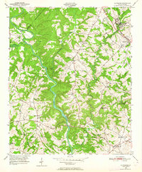
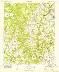
 1951 Clemson1952 Print · USGSCovers Oconee County, including Clemson, Central, and other nearby areas4 unique versions available
 - 1954 Map of Greenville, 1965 Print
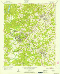
 1954 Greenville1965 Print · USGSCovers Oconee County, including Athens, Greenville, and other nearby areas2 unique versions available
 - 1955 Map of Knoxville
 1955 Knoxville1955 Print · USGSCovers Oconee County, including Knoxville, Asheville, and other nearby areas
 - 1957 Map of Tugaloo Lake, 1958 Print
 1957 Tugaloo Lake1958 Print · USGSCovers Oconee County, including Toccoa, Tugaloo, and other nearby areas4 unique versions available
 - 1957 Map of Rainy Mountain, 1958 Print
 1957 Rainy Mountain1958 Print · USGSCovers Oconee County, including Long Creek, Rabun County, and other nearby areas4 unique versions available
Showing maps 1-25 of 59
Top cities of Oconee County
- Seneca historical maps
- Walhalla historical maps
- Westminster historical maps
- West Union historical maps
- Salem historical maps
Frequently asked questions
- What are the different types of historical maps available for Oconee County?
- What is the oldest map of Oconee County?
- Where can I purchase historical maps of Oconee County for my home or office?
- Where can I download high-res historical maps of Oconee County?
- Are there historical topographic maps available for Oconee County?
- Is there historical aerial imagery available for Oconee County?
- Where are historical maps of Oconee County sourced from?