1980s Maps of Oconee County, South Carolina
Explore 5 historic maps of Oconee County from the 1980s. These maps offer a rare glimpse into what life looked like during the 1980s — showing old roads, neighborhoods, homes, and landmarks that have changed or disappeared over time.
Whether you're researching your family's past, planning a metal detecting trip, or studying how Oconee County's landscape evolved across the 1980s, these high-resolution maps are a powerful tool for exploring the history of this region.
- Focus on a specific era: All maps on this page are from the 1980s, giving you a focused view of this time period.
- See what’s changed: Compare century-old streets, trails, and buildings to today's modern landscape using overlays and satellite layers.
- Research with precision: Use these maps for genealogy, historical research, land use analysis, or educational projects.
- View, download, or print: Maps are fully viewable online in high resolution, and can be downloaded or printed for your own records.
Start exploring Oconee County's history through authentic maps from the 1980s. This is your window into the past.
Oconee County, SC maps
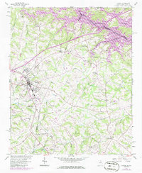
(5)- 1981 Map of Toccoa, 1982 Print
 1981 Toccoa1982 Print · USGSThe tri-state mountain region where Georgia meets the Carolinas is shown here in the early eighties. Genealogists and historians can trace family-named locations and settlements from Dahlonega to Tallulah Falls, along with the Southern rail corridor.2 unique versions available
 - 1983 Map of Fontana Lake
 1983 Fontana Lake1983 Print · USGSWestern North Carolina's high peaks and reservoir-carved valleys are documented here during the early eighties. Genealogists and local historians can trace the mountain communities of Bryson City and Franklin or explore the boundaries of the Qualla Boundary.2 unique versions available
 - 1984 Map of Greenville
 1984 Greenville1984 Print · USGSThe South Carolina Upstate undergoes rapid suburban growth in the mid-eighties as modern interstates begin to reshape the landscape. Researchers can trace historic rail lines like the Greenville and Northern Railway and locate local landmarks such as Clemson University and Paris Mountain State Park.
 - 1985 Map of Lavonia, 1986 Print
 1985 Lavonia1986 Print · USGSLavonia and the Georgia-South Carolina border are captured here in the mid-1980s as the rail-line economy met the rising waters of the Tugaloo. Researchers can trace family history through sites like Parkertown Mill, Pleasant Grove Cem, and Bowersville.
 - 1986 Map of Hendersonville
 1986 Hendersonville1986 Print · USGSThe Blue Ridge foothills of North and South Carolina are documented here in the mid-eighties as modern highways began to reshape mountain travel. Local historians can trace the paths of the Southern Railway through Hendersonville or locate landmarks like Looking Glass Rock and Inman Mills.2 unique versions available
End of results
Showing maps 1-5 of 5
Top cities of Oconee County
- Seneca historical maps
- Walhalla historical maps
- Westminster historical maps
- West Union historical maps
- Salem historical maps
Frequently asked questions
- What are the different types of historical maps available for Oconee County?
- What is the oldest map of Oconee County?
- Where can I purchase historical maps of Oconee County for my home or office?
- Where can I download high-res historical maps of Oconee County?
- Are there historical topographic maps available for Oconee County?
- Is there historical aerial imagery available for Oconee County?
- Where are historical maps of Oconee County sourced from?