Old Maps of Harmon Estates, South Carolina for Academic Research
Study the evolution of Harmon Estates with 15 high-resolution historic maps. Whether you're teaching, researching, or modeling changes in land use, these maps provide essential visual documentation of urban, environmental, and geographic change.
- Analyze long-term change: Track patterns in development, transportation, and natural features.
- Ideal for environmental or urban studies: Support academic projects with primary historical map data.
- Use in the classroom or lab: Educators and researchers rely on these maps to bring historical context to life.
These maps are a powerful tool for teaching, research, and visualizing how Harmon Estates has changed over the decades.
Harmon Estates, SC maps
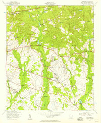
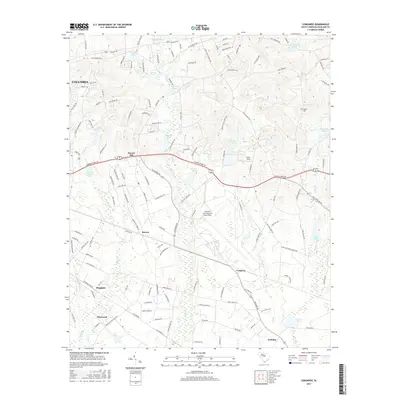
(15)- 1948 Map of Hopkins
 1948 Hopkins1948 Print · USGSRichland and Calhoun counties are captured here just after the war, showing the expansion of federal military sites into the rural South Carolina landscape. Genealogists can locate family-named landmarks like Coughmans Pond and dozens of country schools including Lower Richland High Sch and Hopkins Sch.3 unique versions available
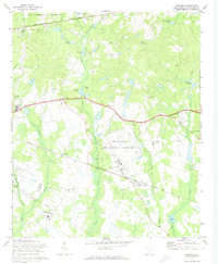
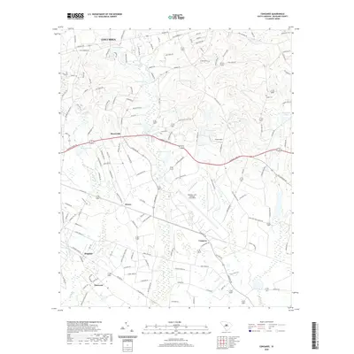
 - 1953 Map of Congaree, 1957 Print
 1953 Congaree1957 Print · USGSRichland County at the start of the 1950s reveals a landscape defined by significant military installations and a network of tight-knit rural communities. Researchers can locate numerous local landmarks such as Lower Richland High School, Congaree Air Force Base, and the Zion Benevolent Church.
 - 1954 Map of Augusta
 1954 Augusta1954 Print · USGSThe Savannah River valley and South Carolina Midlands are captured here during a period of post-war growth. Researchers can trace the rail-and-river economy through the Southern RR corridor and locate historic settlements like Aiken, Orangeburg, and Sumter.
 - 1957 Map of Augusta, 1966 Print
 1957 Augusta1966 Print · USGSThe Savannah River and Santee basins are captured here during a period of massive military and industrial expansion in the late fifties. Genealogists can trace family footprints across Four Hole Swamp or near the Savannah River Plant.3 unique versions available
 - 1958 Map of Augusta
 1958 Augusta1958 Print · USGSThe borderlands between Georgia and South Carolina come alive in the 1950s, showing the early footprint of the Savannah River Plant. Genealogists and historians can trace rail-dependent towns and rural landmarks from Orangeburg to the Fort Jackson Military Reservation.
 - 1961 Map of Augusta
 1961 Augusta1961 Print · USGSThe South Carolina lowcountry and CSRA appear here in the early sixties, during a period of massive military and industrial growth. Researchers can trace the development of the Savannah River Plant or locate legacy landmarks like Nelson Ferry and Magnolia Cemetery.2 unique versions available
 - 1962 Map of Augusta
 1962 Augusta1962 Print · USGSThe South Carolina and Georgia borderlands are seen here in the early sixties, showing the rise of the Savannah River Plant and the expansion of Fort Jackson. Researchers can trace old rail lines like the Southern Railway and find landmarks such as St. Pauls Church or the Santee Canal.
 - 1972 Map of Congaree, 1974 Print
 1972 Congaree1974 Print · USGSRichland County's landscape in the early seventies is marked by the expansion of military and educational facilities alongside quiet rural settlements. Researchers can locate family landmarks and community hubs like Horrel Hill, Mc Entire Air National Guard Base, and Beulah Ch.3 unique versions available
 - 1986 Map of Sumter
 1986 Sumter1986 Print · USGSMid-South Carolina in the mid-eighties reveals a landscape of massive river bottomlands and significant military installations. Genealogists and historians can trace the rural networks around Fort Motte, Lone Star, and Sardinia alongside Lake Marion.
 - 1990 Map of Sumter
 1990 Sumter1990 Print · USGSCentral South Carolina's river systems and military landscapes are captured here during the late twentieth century. Genealogists and historians can trace the growth of Sumter or locate rural communities such as Wedgefield and Kingville near the Congaree River.
 - 2011 Map of Congaree, 2011 Print
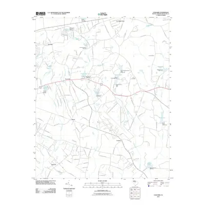 2011 Congaree2011 Print · USGSCovers Harmon Estates, including Columbia, Deer Ridge Farms, and other nearby areas
 - 2014 Map of Congaree, 2014 Print
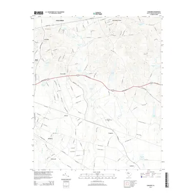 2014 Congaree2014 Print · USGSCovers Harmon Estates, including Columbia, Deer Ridge Farms, and other nearby areas
 - 2017 Map of Congaree, 2017 Print
 2017 Congaree2017 Print · USGSCovers Harmon Estates, including Columbia, Deer Ridge Farms, and other nearby areas
 - 2020 Map of Congaree, 2020 Print
 2020 Congaree2020 Print · USGSCovers Harmon Estates, including Columbia, Deer Ridge Farms, and other nearby areas
 - 2024 Map of Congaree, 2024 Print
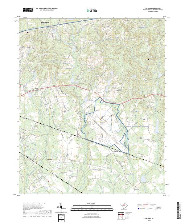 2024 Congaree2024 Print · USGSRichland County, South Carolina, maintains its rural character and military significance in this modern-era documentation. Genealogists and local historians can trace legacy landmarks like Brown's Chapel Cem, Horrel Hill, and the settlement at Hopkins.
End of results
Showing maps 1-15 of 15
Top cities near Harmon Estates
- Columbia historical maps
- Cayce historical maps
- Forest Acres historical maps
- Lugoff historical maps
- Blythewood historical maps
- Elgin historical maps
See more
Frequently asked questions
- What are the different types of historical maps available for Harmon Estates?
- What is the oldest map of Harmon Estates?
- Where can I purchase historical maps of Harmon Estates for my home or office?
- Where can I download high-res historical maps of Harmon Estates?
- Are there historical topographic maps available for Harmon Estates?
- Is there historical aerial imagery available for Harmon Estates?
- Where are historical maps of Harmon Estates sourced from?