1960s Maps of Spartanburg County, South Carolina
Explore 14 historic maps of Spartanburg County from the 1960s. These maps offer a rare glimpse into what life looked like during the 1960s — showing old roads, neighborhoods, homes, and landmarks that have changed or disappeared over time.
Whether you're researching your family's past, planning a metal detecting trip, or studying how Spartanburg County's landscape evolved across the 1960s, these high-resolution maps are a powerful tool for exploring the history of this region.
- Focus on a specific era: All maps on this page are from the 1960s, giving you a focused view of this time period.
- See what’s changed: Compare century-old streets, trails, and buildings to today's modern landscape using overlays and satellite layers.
- Research with precision: Use these maps for genealogy, historical research, land use analysis, or educational projects.
- View, download, or print: Maps are fully viewable online in high resolution, and can be downloaded or printed for your own records.
Start exploring Spartanburg County's history through authentic maps from the 1960s. This is your window into the past.
Spartanburg County, SC maps
(14)- 1960 Map of Knoxville
 1960 Knoxville1960 Print · USGSThe Southern Appalachians come alive in the 1950s, showing the intersection of new national park tourism and deep-rooted mountain industry. Trace old rail lines like the Clinchfield RR and find high-altitude landmarks from Mt Le Conte to the Cherokee Indian Reservation.2 unique versions available
 - 1960 Map of Charlotte
 1960 Charlotte1960 Print · USGSMid-century North Carolina and South Carolina meet in this 1960 survey of the Piedmont's industrial and textile heartland. Trace the growth of Charlotte alongside historic landmarks like Kings Mountain National Military Park and the Charlotte Naval Ammunition Depot.2 unique versions available
 - 1960 Map of Spartanburg
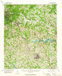
 1960 Spartanburg1960 Print · USGSThe South Carolina Piedmont and North Carolina borderlands come alive in this mid-century survey of the region between Spartanburg and Columbia. Researchers can trace the Seaboard Air Line railroad and explore landmarks like Anderson Quarry, Lake Murray, and Mount Croghan.2 unique versions available
 - 1961 Map of Inman, 1964 Print
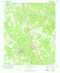
 1961 Inman1964 Print · USGSUpper Spartanburg County and Polk County thrive in the early sixties as the textile industry and new reservoirs reshape the landscape. Genealogists can locate family names at Morgan Chapel Cem and Polk Memorial Gardens, or trace early industrial hubs like Inman Mills.
 - 1962 Map of Charlotte
 1962 Charlotte1962 Print · USGSThe North Carolina Piedmont in the early sixties showcases a landscape transformed by massive reservoirs and industrial growth. Researchers can trace the development of Lake Norman, locate the Charlotte Naval Ammunition Depot, or find family landmarks like Wesley Chapel and Brown & Norcott Mills.
 - 1963 Map of Spartanburg
 1963 Spartanburg1963 Print · USGSMid-century South Carolina comes alive in this survey, showing the rail-linked corridor between the Upstate and the Midlands. Genealogists can trace family lands near old hubs like Union and Lancaster, or along the banks of the Broad River and Pee Dee River.
 - 1964 Map of Spartanburg
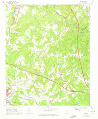
 1964 Spartanburg1964 Print · USGSMid-century South Carolina comes alive in this survey of the Piedmont and Upcountry, stretching from the Blue Ridge foothills to the Sandhills. Genealogists and historians can trace the rail-and-river economy through Monarch Mills, Glenn Springs, and the Southern Railway corridor.
 - 1964 Map of Knoxville
 1964 Knoxville1964 Print · USGSThe Southern Appalachians and Great Smokies are captured here during the mid-sixties, showing the rugged borderlands of Tennessee and North Carolina. Researchers can trace historic mountain routes like U S 441, the expanse of Pisgah National Forest, and the growing footprints of Asheville and Knoxville.
 - 1968 Map of Landrum, 1992 Print
 1968 Landrum1992 Print · USGSAs the mid-century era transitioned into the late 1980s, the border between the Carolinas remained a vital corridor for the SOUTHERN railroad. Genealogists and historians can trace family locations near Burnt Chimney Corner, Peniel, and numerous landmarks like Morgan Chapel or the Pacolet Hills Ch.
 - 1969 Map of Cross Anchor, 1972 Print
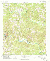
 1969 Cross Anchor1972 Print · USGSThe rural Piedmont of the late sixties comes into focus here, showing the wooded creek bottoms and family farms of southern Spartanburg County. Researchers can locate community centers like Cross Anchor and Cross Keys, alongside several old burial sites like Belmont Cem.4 unique versions available
 - 1969 Map of Pacolet Mills, 1972 Print
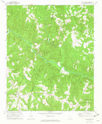
 1969 Pacolet Mills1972 Print · USGSThe industrial and rural landscape of South Carolina's upstate comes alive in this late-sixties survey of the river country. Genealogists and local researchers can trace the community life of Pacolet Mills or locate landmarks like Whig Hill Cem and Knuckles Chapel.2 unique versions available
 - 1969 Map of Ora, 1972 Print
 1969 Ora1972 Print · USGSLaurens County in the late sixties shows a transition from rural crossroads to industrializing outskirts. Genealogists can locate family landmarks like Sandy Springs Ch and Leesville Ch or trace the old SEABOARD COAST LINE railroad.2 unique versions available
 - 1969 Map of Enoree, 1973 Print
 1969 Enoree1973 Print · USGSThe Piedmont landscape of Spartanburg and Laurens counties is captured in the late sixties, centered on the river-and-rail hub of Enoree. Genealogists can trace family footprints through numerous rural landmarks like Cedar Shoals Ch, Antioch Ch, and the settlement at Lanford.
 - 1969 Map of Philson Crossroads, 1973 Print
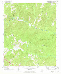 1969 Philson Crossroads1973 Print · USGSThe rural Upstate of South Carolina is captured here in the late sixties, where the borders of Spartanburg, Laurens, and Union counties meet. Researchers can trace family roots through several local congregations and burial sites, including Antioch Ch, Bethany Ch, and Macedonia Cem.2 unique versions available
End of results
Showing maps 1-14 of 14
Top cities of Spartanburg County
- Spartanburg historical maps
- Lyman historical maps
- Woodruff historical maps
- Inman historical maps
- Duncan historical maps
- Pacolet historical maps
See more
Frequently asked questions
- What are the different types of historical maps available for Spartanburg County?
- What is the oldest map of Spartanburg County?
- Where can I purchase historical maps of Spartanburg County for my home or office?
- Where can I download high-res historical maps of Spartanburg County?
- Are there historical topographic maps available for Spartanburg County?
- Is there historical aerial imagery available for Spartanburg County?
- Where are historical maps of Spartanburg County sourced from?