1990s Maps of Spartanburg County, South Carolina
Explore 5 historic maps of Spartanburg County from the 1990s. These maps offer a rare glimpse into what life looked like during the 1990s — showing old roads, neighborhoods, homes, and landmarks that have changed or disappeared over time.
Whether you're researching your family's past, planning a metal detecting trip, or studying how Spartanburg County's landscape evolved across the 1990s, these high-resolution maps are a powerful tool for exploring the history of this region.
- Focus on a specific era: All maps on this page are from the 1990s, giving you a focused view of this time period.
- See what’s changed: Compare century-old streets, trails, and buildings to today's modern landscape using overlays and satellite layers.
- Research with precision: Use these maps for genealogy, historical research, land use analysis, or educational projects.
- View, download, or print: Maps are fully viewable online in high resolution, and can be downloaded or printed for your own records.
Start exploring Spartanburg County's history through authentic maps from the 1990s. This is your window into the past.
Spartanburg County, SC maps
(5)- 1991 Map of Greenville
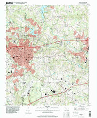
 1991 Greenville1991 Print · USGSThe South Carolina Upstate was a landscape of rapid growth and engineering in the early nineties. Researchers can trace the expansion of Greenville and Spartanburg, find Clemson University, or study the massive reservoirs of Hartwell Lake and Lake Keowee.
 - 1991 Map of Gastonia
 1991 Gastonia1991 Print · USGSThe Piedmont region along the North Carolina and South Carolina border shows a bustling industrial and transit corridor in the early nineties. Researchers can trace the sprawling footprints of Gastonia and Shelby or explore the grounds of Kings Mountain National Military Park and Lake Wylie.
 - 1993 Map of Fingerville East, 1996 Print
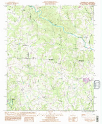 1993 Fingerville East1996 Print · USGSThe rural borderlands of South Carolina and North Carolina are captured here in the mid-nineties, showing a landscape defined by small creeks and country crossroads. Researchers can trace family roots through numerous local landmarks like Cedar Grove Ch, Cooley Springs, and McKinney Bridge.
 - 1993 Map of Chesnee, 1996 Print
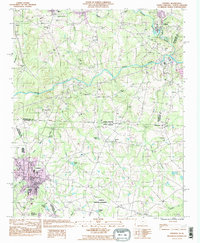 1993 Chesnee1996 Print · USGSThe Carolina borderlands come alive in this early 1990s survey, showing the landscape before recent regional expansion. Genealogists and historians can trace local family roots at County Memorial Cem or locate community hubs like Hicks Grove Ch and Chase High Sch.
 - 1994 Map of Greer, 2000 Print
 1994 Greer2000 Print · USGSThe industrial corridor between Greenville and Spartanburg comes to life in the mid-1990s as it transitions from its textile roots toward modern regional infrastructure. Genealogists and historians can trace the legacy of local congregations and family landmarks from Victor Mills and Washington Cem to the banks of Lake Lyman.
End of results
Showing maps 1-5 of 5
Top cities of Spartanburg County
- Spartanburg historical maps
- Lyman historical maps
- Woodruff historical maps
- Inman historical maps
- Duncan historical maps
- Pacolet historical maps
See more
Frequently asked questions
- What are the different types of historical maps available for Spartanburg County?
- What is the oldest map of Spartanburg County?
- Where can I purchase historical maps of Spartanburg County for my home or office?
- Where can I download high-res historical maps of Spartanburg County?
- Are there historical topographic maps available for Spartanburg County?
- Is there historical aerial imagery available for Spartanburg County?
- Where are historical maps of Spartanburg County sourced from?