Old Maps of Williamsburg County, South Carolina for Hiking & Exploration
Hike through history with 195 historic maps of Williamsburg County. Explore old trails, ghost towns, and forgotten backroads — perfect for outdoor adventurers and local explorers.
- Rediscover forgotten places: Map out old mining camps, roads, and footpaths that no longer exist on modern maps.
- Layer with modern tools: Combine with LiDAR or satellite views to plan hikes through historical terrain.
- Made for exploration: Popular among hikers, overlanders, and local history lovers.
Use these maps to find adventure and explore the hidden past of Williamsburg County.
Williamsburg County, SC maps
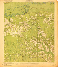
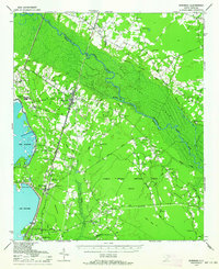
(195)- 1920 Map of Chicora
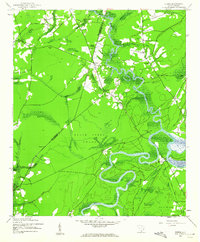
 1920 Chicora1920 Print · USGSBerkeley County was a landscape of river landings and bay-country settlements just after the turn of the century. Genealogists can locate family-named landmarks like Prioleau and numerous community anchors like St Luke Church, Eadytown, and the Francis Marion Tomb.
 - 1920 Map of Manning
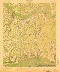
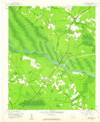
 1920 Manning1920 Print · USGSClarendon County in the early twentieth century was a land of timber-rich wetlands and growing rail junctions. Genealogists can trace family footprints through numerous rural landmarks like Biggers School, St Marks Church, and settlements like Alcolu or Davis Station.
 - 1921 Map of Chicora
 1921 Chicora1921 Print · USGSBerkeley County's riverfront and wetlands are captured in the early 1920s, showing the landscape before the Santee Cooper project transformed the region. Genealogists can locate family-named sites like the Francis Marion Tomb, Eadytown, and Rocks Creek School.4 unique versions available
 - 1921 Map of Manning
 1921 Manning1921 Print · USGSClarendon County was a hub of rail lines and swamp-bordering settlements in the years following the Great War. You can trace early 20th-century family landmarks like White Oak Church, the Wilson Mill School, and the path of the Southern Railroad as it crosses the Pocotaligo Swamp.3 unique versions available
 - 1943 Map of Chicora
 1943 Chicora1943 Print · USGSThe Santee River lowlands are captured here in the early 1940s, just as modern water management began to reshape the region. Genealogists can locate family-named landmarks like the Francis Marion Tomb, Eadytown, and the Oakland Club.
 - 1943 Map of Trio, 1962 Print
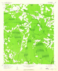 1943 Trio1962 Print · USGSCoastal South Carolina at the height of the Second World War was a land defined by its Carolina bays and logging heritage. Researchers can trace the path of the Logging RR or locate family landmarks like the Faireloth Plantation and St John Ch.2 unique versions available
 - 1943 Map of Henry, 1962 Print
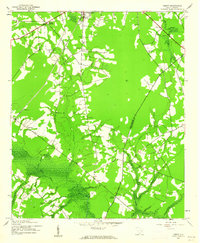 1943 Henry1962 Print · USGSWilliamsburg County during the early 1940s reveals a landscape defined by the Black River Swamp and the Seaboard Air Line. Researchers can locate old community landmarks like Bethel Sch, Harmon Cem, and Snow Junction.2 unique versions available
 - 1943 Map of Rhems, 1962 Print
 1943 Rhems1962 Print · USGSThe rural lowlands of Georgetown and Williamsburg Counties are captured here during the early 1940s as the river-based economy evolved. Genealogists and local historians can trace family roots through sites like Dorsey Town Sch, Rhems Plantation, and the Old Railroad Grade.2 unique versions available
 - 1943 Map of Andrews, 1962 Print
 1943 Andrews1962 Print · USGSThe Andrews area in the early 1940s is captured here at the junction of the SEABOARD railroad and rural crossroads. Researchers can trace family sites at Mt Lebanon Cem and Harmony Ch or explore the swampy borders of Johnsons Swamp.3 unique versions available
 - 1943 Map of Jamestown, 1962 Print
 1943 Jamestown1962 Print · USGSBerkeley and Williamsburg counties are shown here during the early 1940s as the rail-and-river economy shifted toward modern transit. Genealogists can trace family settlements at Beufordtown, Gumville, and Palmerville, or locate the site of Lanes Ferry (Abandoned).2 unique versions available
 - 1943 Map of Outland, 1962 Print
 1943 Outland1962 Print · USGSGeorgetown County at the height of the war years reveals a landscape of river landings and rural crossroads. You can trace family roots through numerous sites like Hucks Field Cem, Huggins Crossroads, and Jerusalem Ch.2 unique versions available
 - 1943 Map of Bonneau, 1964 Print
 1943 Bonneau1964 Print · USGSBerkeley County during the early 1940s shows a landscape of timber-driven growth and newly formed shorelines. Researchers can trace the Santee River Logging RR through the swamp or locate family sites like Gravel Hill Cem and St Stephens.2 unique versions available
 - 1944 Map of Manning
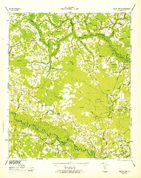
 1944 Manning1944 Print · USGSClarendon County in the mid-1940s centers on the rail hub of Manning and the winding reaches of the Pocotaligo Swamp. Researchers can trace rural family sites near Wilson Mill Sch, Green Savanna Sch, and Brewington Ch.
 - 1944 Map of Outland
 1944 Outland1944 Print · USGSGeorgetown and Williamsburg counties during the Second World War reveal a landscape of dense swamps and strategic military zones. Researchers can trace family history through numerous rural sites like Deep Creek School, Walkers Chapel, and the Hucks Field Cem.
 - 1946 Map of Hyman
 1946 Hyman1946 Print · USGSCoastal plain settlements and river landings define this mid-1940s survey of the Florence and Williamsburg county line. Researchers can trace family history through numerous rural landmarks like the Leo Post Office, Gause Cem, and Prosser Tabernacle.
 - 1946 Map of Kingstree
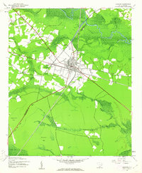
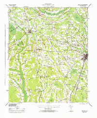
 1946 Kingstree1946 Print · USGSWilliamsburg County just after the war shows a landscape of riverine settlements and vital rail lines centered on Kingstree. Genealogists and historians can trace numerous rural congregations and schoolhouses, from Dickey Chapel and Lane Chapel to the Central Sch near Salters Depot.
 - 1946 Map of Lake City
 1946 Lake City1946 Print · USGSMid-century Florence and Williamsburg counties are seen here through a network of rural crossroads and river bottomlands just after the war. Researchers can trace family roots at Holly Tree Plantation, Bethany Cem, and dozens of local schools from Olanta to Lake City.
 - 1946 Map of Johnsonville
 1946 Johnsonville1946 Print · USGSThe Pee Dee River basin and its surrounding swamplands are captured here in the mid-1940s, showing a landscape defined by river landings and rural crossroads. Genealogists and historians can locate dozens of country churches and schools, from Buzzard Skull Ch to the Gunter Island School.
 - 1946 Map of Indiantown
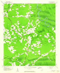
 1946 Indiantown1946 Print · USGSWilliamsburg County and the surrounding Lowcountry wetlands are documented here in the years following the war. Genealogists and local historians can trace family locations near Kellehan Crossroads, Old Morrisville, and the SEABOARD AIR LINE railway.
 - 1949 Map of Georgetown, 1953 Print
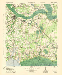
 1949 Georgetown1953 Print · USGSThe South Carolina coast and North Carolina borderlands appear here in the mid-century, prior to the major modern development of the Grand Strand. Genealogists and historians can trace the rail networks of the Seaboard Air Line Railroad and locate coastal landmarks from Fort Caswell to McClellanville.
 - 1954 Map of Augusta
 1954 Augusta1954 Print · USGSThe Savannah River valley and South Carolina Midlands are captured here during a period of post-war growth. Researchers can trace the rail-and-river economy through the Southern RR corridor and locate historic settlements like Aiken, Orangeburg, and Sumter.
 - 1957 Map of Augusta, 1966 Print
 1957 Augusta1966 Print · USGSThe Savannah River and Santee basins are captured here during a period of massive military and industrial expansion in the late fifties. Genealogists can trace family footprints across Four Hole Swamp or near the Savannah River Plant.3 unique versions available
 - 1958 Map of Augusta
 1958 Augusta1958 Print · USGSThe borderlands between Georgia and South Carolina come alive in the 1950s, showing the early footprint of the Savannah River Plant. Genealogists and historians can trace rail-dependent towns and rural landmarks from Orangeburg to the Fort Jackson Military Reservation.
 - 1961 Map of Augusta
 1961 Augusta1961 Print · USGSThe South Carolina lowcountry and CSRA appear here in the early sixties, during a period of massive military and industrial growth. Researchers can trace the development of the Savannah River Plant or locate legacy landmarks like Nelson Ferry and Magnolia Cemetery.2 unique versions available
 - 1962 Map of Augusta
 1962 Augusta1962 Print · USGSThe South Carolina and Georgia borderlands are seen here in the early sixties, showing the rise of the Savannah River Plant and the expansion of Fort Jackson. Researchers can trace old rail lines like the Southern Railway and find landmarks such as St. Pauls Church or the Santee Canal.
Showing maps 1-25 of 195
Top cities of Williamsburg County
- Kingstree historical maps
- Lane historical maps
- Hemingway historical maps
- Greeleyville historical maps
- Stuckey historical maps
Frequently asked questions
- What are the different types of historical maps available for Williamsburg County?
- What is the oldest map of Williamsburg County?
- Where can I purchase historical maps of Williamsburg County for my home or office?
- Where can I download high-res historical maps of Williamsburg County?
- Are there historical topographic maps available for Williamsburg County?
- Is there historical aerial imagery available for Williamsburg County?
- Where are historical maps of Williamsburg County sourced from?