2020s Maps of Waldro Township, South Dakota
Explore 2 historic maps of Waldro Township from the 2020s. These maps offer a rare glimpse into what life looked like during the 2020s — showing old roads, neighborhoods, homes, and landmarks that have changed or disappeared over time.
Whether you're researching your family's past, planning a metal detecting trip, or studying how Waldro Township's landscape evolved across the 2020s, these high-resolution maps are a powerful tool for exploring the history of this region.
- Focus on a specific era: All maps on this page are from the 2020s, giving you a focused view of this time period.
- See what’s changed: Compare century-old streets, trails, and buildings to today's modern landscape using overlays and satellite layers.
- Research with precision: Use these maps for genealogy, historical research, land use analysis, or educational projects.
- View, download, or print: Maps are fully viewable online in high resolution, and can be downloaded or printed for your own records.
Start exploring Waldro Township's history through authentic maps from the 2020s. This is your window into the past.
Waldro Township, SD maps
(2)- 2021 Map of Kimball North, 2021 Print
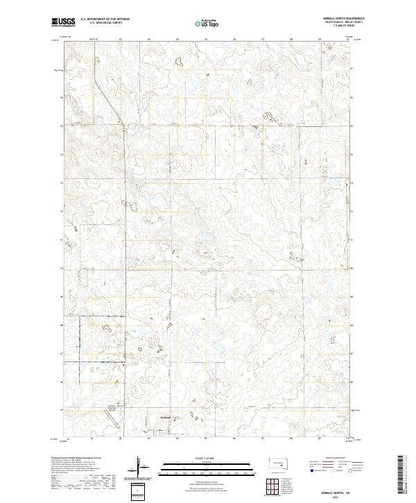 2021 Kimball North2021 Print · USGSThe northern reaches of Kimball and the surrounding Brule County prairie are captured here in the early twenty-first century. Researchers can trace the section-line road network and locate landmarks like Sobek Lake and the Kimball Municipal Airport.
 - 2021 Map of Pukwana SE, 2021 Print
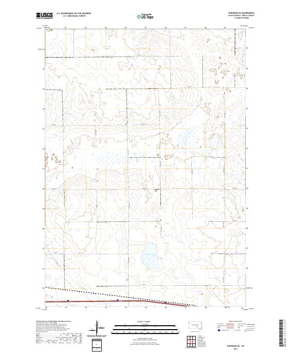 2021 Pukwana SE2021 Print · USGSBrule County's rural landscape is captured here in the early twenty-first century, showing the intersection of local townships and prairie hydrology. Researchers can trace the section lines and rural property access along 250 St and 357th Ave near Silver Lake.
End of results
Showing maps 1-2 of 2
Top cities near Waldro Township
Frequently asked questions
- What are the different types of historical maps available for Waldro Township?
- What is the oldest map of Waldro Township?
- Where can I purchase historical maps of Waldro Township for my home or office?
- Where can I download high-res historical maps of Waldro Township?
- Are there historical topographic maps available for Waldro Township?
- Is there historical aerial imagery available for Waldro Township?
- Where are historical maps of Waldro Township sourced from?