2020s Maps of Crow Creek District, South Dakota
Explore 6 historic maps of Crow Creek District from the 2020s. These maps offer a rare glimpse into what life looked like during the 2020s — showing old roads, neighborhoods, homes, and landmarks that have changed or disappeared over time.
Whether you're researching your family's past, planning a metal detecting trip, or studying how Crow Creek District's landscape evolved across the 2020s, these high-resolution maps are a powerful tool for exploring the history of this region.
- Focus on a specific era: All maps on this page are from the 2020s, giving you a focused view of this time period.
- See what’s changed: Compare century-old streets, trails, and buildings to today's modern landscape using overlays and satellite layers.
- Research with precision: Use these maps for genealogy, historical research, land use analysis, or educational projects.
- View, download, or print: Maps are fully viewable online in high resolution, and can be downloaded or printed for your own records.
Start exploring Crow Creek District's history through authentic maps from the 2020s. This is your window into the past.
Crow Creek District, SD maps
(6)- 2021 Map of Bedashosha Lake, 2021 Print
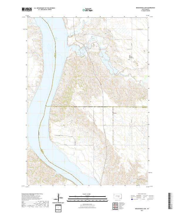 2021 Bedashosha Lake2021 Print · USGSThe Missouri River breaks of Buffalo and Lyman counties are captured here in the early twenty-first century. Researchers can trace the shoreline of Lake Francis Case or locate local landmarks like Grosse and the Saint John The Baptist Episcopal Cem.
 - 2021 Map of Shelby, 2021 Print
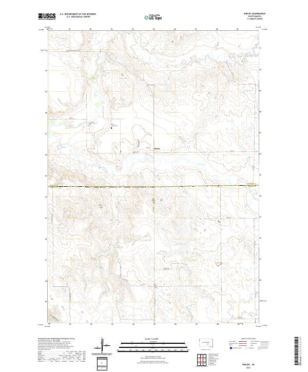 2021 Shelby2021 Print · USGSBuffalo County ranching country is documented here in the 2020s, showing the intersection of local routes and creek drainages. Researchers can locate Crow Creek Cem and the small settlement of Shelby alongside Smith Cr.
 - 2021 Map of Pukwana NE, 2021 Print
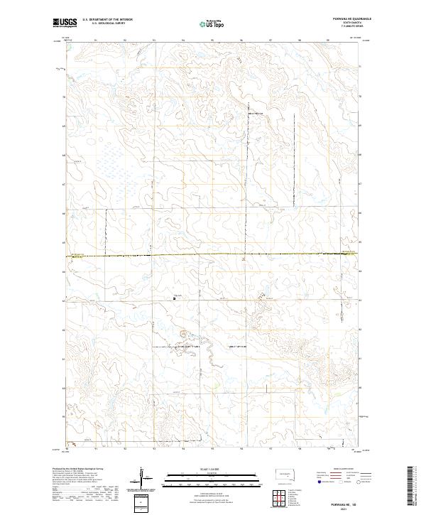 2021 Pukwana NE2021 Print · USGSBuffalo and Brule counties appear here in the early twenty-first century as a landscape of vast prairie drainages and isolated rural outposts. Genealogists and local historians can locate Vega Cem or trace the riparian corridors of Crow Cr and Smith Cr.
 - 2021 Map of Dry Run, 2021 Print
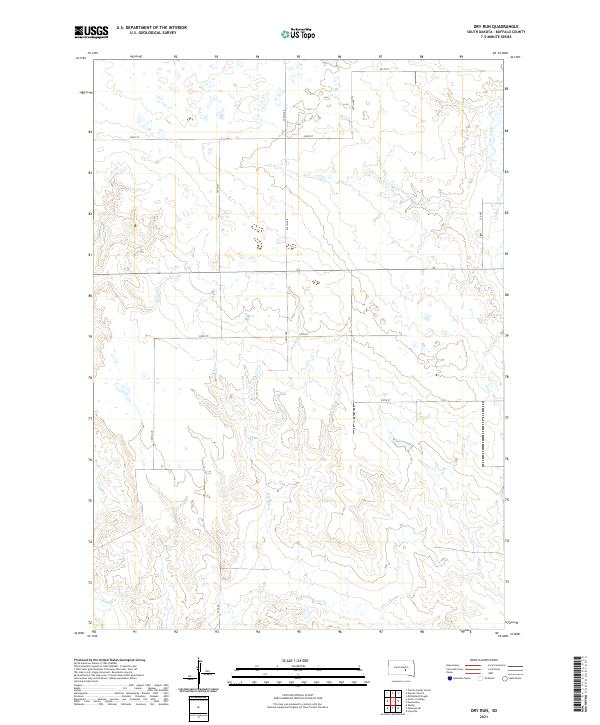 2021 Dry Run2021 Print · USGSBuffalo County prairie lands are shown here as they appeared recently, defined by the steady flow of Crow Creek and the namesake Dry Run. Geologists and local land researchers can trace the section-line road network and drainage patterns across T107N R69W and Elm Cr.
 - 2021 Map of North of Shelby, 2021 Print
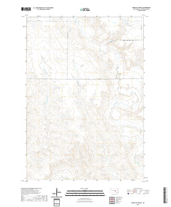 2021 North of Shelby2021 Print · USGSBuffalo County cattle country and high plains drainage are documented in this recent survey. Researchers can trace the section-line road network via Ree Heights Rd and 225th St as they cross the winding beds of Elm Cr and Crow Cr.
 - 2021 Map of Big Bend Dam SE, 2021 Print
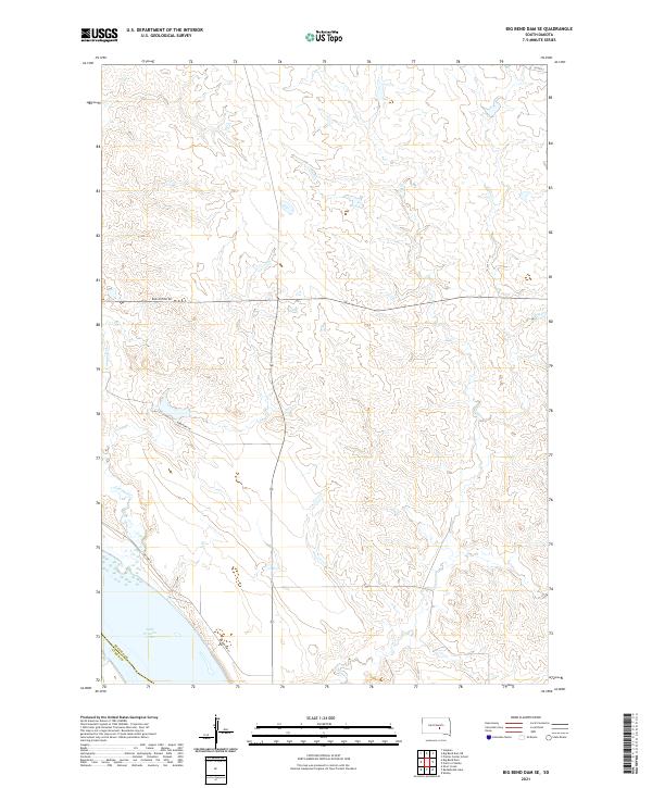 2021 Big Bend Dam SE2021 Print · USGSThe Missouri River shoreline in central South Dakota is captured here during the early 2020s. Genealogists and land researchers can trace the modern boundaries of the Crow Creek Reservation area near Lake Francis Case and Bad Nation Rd.
End of results
Showing maps 1-6 of 6
Top cities near Crow Creek District
Top neighborhoods of Crow Creek District
Frequently asked questions
- What are the different types of historical maps available for Crow Creek District?
- What is the oldest map of Crow Creek District?
- Where can I purchase historical maps of Crow Creek District for my home or office?
- Where can I download high-res historical maps of Crow Creek District?
- Are there historical topographic maps available for Crow Creek District?
- Is there historical aerial imagery available for Crow Creek District?
- Where are historical maps of Crow Creek District sourced from?