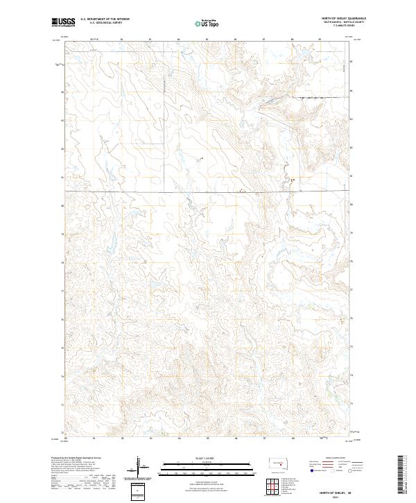
2021 Map of North of Shelby
USGS Topo · Published 2021About this map
Elm Cr and Crow Cr carve a network of drainage patterns across this interior portion of Buffalo County, defining the hydrology of the rural landscape. The terrain is organized by the Public Land Survey System, with township lines such as t107n r70w and t108n r69w demarcating the vast grazing and agricultural lands. Human imprint on the land is primarily evidenced by the section-line road system, including the north-south artery of Ree Heights Rd and the east-west corridor of 225th St. This area reflects the persistent grid-based settlement of the Great Plains, where long stretches of road like 353rd Ave and Prairie Dog Ln serve isolated farmsteads and open rangeland.
Find a feature on this map
12 named features on this map. Tap any name to fly to it.
Don’t see what you’re looking for? This feature index may not catch every label — zoom into the map to look around manually.
Map Details
Editions of this 2021 North of Shelby Map
This is the sole edition of this map. No revisions or reprints were ever made.
Other maps of this area

1935 · Chamberlain
USGS Topo · 1:62,500

1939 · Chamberlain
USGS Topo · 1:62,500

1941 · Pukwana
USGS Topo · 1:62,500

1951 · Pukwana
USGS Topo · 1:62,500

1953 · Huron
USGS Topo · 1:250,000

1954 · Huron
USGS Topo · 1:250,000

1955 · Mitchell
USGS Topo · 1:250,000

1959 · Mitchell
USGS Topo · 1:250,000

1966 · Big Bend Dam NE
USGS Topo · 1:24,000

1966 · Big Bend Dam SE
USGS Topo · 1:24,000
Featured Places
- Grant West Township, Crow Creek District
- Fort Thompson District, SD
- Wilson Township, Crow Creek District
- Pershing Township, SD
- Crow Creek District, SD