1970s Maps of Davison County, South Dakota
Explore 4 historic maps of Davison County from the 1970s. These maps offer a rare glimpse into what life looked like during the 1970s — showing old roads, neighborhoods, homes, and landmarks that have changed or disappeared over time.
Whether you're researching your family's past, planning a metal detecting trip, or studying how Davison County's landscape evolved across the 1970s, these high-resolution maps are a powerful tool for exploring the history of this region.
- Focus on a specific era: All maps on this page are from the 1970s, giving you a focused view of this time period.
- See what’s changed: Compare century-old streets, trails, and buildings to today's modern landscape using overlays and satellite layers.
- Research with precision: Use these maps for genealogy, historical research, land use analysis, or educational projects.
- View, download, or print: Maps are fully viewable online in high resolution, and can be downloaded or printed for your own records.
Start exploring Davison County's history through authentic maps from the 1970s. This is your window into the past.
Davison County, SD maps
(4)- 1979 Map of Delmont NE, 1980 Print
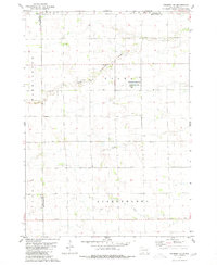 1979 Delmont NE1980 Print · USGSHutchinson County during the late 1970s reveals a quiet landscape of prairie townships and conserved wetlands. Genealogists and historians can trace family roots near Miller Cem or explore the drainage of Twelvemile Creek and the Starr National Waterfowl Production Area.
 - 1979 Map of Hillside, 1980 Print
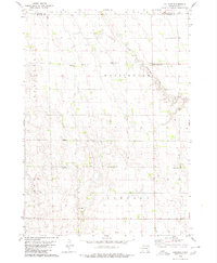 1979 Hillside1980 Print · USGSDouglas and Davison Counties are shown here during the late 1970s, a period when rural schoolhouses and country churches still anchored the South Dakota prairie. Genealogists and local historians can trace family ties at Friedhof Cem, Roberts Chapel Cem, or near the settlement of Hillside.
 - 1979 Map of Letcher SW, 1980 Print
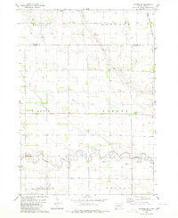 1979 Letcher SW1980 Print · USGSThe South Dakota plains near the Sanborn and Davison county line appear here in the late seventies as a landscape of structured townships and prairie waterways. Researchers can locate artesian Flowing Wells, the path of the Chicago Milwaukee St Paul and Pacific railroad, and the winding course of Firesteel Creek.
 - 1979 Map of Storla, 1980 Print
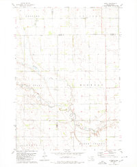 1979 Storla1980 Print · USGSThe crossroads of Aurora, Sanborn, and Davison counties are documented here in the late seventies. Family historians can trace the rural community of Storla and its surrounding landmarks like Trinity Ch, Blendon Sch, and Knutson Cem.
End of results
Showing maps 1-4 of 4
Top cities of Davison County
Frequently asked questions
- What are the different types of historical maps available for Davison County?
- What is the oldest map of Davison County?
- Where can I purchase historical maps of Davison County for my home or office?
- Where can I download high-res historical maps of Davison County?
- Are there historical topographic maps available for Davison County?
- Is there historical aerial imagery available for Davison County?
- Where are historical maps of Davison County sourced from?